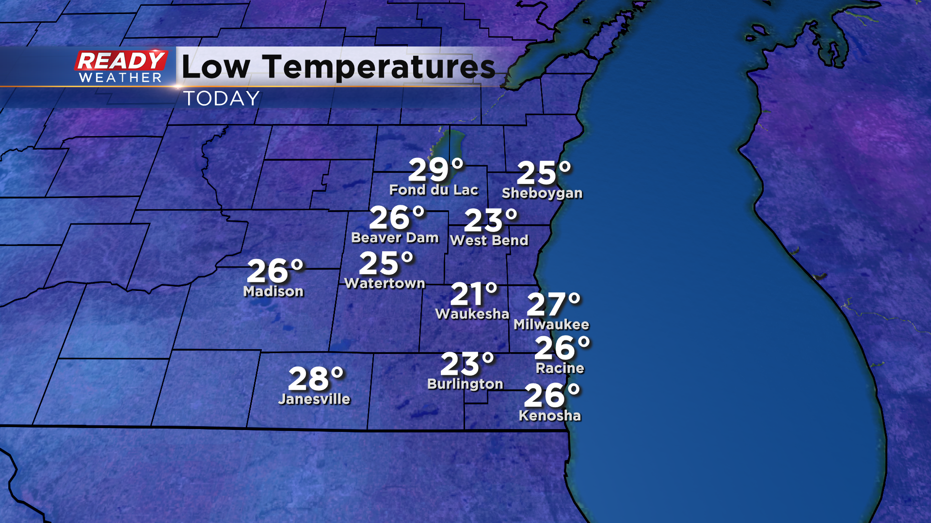
It was a chilly start to the day! Check out these morning low temperatures:
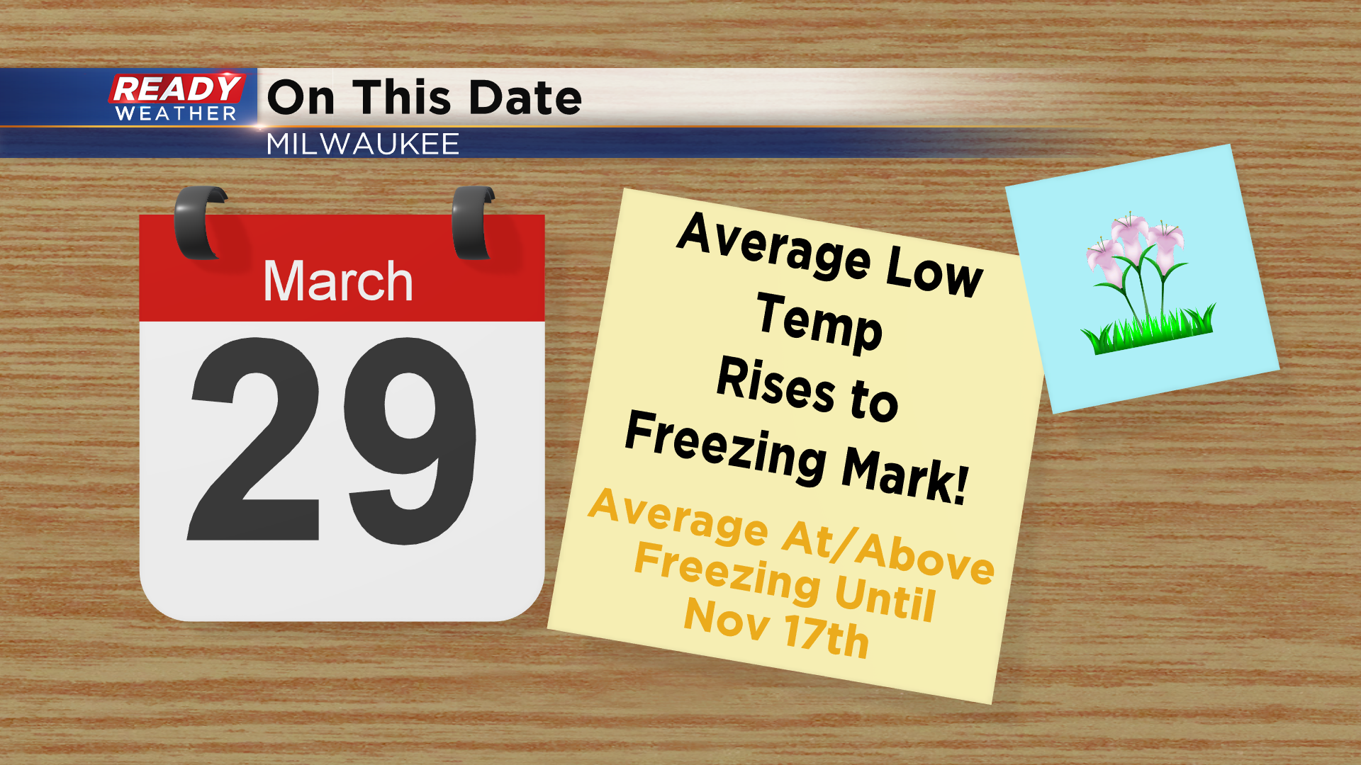
Despite the cold start, today's date brings our average low up to the freezing mark for the first time this season.
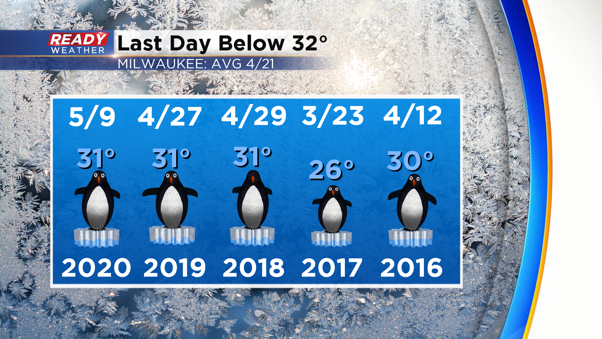
And it got me wondering when our last sub-freezing day of the season fell in recent history. Here's what I found:
Average low temperatures stay at or above freezing now until November 17th. That's 233 days of potential freezing free weather. If only Mother Nature would cooperate with those hard dates. We've had temps below freezing as late as May 27th, that happened in 1961... and reappear for the winter season as early as September 28th, set back in 1956.
In more pertinent forecasting, we are looking for one more punch of cold air set to arrive by Tuesday night. Lows Wednesday morning will be near 30 degrees and morning low temperatures Thursday and Friday morning will be in the 20! Ouch!
The good news is that we warm up for the weekend with lows in upper 40s and high in the 60s. Beyond that mild temps are highly likely.
I'm meteorologist Rebecca Schuld