Freezing drizzle may create icy spots on roads this evening


After some sunshine early this morning the low clouds filled in and have been with us most of the day. We're starting to see reports of freezing drizzle and mist to our southwest. This freezing drizzle/mist is expected to move into southeast Wisconsin after sunset and continue throughout the evening.
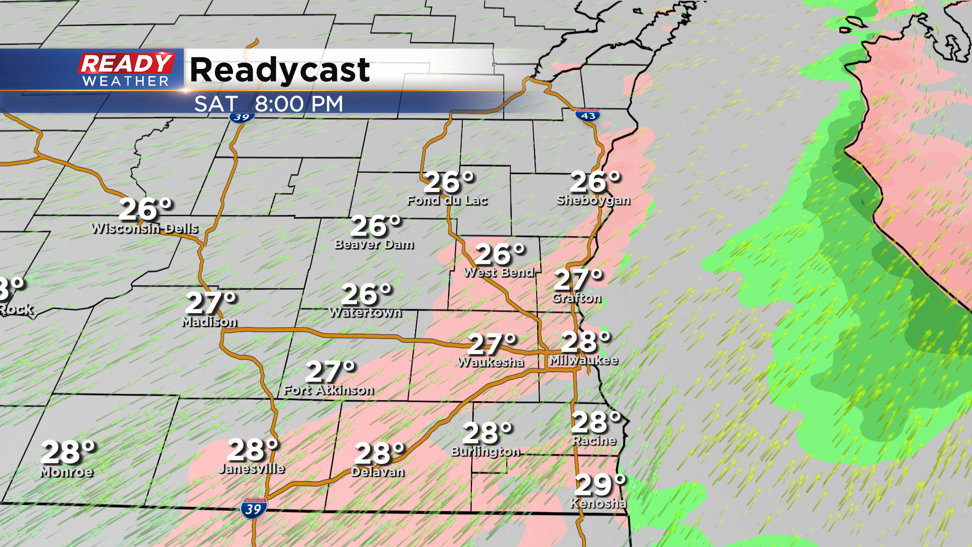
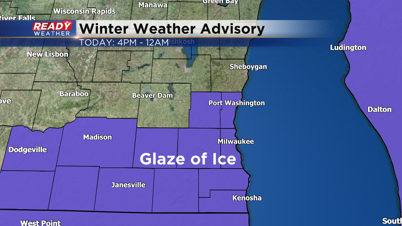
With pavement temperatures very cold, this could lead to a glaze of ice on surfaces that aren't treated. Bridges, elevated roads, side streets, and sidewalks are most at risk of becoming slippery this evening. With a glaze of ice possibly creating hazardous travel this evening, a Winter Weather Advisory has been issued for most of southeast Wisconsin, excluding Sheboygan, Fond du Lac, and Dodge counties, beginning at 4pm and ending at midnight tonight.
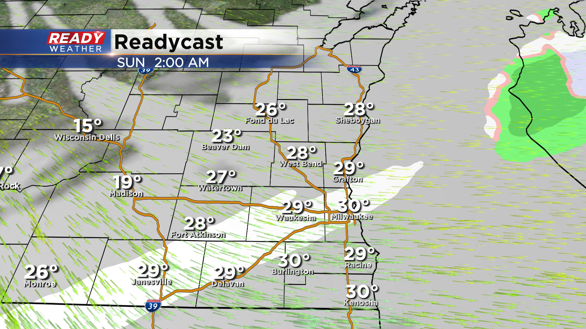
The freezing drizzle ends around midnight as a cold front begins to work through southeast Wisconsin. This may trigger a few flurries overnight, but no real accumulation is expected.
Behind this front, winds turn to the northwest and will really ramp up with gusts of 30-35 mph expected throughout Sunday morning.
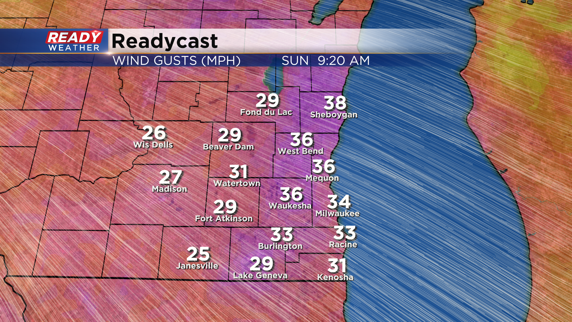
20-30 mph gusts continue for the afternoon, but don't expect temperatures to warm up too much. We'll reach our high temperature for the day shortly after midnight, with temps falling into the teens during the morning and staying there for the afternoon. The wind will make it feel like it's below zero for most of the day.
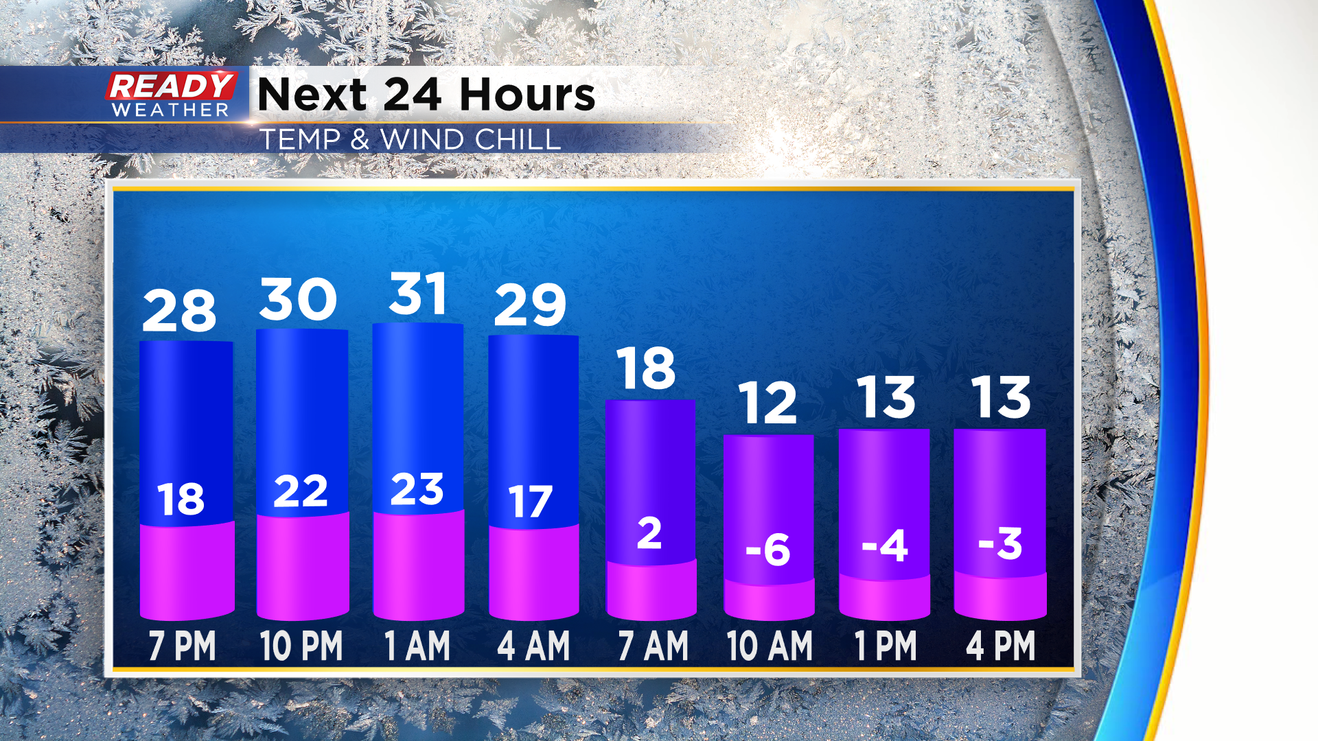
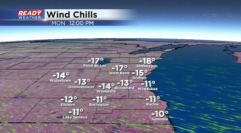
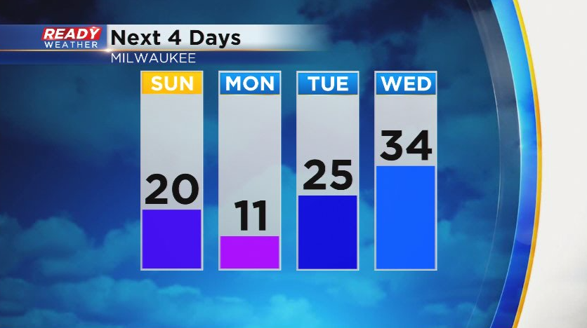
The cold weather doesn't end Sunday. A reinforcing cold front will move through Sunday night (which may trigger a few early morning flurries on Monday). However it'll keep temps in the single digits to around 10° throughout the day with wind chills between -5° and -15°.
Thankfully this arctic air won't stick around all week as temps rebound back into the 30s by Wednesday.
Download the CBS 58 Ready Weather app to track the freezing drizzle and road conditions this evening.