First day of summer has a few storms before dangerous weekend heat


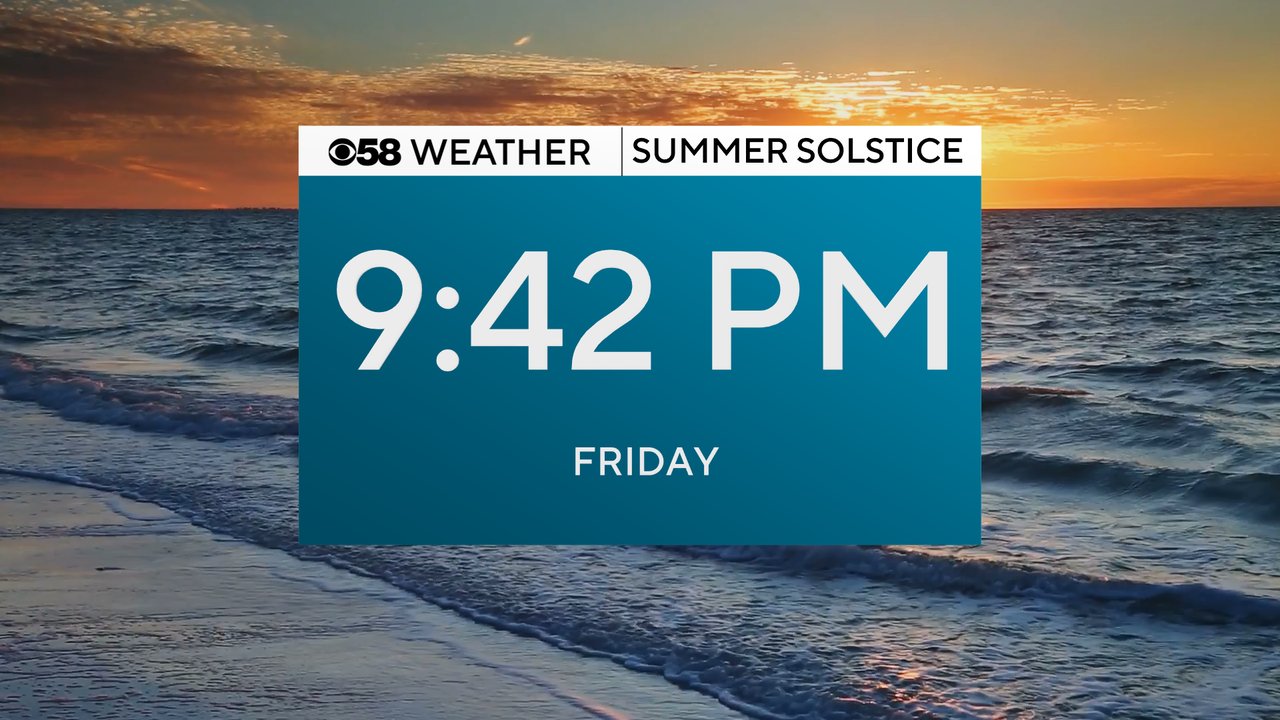
Summer is here! After a fairly cool Spring the summer solstice has officially arrived. Friday is the first day of summer with the solstice officially happening in the evening at 9:42 PM.
Saturday marks the first full day of summer and both Friday and Saturday with will see total daylight around 15 hours and 22 minutes.

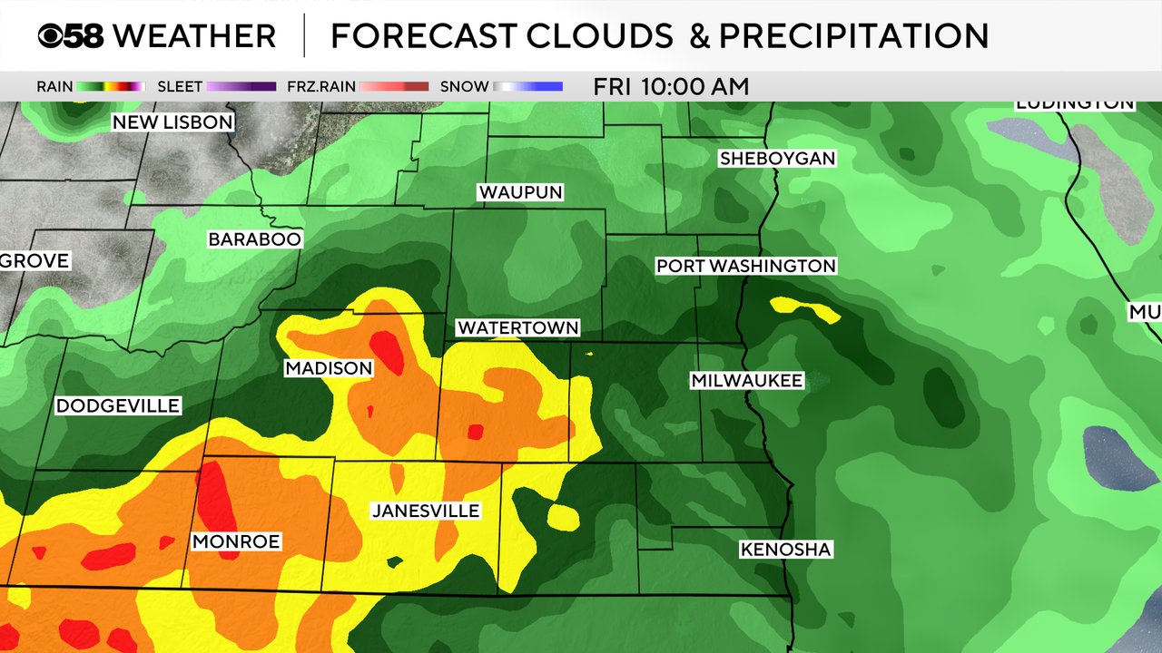
A few showers and storms are already out there Friday morning with some of our local northern and western counties already seeing some rain. At least a few showers look pretty good for most of the area during the morning then only isolated showers or storms Friday afternoon and evening. Rain totals won't amount to much with less than 0.30" for most and strong storms are not likely.
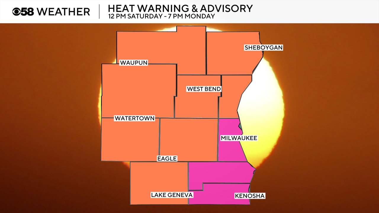
After Friday's rain our attention will quickly shift to dangerous heat that is likely for the weekend. A Heat Advisory and Extreme Heat Warning have been issued for all of southeast Wisconsin. The hottest feel like temps will be in southeast counties under the warning: Milwaukee, Racine and Kenosha. The rest of our local area remains under a Heat Advisory. Both the warning and advisory begin at noon on Saturday and last all day Sunday until 7 PM on Monday.
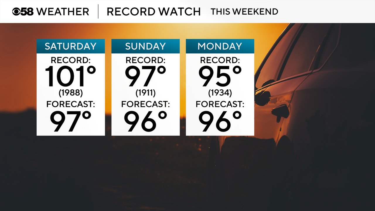
High temperatures Saturday, Sunday and Monday will get close to record levels. The high would have to reach the 100s on Saturday to break a record so that record looks safe with a current forecast of 97. But the records on Sunday of 97 and Monday of 95 are much more attainable with the current forecast each day of 96.
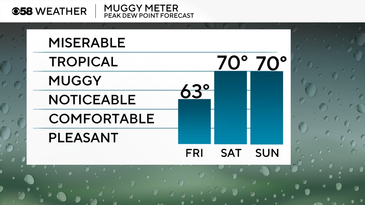
The humidity will remain manageable Friday in the middle 60s for peak dew points but near tropical-level humidity is on the way for Saturday, Sunday and Monday with dew points around 70 degrees.
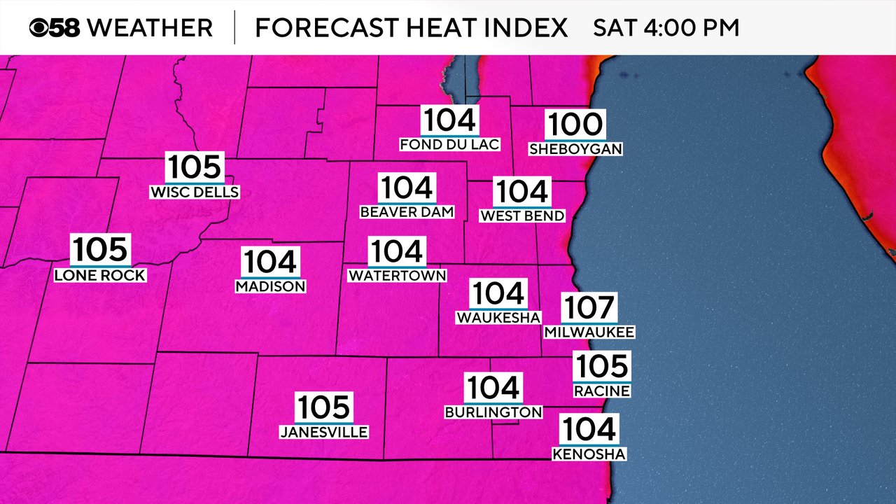
All of that heat combined with the humidity will push the feels like temperatures well into the 100s. Even some 105, 106 or 107 heat index values are possible.
Download the CBS 58 Weather app to track the heat for your location.