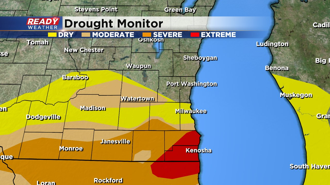
It's been a dry week across southeast Wisconsin with no rain since last Friday evening when a cold front passed through. That front only dropped .10-.25" of rain for most of the area, so it's no surprise to see drought conditions have worsened. The extreme drought has expanded across all of Kenosha county and throughout eastern Racine county while the severe drought has expanded into southern Waukesha county and across the WI/IL border.
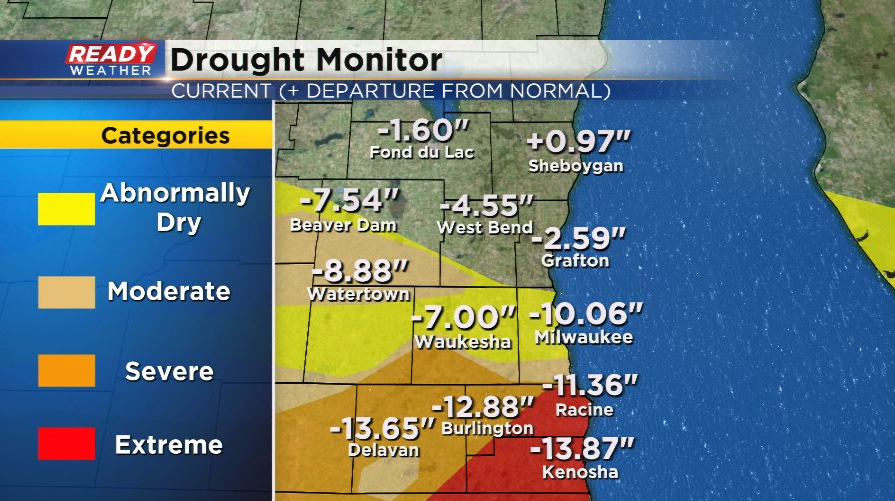
What's most staggering has been the rainfall differences between our far southern and northern counties. Fond du Lac and Sheboygan counties have had more rain over the last 90 days than Kenosha has had this entire year! Far southern areas are running at a rainfall deficit of 10-14", while Sheboygan is nearly an inch above normal.
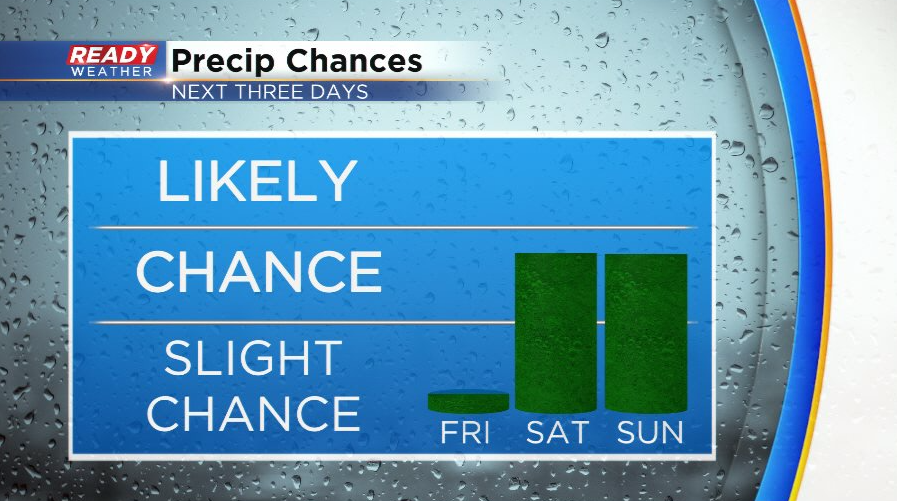
Dry weather will continue for the remainder of today and through most of Friday before off and on showers return for the weekend. At this point, .25-.50" of rain looks like a decent bet for most, but high amount may be possible.
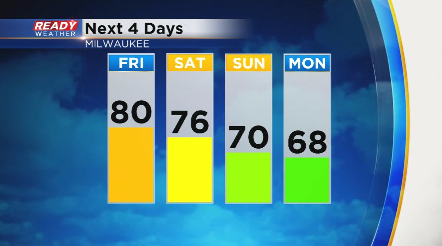
Before the rain arrives, winds will turn southerly on Friday and boost temps into the low 80s! It'll likely be our best chance at breaking the all time 80 degree days record (we're currently tied with 2010 at 80 days) as temps slip back into the 60s moving into next week.
Download the CBS 58 Ready Weather App to track the weekend showers.
