Dry weather returns after our first shower in two and a half weeks


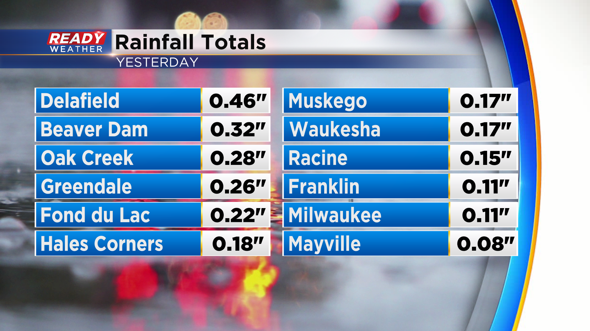
Tuesday morning's rain was wonderful to see! While Milwaukee only picked up .11", we'll take any rain we can get at this point.
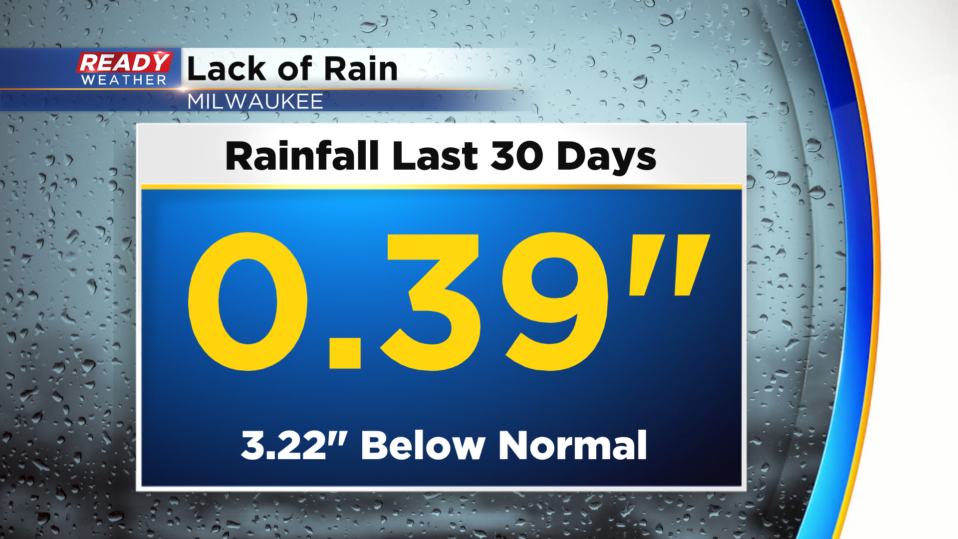
Including yesterday's rain, Milwaukee has only had .39" of rain over the last 30 days, which is over three inches below normal.
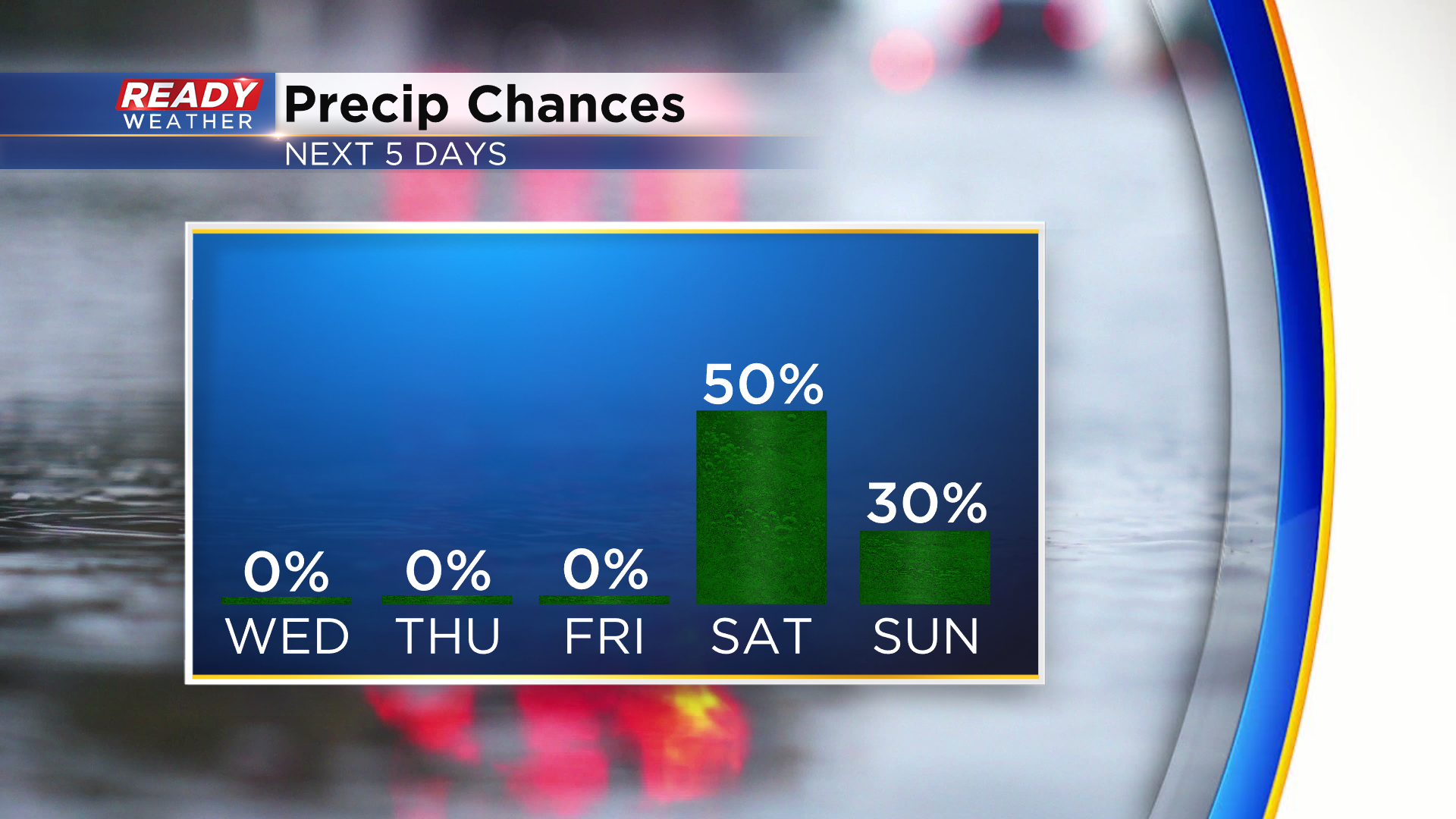
High pressure settling into the Great Lakes region will keep us dry through the end of the work week. Our next chance for showers and storms arrives Saturday with a cold front. Showers may linger into Sunday as well, but there's uncertainty there regarding where the low pressure system may sit and spin.
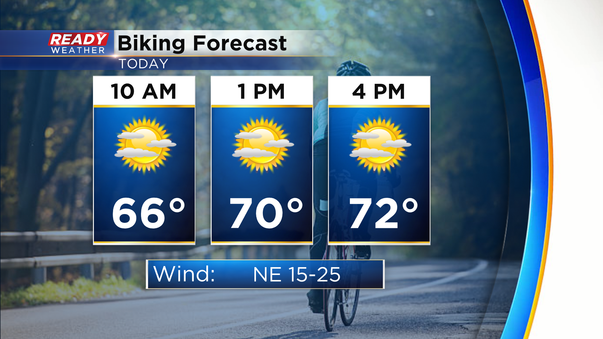
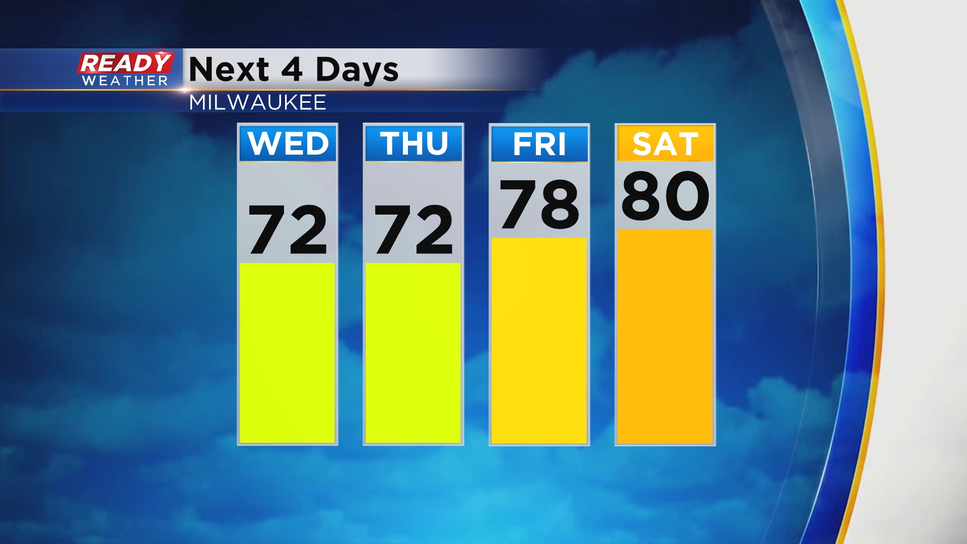
Sunshine returns today, but it will once again be filtered by Canadian wildfire smoke. The smoke is expected to remain elevated and not mix down to ground level. It'll be a breezy and cool day with highs in the low to mid 70s.
Temps remain on the cooler side on Thursday before warming back into the upper 70s to low 80s to end the week.
We'll cool back down early next week. Download the CBS 58 Ready Weather App to see the full forecast.