Dry for a few days after severe storms rolled through Tuesday evening


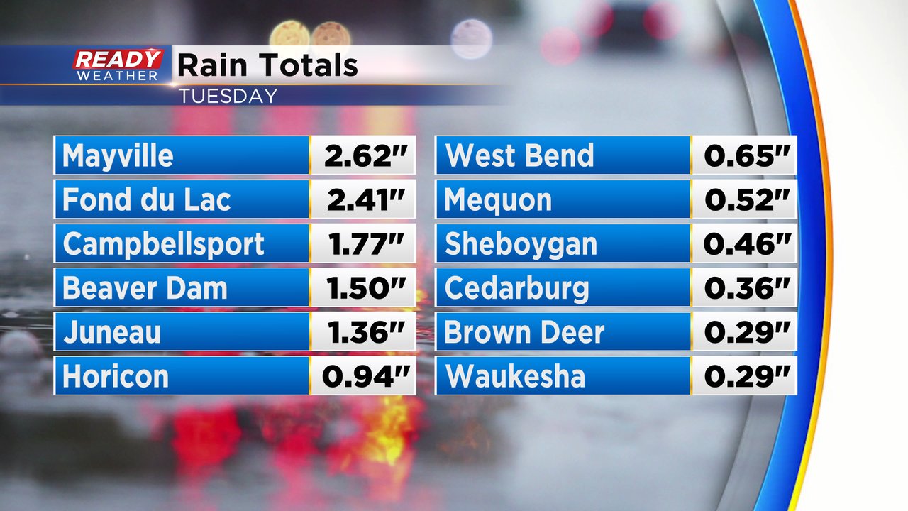
It was an active evening across southeast Wisconsin Tuesday with multiple tornado and severe thunderstorm warnings across southeast Wisconsin. The strongest storms rolled through our northwest counties like Fond du Lac and Dodge County which got 1-3" of rainfall. The rest of southeast Wisconsin saw much less and southern Milwaukee County and eastern Racine and Kenosha Counties got hardly any rain.
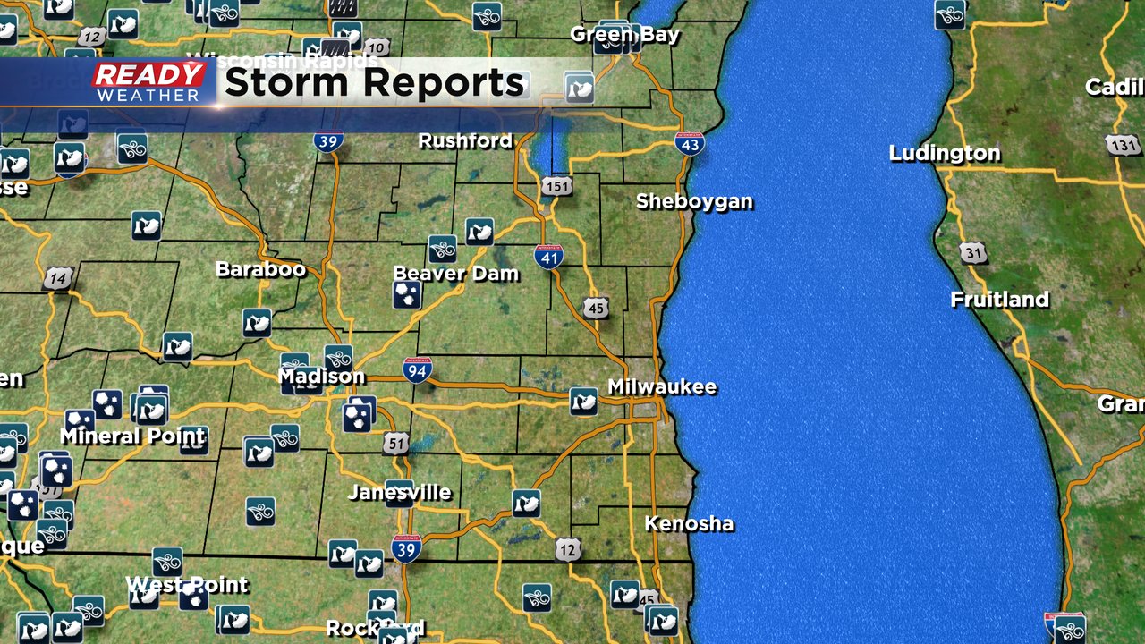
Check out the radar loop below with the tornado and severe thunderstorm warnings. You see that first batch of storms roll through just after 8 PM primarily in northern counties then the storms finally gathered and pushed east with a few more warnings through 1 AM.
Dane County and Madison were the hardest hit areas with 100s of trees coming down around the Madison metro. Locally, Fond du Lac and Dodge Counties reported some damage but we also got some isolated damage reports in Waukesha and Walworth Counties.
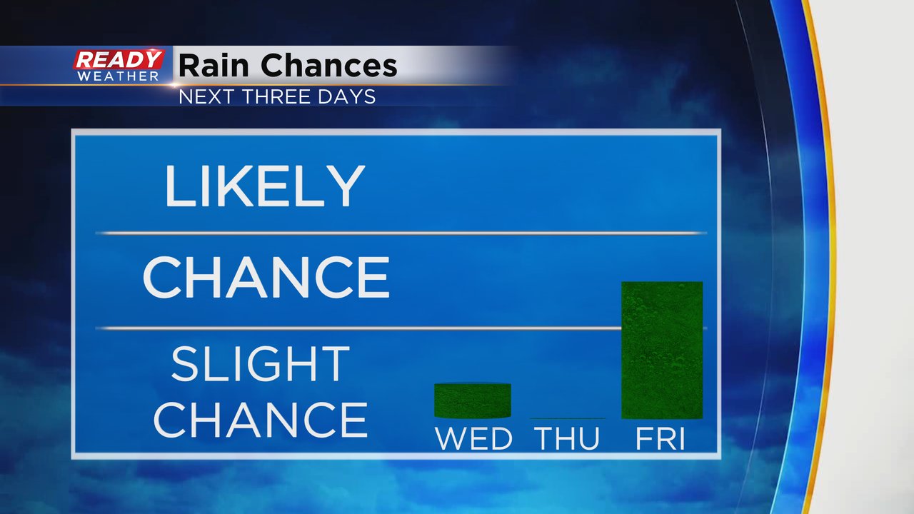
An isolated shower or storm is possible Wednesday afternoon, but the vast majority of southeast Wisconsin will stay dry. Friday's storm chance is increasing with a few stronger storms possible in the afternoon and evening.
Download the CBS 58 Ready Weather to track more rain chances.