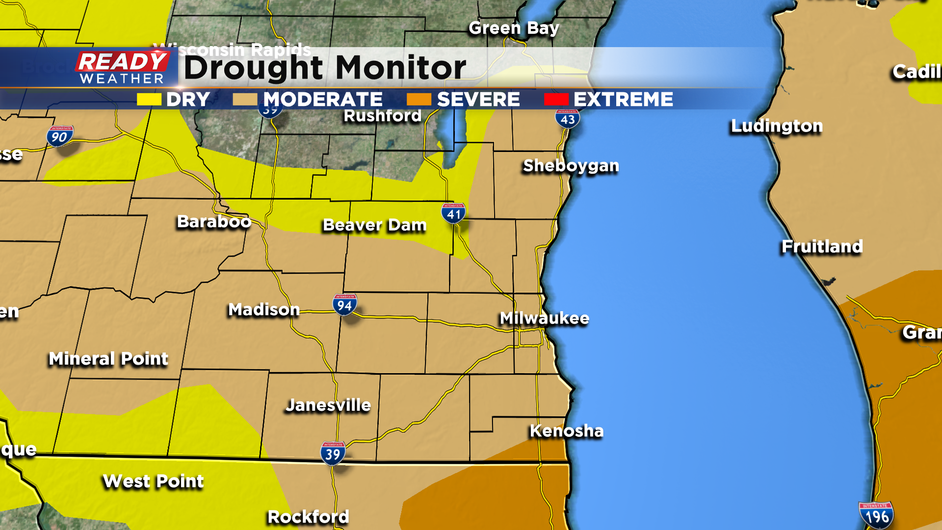
Drought conditions worsen as widespread rainfall eludes southeast Wisconsin
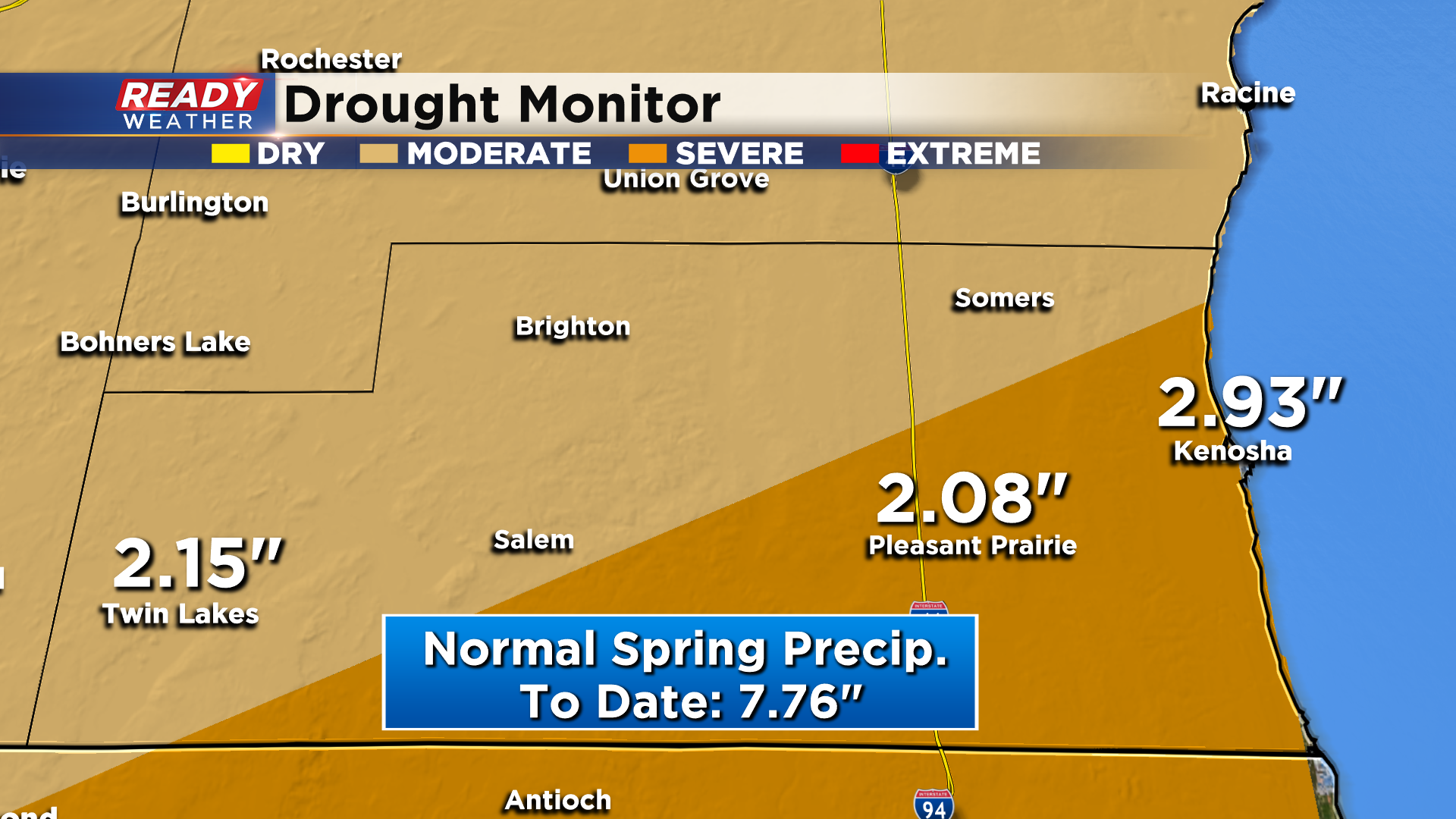
Although southeast Wisconsin has had hit or miss showers at times over the last week, the rain that's fallen hasn't been very heavy, and many folks have missed out on these showers. The lack of soaking rain in southeast Wisconsin has lead to severe drought conditions in part of Kenosha county, while the majority of the area remains under a moderate drought.
Most of Kenosha county has picked up under 3" of rain since the beginning of spring (March 1st). Normal precipitation through this point in spring is closer to 8".
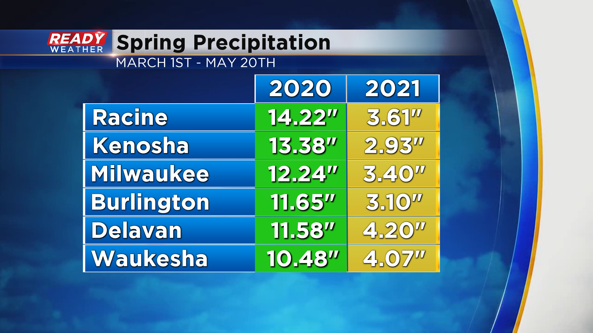
Precipitation this spring has been a night and day difference from last spring, especially in areas along and south of I-94. At this point last spring, many spots were having one of their wettest springs on record with over a foot of precip in Milwaukee, Racine, and Kenosha. This year most of us are experiencing one of our driest springs on record with many spots running a good 3-5" below normal,
While we're in an active weather pattern, the steadier precipitation train continue to remain displaced to our west, only allowing hit or miss showers to move in at times.
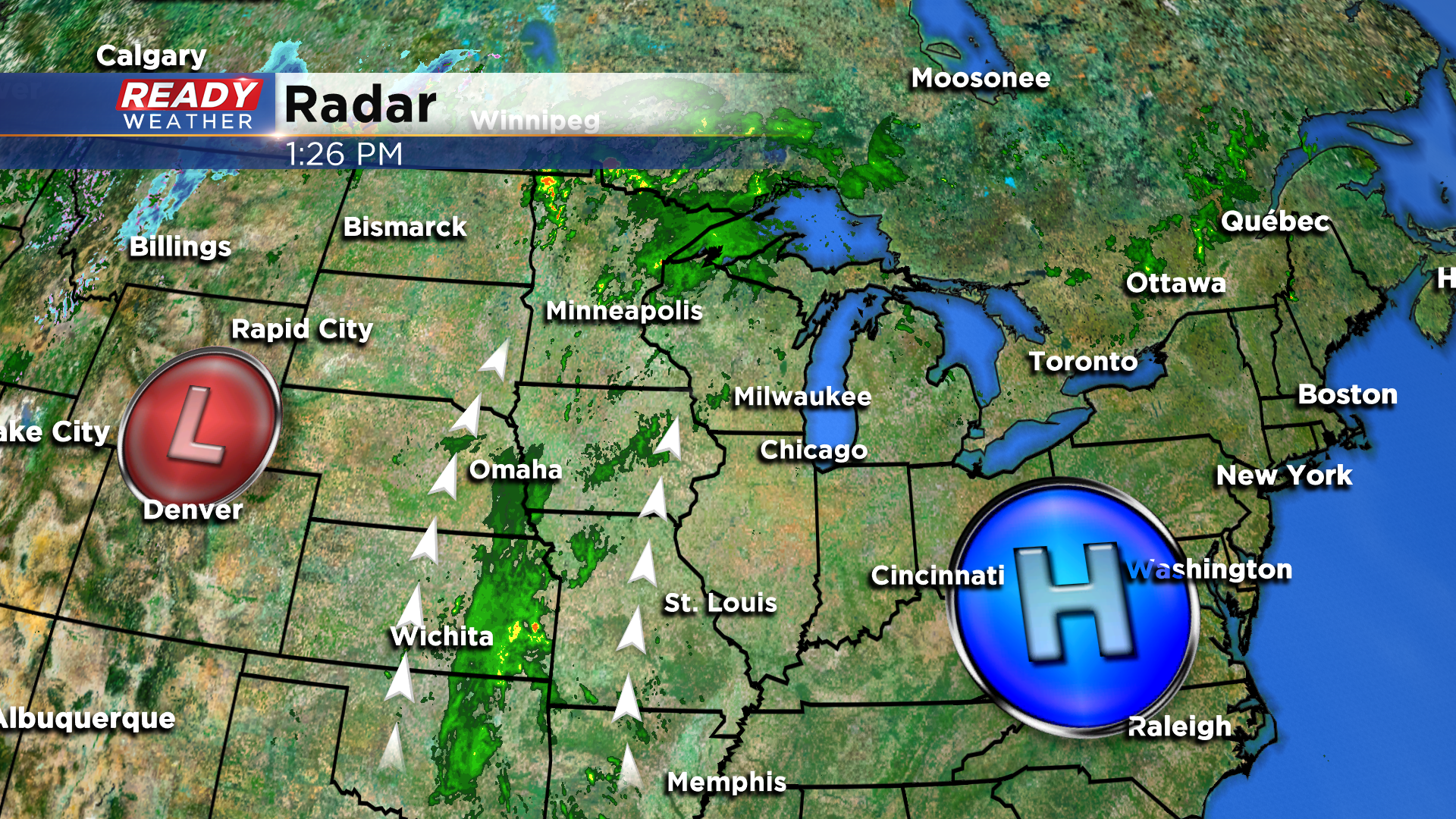
This pattern will generally remain in place into the weekend, bringing isolated chances for showers and storms.
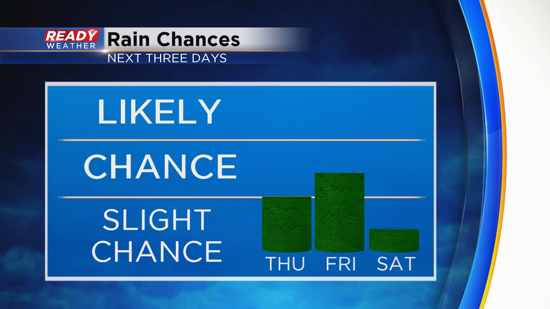
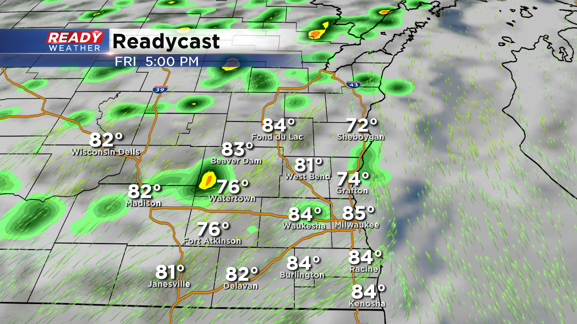
Friday afternoon will be our best chance at seeing a few downpours as scattered showers and storms develop, with the best chance being northwest of the Milwaukee metro.
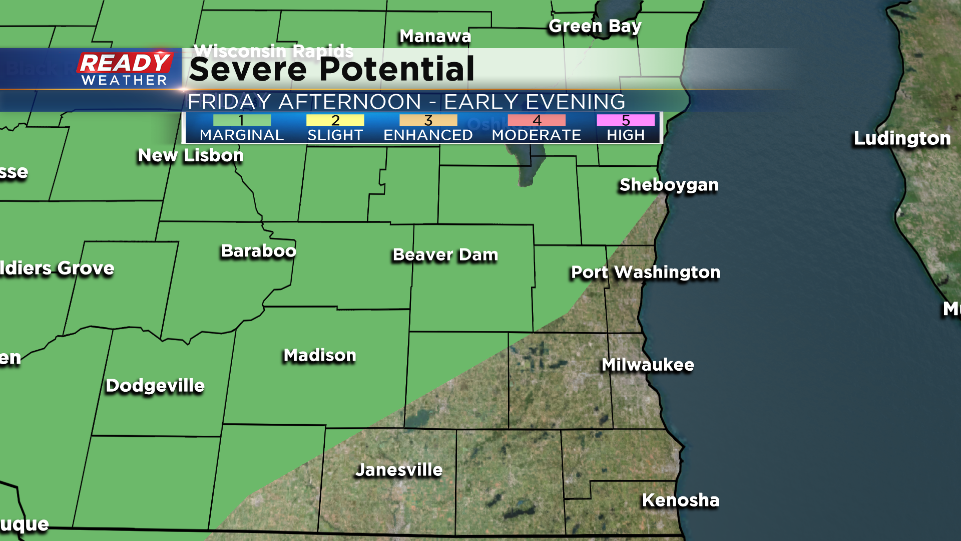
A few of those storms could be on the strong side with gusty winds, so a level 1, Marginal Risk, for severe storms is in place northwest of the metro for Friday afternoon.
Showers and storms will fizzle out around sunset. Download the CBS 58 Ready Weather App to see the full 7 day forecast.
