2018 Winter Outlook shows warmer and drier than normal
Every year the National Weather Service throws out a Winter Outlook to give us guidance on what the winter might look like. If anyone knows my forecasting techniques, they know I wouldn’t bet my own money on these outlooks. You might have more luck having a chimpanzee throw a dart at the Milwaukee County Zoo to determine these long-range forecasts because they’re so difficult rather than our normal forecast techniques. The way our super computers and computer models work is they’re primarily accurate within 48 hours, and then it becomes a true challenge to define who sees what in the weather.

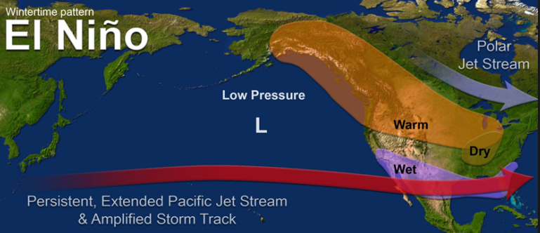
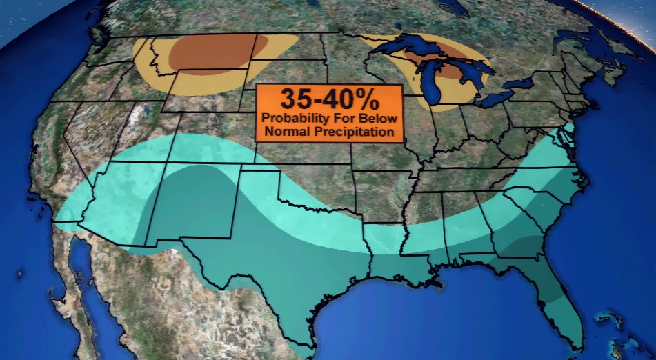
All of this said, we do have patterns we can watch that give forecasters clues on what can happen in advance of a season. There is a 75% chance of an El Niño year, which is determined by warming waters in the Pacific Ocean. For our forecasting purposes, an El Niño season for the Midwest means “warmer, drier conditions”. This is evident in the NOAA outlooks they presented to the public with a 35-40 percent chance of above normal temperatures. The same percentage can be said for precipitation; however, the precipitation is expected to be below average.
This forecasts hinges on an El Niño event – without it means this will look dramatically. This is the big challenge of trying to forecast long-range. We will see if this comes into fruition in the coming months!