Winter Storm Warning Issued. Heavy snow arrives Saturday to Sunday.


Updated: 3:00 pm January 29th
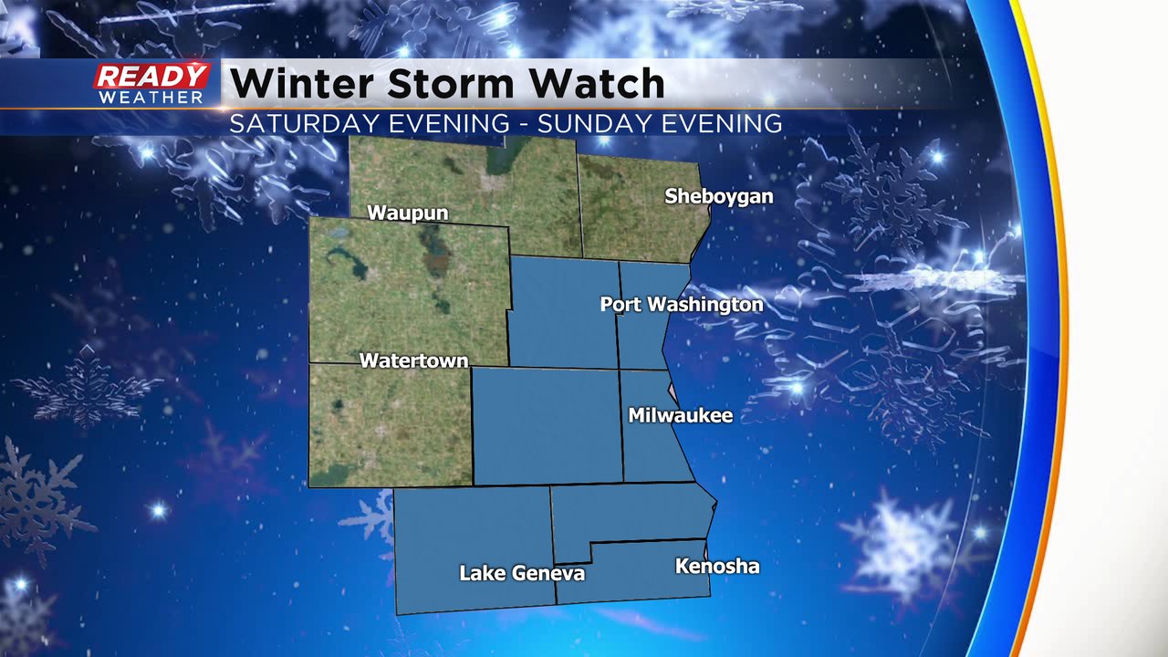
The National Weather Service has upgraded the winter storm watch to a warning for all of the counties in pink. This includes all of the Milwaukee metro area. The warning starts Saturday at 6 pm and goes until Sunday at 6 pm. All the counties in purple are under a winter weather advisory for the same time. The greatest road impact will be for the warned area.
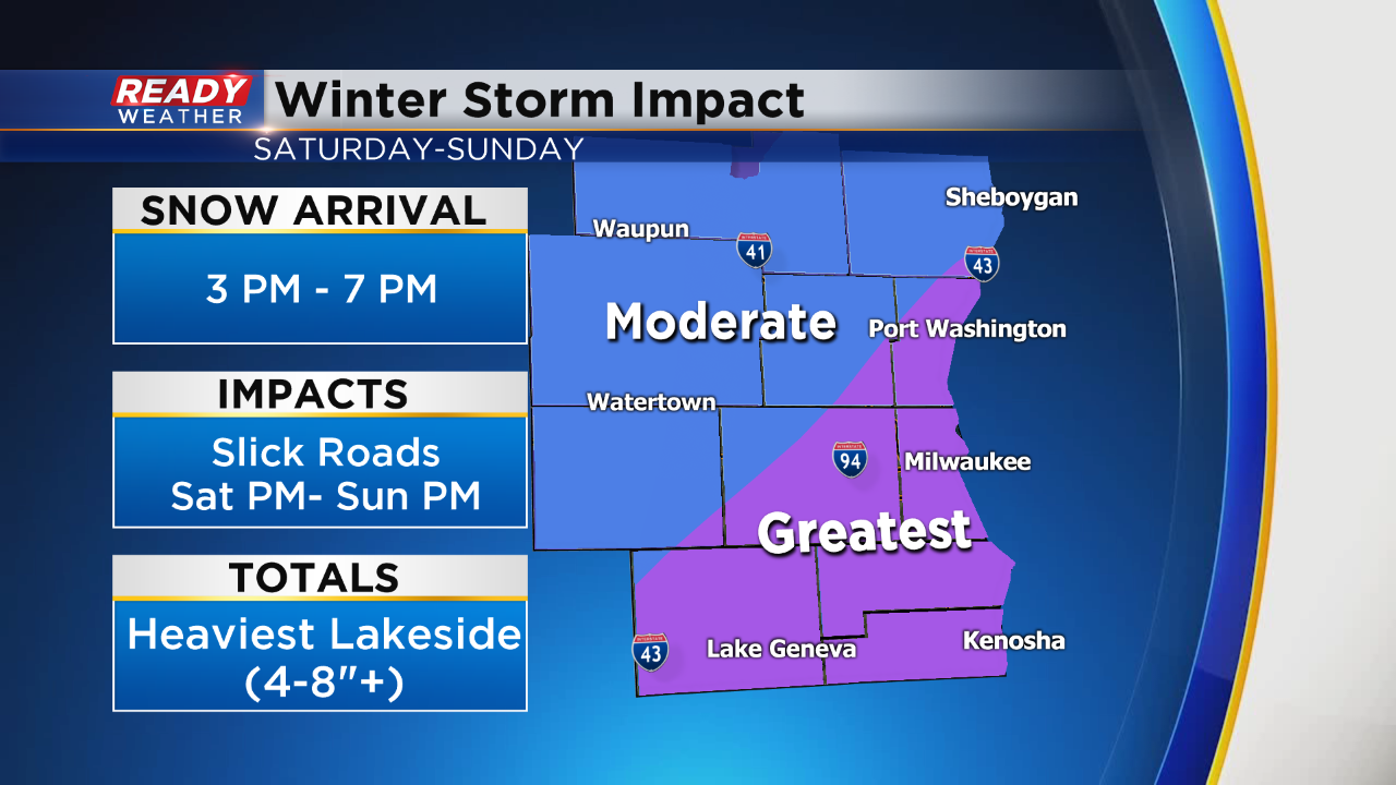
The snow is forecast to arrive from the southwest between 3 pm and 7 pm and continue overnight into Sunday morning. Lakeside areas on Sunday will experience lake enhanced snow, so totals in that area could be higher. The snow will linger along the lake from Ozaukee county south to Kenosha into the early evening.
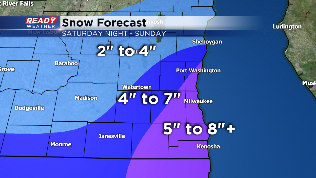
A general swath of 4" to 8" is likely; however, some locally higher totals near the lake are possible. Roads late Saturday night into Sunday morning will be a problem and likely be snow covered. In addition to the roads, strong winds will reduce visibility and create some blowing and drifting snow.
______________________________________________________________________________________________________________
Some of us may still be cleaning up from 4-9" of snow that fell on Tuesday but Mother Nature doesn't care - another round of snow is on the way. The snow is still about 36 hours away as of Friday morning but a Winter Storm Watch has been issued for a handful of our local counties from Saturday evening through Sunday evening. Everyone in southeast Wisconsin will likely see snow from this storm but the counties under the watch are where the highest totals are most likely right now. I would expect everyone to be at least under a Winter Weather Advisory with many upgraded to a Winter Storm Warning Friday afternoon or Saturday morning.
After a pleasant Friday and dry start to Saturday the snow will move in Saturday evening. 6-10 p.m. looks like a good range for when the snow will move in from south to north across our local area. Soon after the snow starts it will come down fast and heavy with many seeing snow covered roads within an hour of the snow starting. The snow will be heaviest Saturday evening through Sunday morning with the steady and heaviest snow ending in the mid to late morning on Sunday. Some lake effect and lake enhanced snow will be possible through Sunday afternoon and evening.

The track of this weekend's storm looks very similar to what we had earlier this week and therefore snow totals look similar as well. 4-8" is possible for most of southeast Wisconsin. A little less might be possible in our far northern and northwest spots where 2-4" is the forecast.

Roads will likely be in rough shape Saturday night into Sunday morning with heavy snow falling. Strong wind will also be part of this storm so expect more blowing and drifting and reduced visibility.

Download the CBS 58 Ready Weather App to stay up to date on the forecast changes and to track the snow as it arrives.