Winter Storm Watch Issued
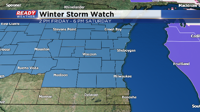
The NWS has issued a winter storm watch for parts of our area starting Friday at 2 pm and lasting until 6 pm Saturday. Walworth, Racine, and Kenosha counties are not included in the watch at this time. While we do expect those counties to be upgraded to a winter weather advisory, the NWS feels that they don't satisfy the winter storm criteria.
A band of snow will develop early Friday morning; however, the heavier snow will pick up Friday afternoon through the evening commute. Snow showers are expected to continue through Saturday morning and into the afternoon.

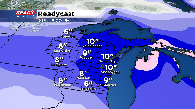
Most of the area will receive 6" to 10" of snow. It looks like Milwaukee and Waukesha counties will sit between 8 and 9 inches. The greatest totals are forecast across Sheboygan and Fond du Lac counties. Those areas have the potential for 11 inches of snow.
The lowest totals of 6 to 7 inches are forecast for our southern counties.
Travel will be an issue on Friday, especially for the Friday evening commute. Travel issues across the state will also exist with heavy snow expected throughout central Wisconsin.
Check back to the blog for future updates on the upcoming winter storm.
