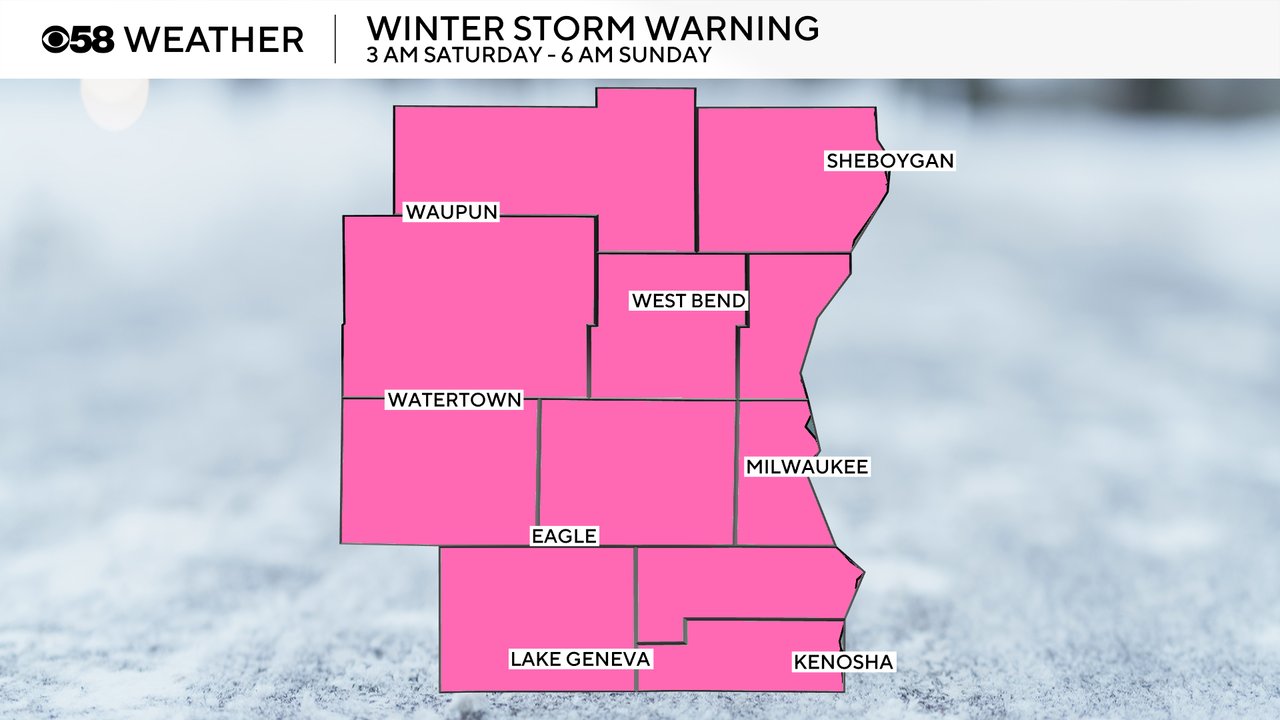
Winter storm warning issued for steady snow all day Saturday into Sunday morning


10pm Update
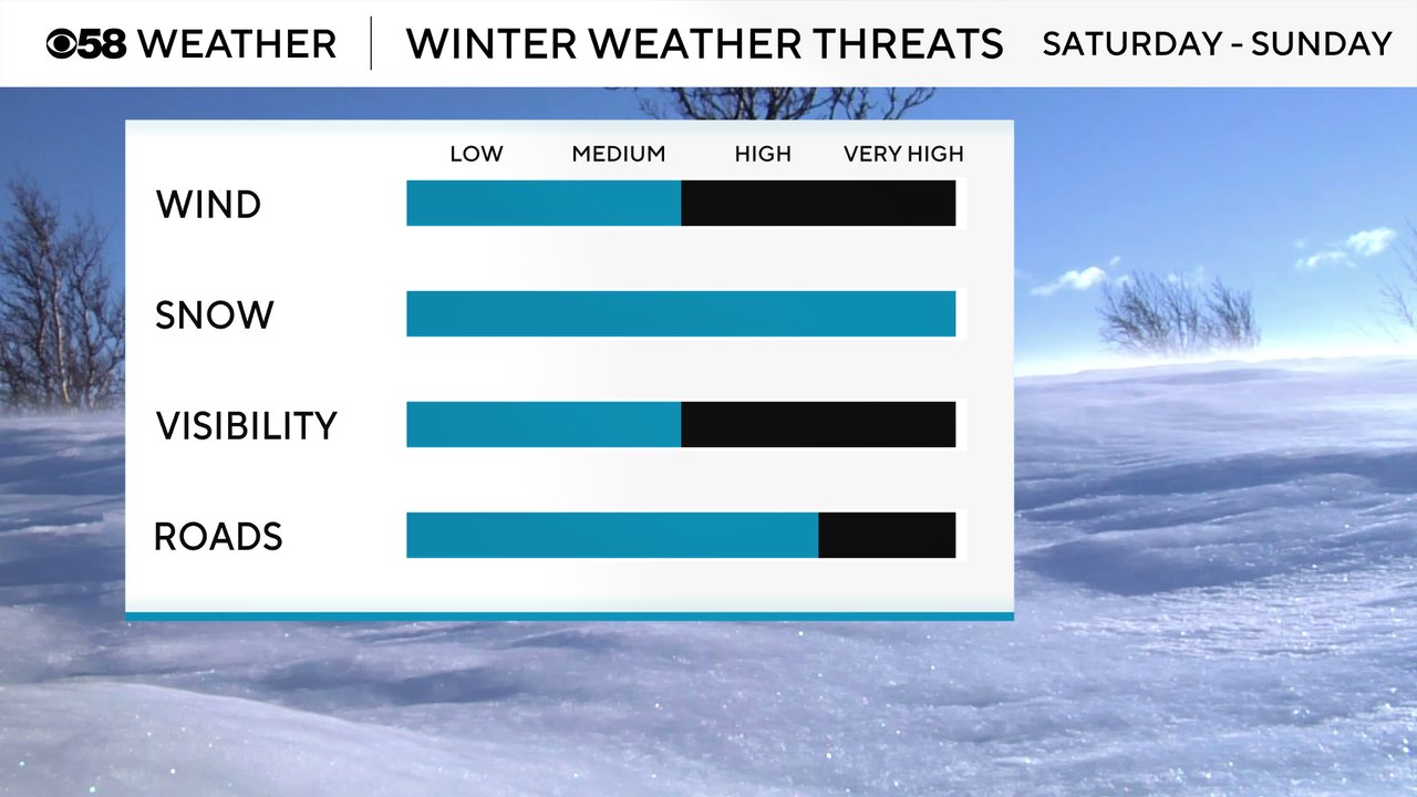
Snow is still on the way! Latest high resolution model runs are trending a bit higher on totals. Other features aloft along with the passing low may bring many spots up to 10" for snow accumulation. With wind off the lake we may find a slightly wetter and heavier snow to shovel out from lakeside, versus inland. Regardless of snow totals, the impacts remain the same throughout southern Wisconsin. Road travel will be very challenging, especially as the day wears on. Blowing snow is possible Sunday as the system pulls away from the state.

2pm Update:
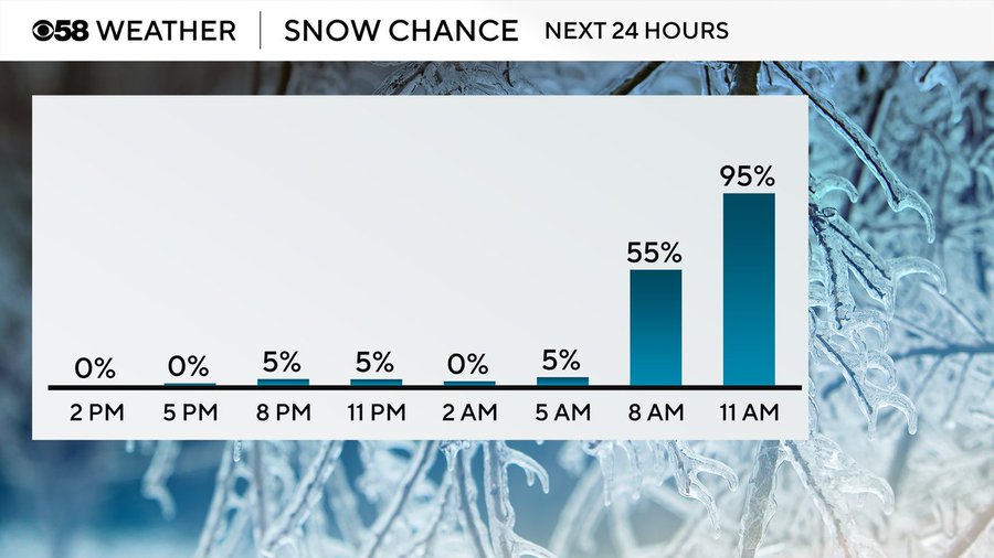
The storm system on the way for this weekend remains intact. Snow chances increase rapidly into Saturday morning. Check it out:
The first widespread winter storm of the season is nearly here. A winter storm warning has been issued for all of southeast Wisconsin from early Saturday morning through Sunday morning. The warning is for all of southeast Wisconsin.
It is possible we could have snow rates at a full inch per hour Saturday afternoon and evening. One big question that will likely remain into the start of this system is totals right near the lake. Despite the potential lake enhancement, a slightly warmer and wetter snow for places like Milwaukee may yield slightly lower totals, meanwhile a few miles inland may favor the high end totals as the snow becomes slightly flurrier moving away from the lake. No matter the totals the impacts will be the same and travel will be increasingly difficult as the day wears on.
---------------------------
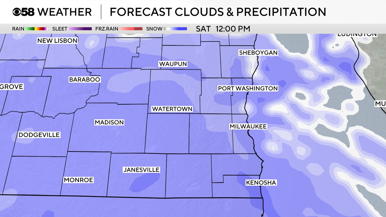
Snow starts late Friday night / early Saturday morning. By noon Saturday steady snow is expected for everyone and will stay steady the rest of Saturday through Saturday night. Saturday afternoon and evening has the best chance for some moderate areas of snowfall which will make roads snow covered.
Wind is not expected to be a big issue with the winter storm Saturday but the wind does pick up on Sunday causing blowing snow. There will be some visibility issues with the rate of the snow Saturday afternoon and the blowing snow on Sunday. To start, major roadways might be in ok shape as the snow stays steady but light, by Saturday afternoon and evening I would expect all roads to be snow covered through Sunday morning. If you do have to travel this weekend, it may be best to leave a day early on Friday or delay travel until late Sunday morning. Otherwise, if you must travel on Saturday, the earlier you leave, the better. First thing Saturday morning would be best.
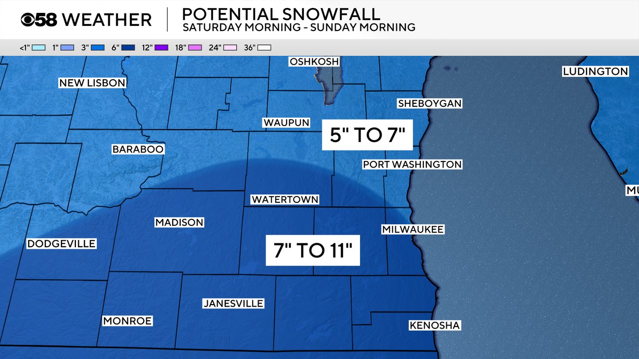
Most of southeast Wisconsin will see 6-10" of snow with this storm. Those totals have stayed fairly steady among weather models over the last few days. Overall, highest totals are expected in our southern and western counties where 7-11" is possible and northern counties might see a little less from 5-7".
Download the CBS 58 Weather app to track the snow with the interactive radar once it starts!