


After a very nice weekend with some sunshine and dry skies the rain chances have returned. Scattered showers and even a few rumbles of thunder have rolled through early Monday morning and could continue off and on the rest of the day.

There will still be plenty of dry time on Monday. Tuesday has a better chance for rain overall and less dry time than Monday but a few drier periods of weather will still be possible. Wednesday also has a lingering rain chance at least through the morning but some could even linger into the afternoon.

This should be a soaking rain for most of southeast Wisconsin with a half to full inch of rain for most of southeast Wisconsin. Western counties will likely see the highest totals with up to 1.50" possible there and higher totals could also happen with thunderstorms.

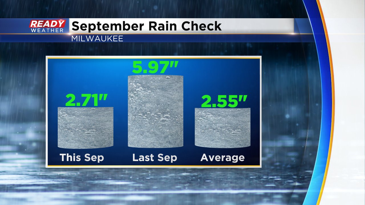
Going into this last week of September we are sitting just barely above average on rainfall to date. Last year by this point of the month we had almost 6" of rain but that was because of a flooding rain around September 10/11. Thankfully we do have good rain this week because if we didn't we would likely end the month below-average on rain.
Download the CBS 58 Ready Weather app to track the rain with the interactive radar.