


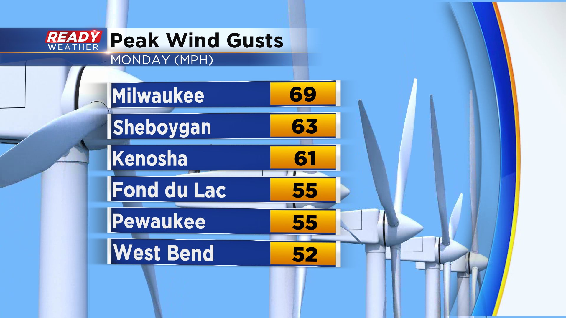
Monday was another mild day with highs in the 60s but it came with a strong wind and lots of damage reports as showers and storms rolled through in the evening. Wind gusts reached as high as 69 mph in the Milwaukee area and many communities saw similarly strong wind.
Tuesday brings cooler temps in the 40s with lots of sunshine and still a strong wind gusting to 30 mph. By Tuesday evening the clouds start rolling in ahead of our next chance for precipitation on Wednesday. We could see a few light rain and snow showers in the morning before that transitions to all rain in the afternoon. It won't be a washout but some off and on showers are possible with long breaks in between. Some could see a brief dusting of snow in the morning. Best chances for that are our northeast communities like Sheboygan, Port Washington and West Bend.

The temperature forecast for Wednesday is shaping up to be very tricky and will likely result in a wide range in temps across the area. A warm front will be moving in from the south surging temperatures near 70 but those that don't see the front will be stuck in the 40s with a lake breeze. Milwaukee is right in the middle with a current forecast around 50 but if the warm front lifts farther north we could easily be near 60.

Download the CBS 58 Ready Weather app to track the rain and snow for Wednesday and see how warm temps get where you live.