Up and down temps with persistent wind and a return of rain the rest of the week


-CBS58 480x270.jpg?1782069971)


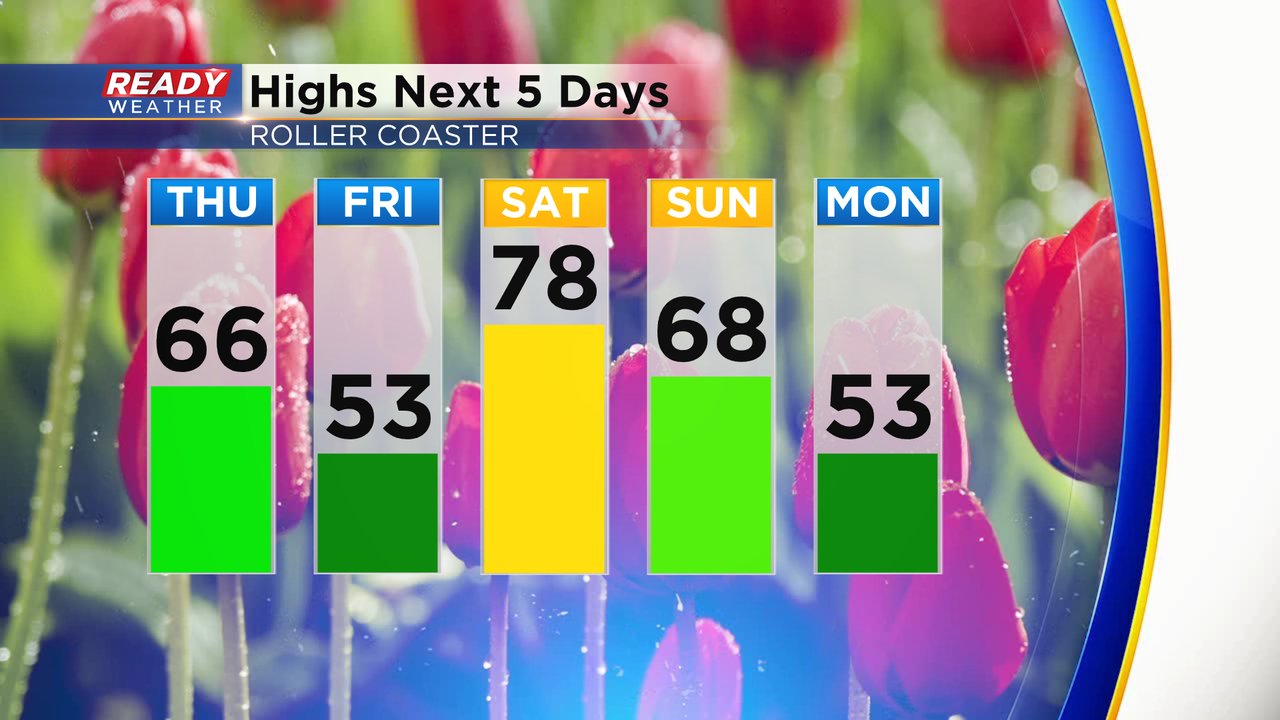
After a gloomy Wednesday with some steady rain in the late afternoon and evening we get to enjoy a lot of sunshine on Thursday. Temperatures will warm with that sunshine with highs reaching the middle 60s for many areas of southeast Wisconsin. Friday will be a bit of a cooler day with a lake breeze with highs in the low 50s. Saturday is on track to be the warmest day of the year and we could even hit 80*! Temperatures slowly fall to start next week.
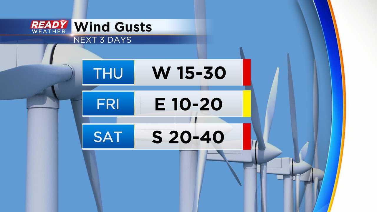
Along with the up and down temperatures the next 72 hours we will see a persistent breeze. Thursday's west wind will gust to 30 mph as warm air returns. The wind shifts to a lake breeze on Friday staying breezy to 20 mph. As temperatures try to soar to 80* on Saturday we see a very strong wind gusting to 40 mph.
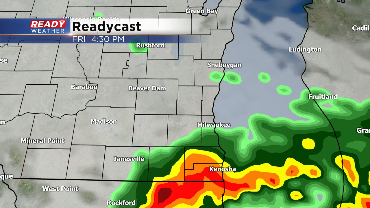
After Thursday's sunshine we see rain chances return on Friday. Scattered showers will be possible in the morning with a few thunderstorms in the afternoon and evening. The best chance for heavy rain will be near the IL border but all of southeast Wisconsin should see between 0.25-0.75" dependent on thunderstorms.
Download the CBS 58 Ready Weather app to track the wind, temps and storms.