Unsettled start to the week & then some summer heat to finish it off


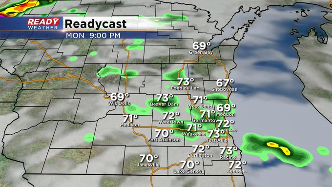
Milwaukee (CBS 58)--A few summer features to discuss as we head into the middle of August. First, we have the chance of some heavier rains and storms into Monday evening as a cold front and low pressure area work their magic across the region. Monday, by the way, marks the first day of school for many MPS students. I would consider taking the rain gear, especially for the afternoon hours in case of any storms we might get.
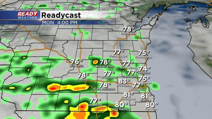
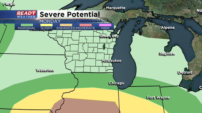
The severe weather threat will be well south of us on Monday. But, again, the chance for heavier rainfall amounts does exist. Perhaps 1/2-1" totals, mainly along and south of I-94.
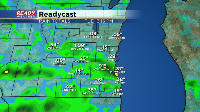
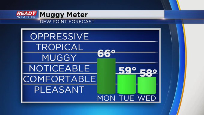
On Tuesday and Wednesday, we could still see a few renegade showers and storms at times. The atmosphere will be ripe for any flare up. But it shouldn't be too widespread. However, the humidity will be a little more tolerable.
We get a break from the humidity and precip by Thursday followed by some Dog Days of Summer heat for the upcoming weekend. It's still August, folks.