The last weekend of 2019 looks to be rather wet

-
5:21

Some speech and sleep concerns in children may be more connected...
-
0:59

Rainbow Springs Nature Preserve
-
5:05

Volunteer Positions at WHS Racine Campus
-
7:34

Sip, Sing, & Safari and more at The Racine Zoo!
-
6:33

Reviews of ’Star Wars: The Mandalorian and Grogu’ and ’Your...
-
4:41

Sargento employee from St. Cloud designated prestigious ‘Wisconsin...
-
2:56

Milwaukee students design their own shoes, step-by-step
-
5:50

Cedarburg family continues to shape the legacy of The Gem Shop
-
3:04

Right on cue. Summerlike weather for the unofficial start of...
-
2:04

Gas prices hit 4-year Memorial Day weekend high as travelers...
-
1:14

Milwaukee Panthers head to NCAA tournament
-
1:01

City leaders close out ’Peace Week’ with city-wide march

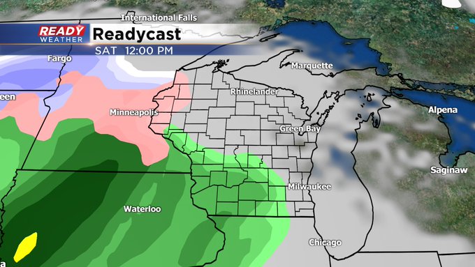
Milwaukee (CBS 58)--Gosh, we've been spoiled this week. A string of 50s and sunshine to boot! Now, after a record high of 58 on Thursday, we've cooled off behind a cool front. I'm not saying cold front because the air isn't chilly, especially for this time of year. In fact, our high will approach 40. This is 10 degrees above normal for the end of December.
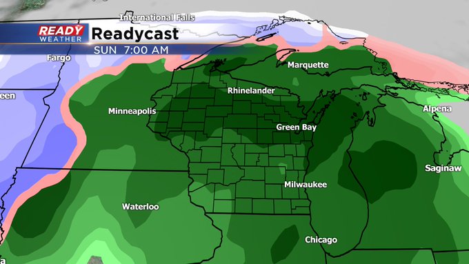
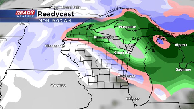
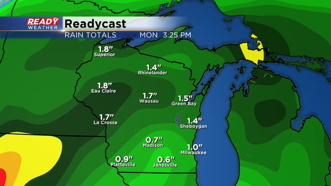
Meantime, look for rain to move into the area Saturday afternoon and hang around Sunday. An inch of rainfall, at least, could fall. I think we'll get "dry slotted" during the day on Sunday but then more moisture returns for Sunday evening. We're holding off on the snow until Monday during the day. It will linger into Tuesday and could provide a bit of an accumulation. Stay tuned!