Storms Fire Tonight and Thursday, Some Severe
With high pressure centered over head for much of today, it will bring one of the nicest days we have seen so far in June. Guess what? It won’t last long. Two weather makers will be at work between now and Thursday night. A warm front will drive in later tonight, sparking showers and thunderstorms. Then, a cold front will trigger showers and thunderstorms tomorrow afternoon and evening. Both rounds could mix a chance of strong to severe storms.
Round number one later tonight will form off of a warm front and a low level jet. The LLJ helps to fuel thunderstorms overnight and bringing organized storms. Due to this threat, the Storm Prediction Center has put our western counties under a slight risk of severe weather, and the rest of the viewing area under a marginal risk. Hail and gusty winds will be the main threat for these storms.
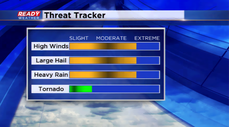
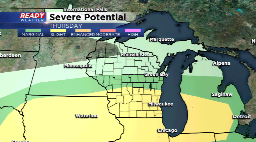
The second round for Thursday afternoon and evening has a chance to be more potent. The SPC has all of SE Wisconsin under a slight risk of severe thunderstorms. Severe thunderstorms love moisture, turning winds (shear), instability, and lift (cold front). The key is to have a few of these elements in close proximity to one another. Once the storms start to fire along the front, which could be In our northern counties tomorrow afternoon, the activity will begin to spread southward by the evening and early night. All forms of severe weather will be possible. Primary threats will be large hail, damaging winds, and heavy downpours.
Download the free Ready Weather app to stay ahead of the storm and get real-time watches and warnings.
