


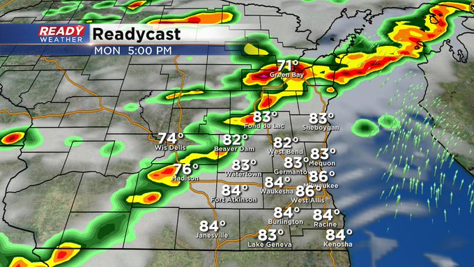
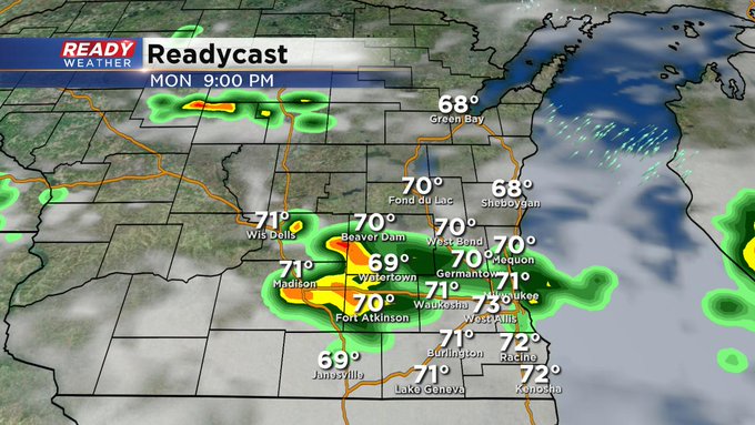
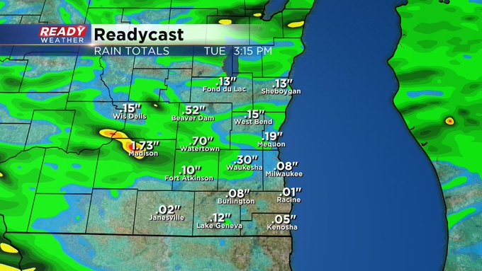
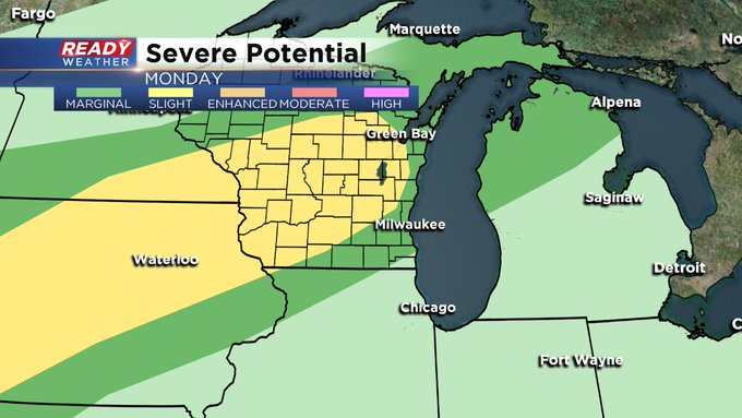
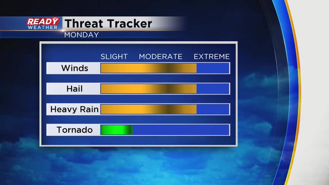
(Milwaukee) CBS 58--Sunday was a day we took a break from the storms. But more activity is on the way for Monday, especially after 3 or 4 pm. A strong cold front will give us the better chance for storm activity, including damaging winds, large hail, frequent lightning, and heavy rain. Once the cold front works its way through later Monday evening, we should start to quiet down again although we could see a few thunder showers on Tuesday and then later Wednesday evening.

Most of the metro area is under a "marginal" risk for severe weather, but you head just north and west and you're in "slight" risk territory.
As mentioned yesterday, a really nice air mass will set up shop toward the end of this week with lower heat and humidity. The upcoming weekend should be fairly beautiful.
The CBS 58 Ready Weather team will keep you updated with the storm development Monday afternoon. Make sure you've updated the free CBS 58 Ready Weather app. We just made some important changes to it.