


A line of storms just ahead of a cold front rolled through Wisconsin and parts of southeast Wisconsin Monday night into early Tuesday morning. A few of those storms did survive into southeast Wisconsin with one small storm moving through parts of Fond du Lac and Sheboygan Counties and another through Jefferson, southern Waukesha and Racine/Kenosha Counties. The cold front is currently draped just south of Milwaukee to Janesville and will start moving again Tuesday afternoon. That front could still spark a few storms in our southern counties but the better chance is in northern Illinois.
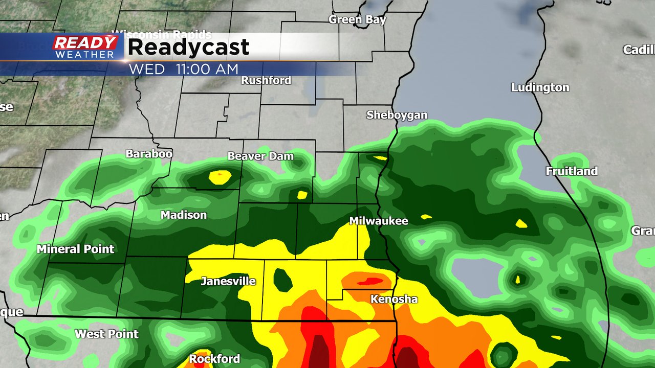
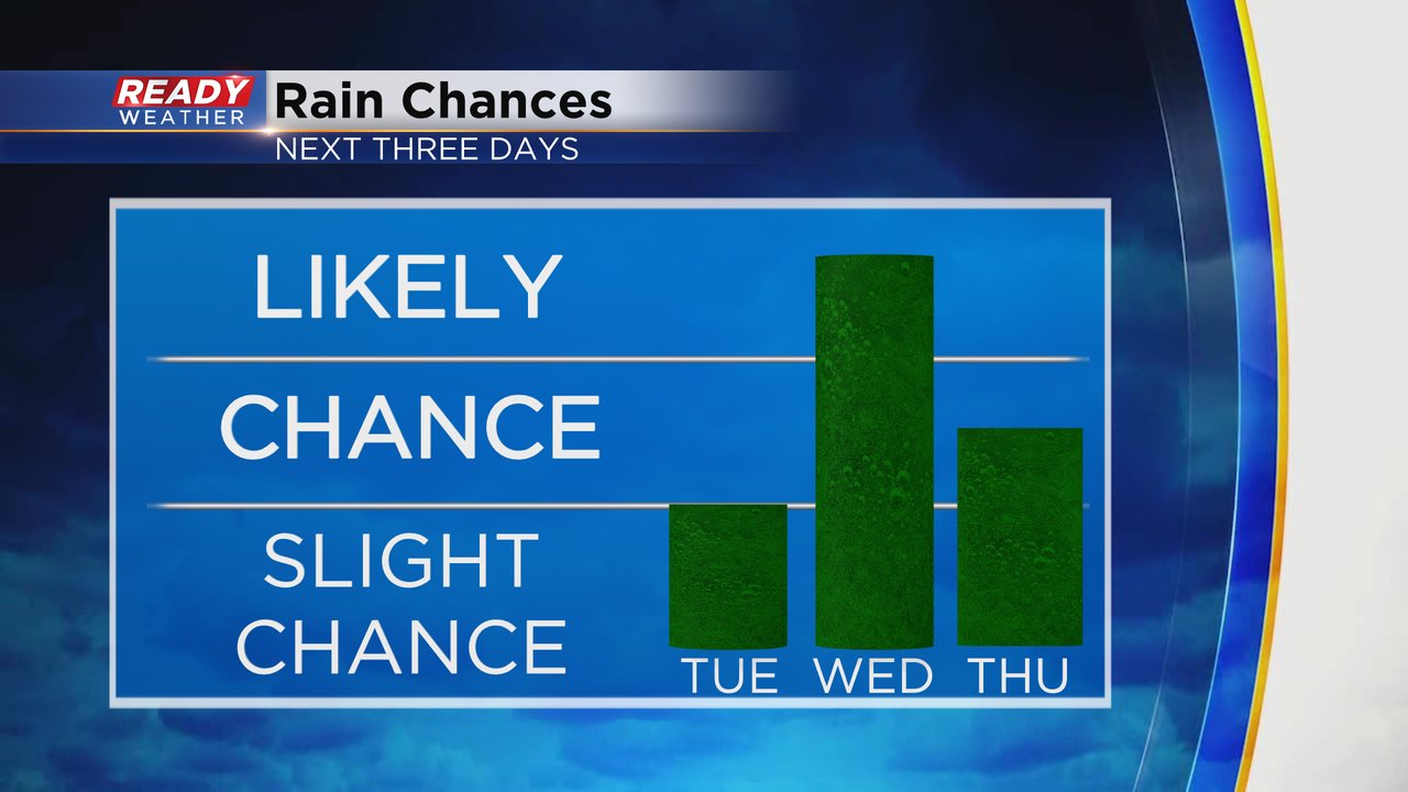
Wednesday has our best chance for rain over the next three days with scattered showers and storms likely especially Wednesday morning through the early afternoon when steady, heavy rain is a possibility.
Thursday has a decent rain chance but looks a lot lighter. Friday and Sunday also have scattered storm chances.
Rain totals over the next 72 hours will mostly stay in the 0.50-1.00" range with most of that rain falling on Wednesday. It's a good soaking rain that will still really need and hopefully we can add to it during the day Friday and Sunday.

Any storms that we do see on Tuesday and Wednesday could be on the stronger side. Both days are in the Level 1 Marginal Risk for a storm with some gusty wind or small hail. The severe threat goes away on Thursday but Friday could feature a chance for strong to isolated severe storms.

Download the CBS 58 Ready Weather app to track all of the storm chances.