


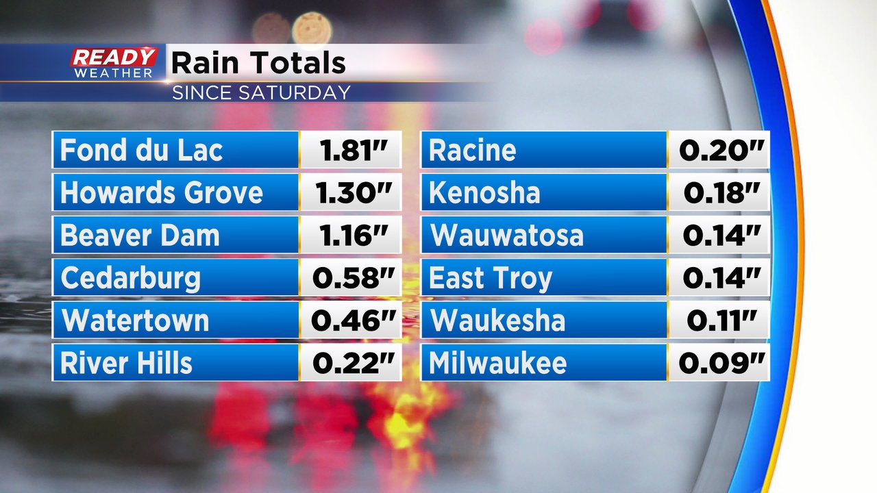
Rain chances over the weekend were few and far between with most of us only seeing spotty showers here and there. That has changed since Sunday night with some good steady rain moving through southeast Wisconsin. The heaviest rain has so far fallen in northern counties with southern locations seeing pretty light showers. Rain totals have ranged anywhere from over an inch in northern counties to 0.10-0.30" in southern counties.
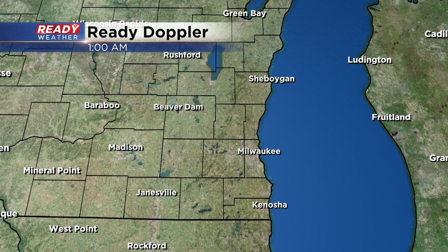
The heavy and steady rain started in northern counties but it's starting to lighten up there. Southern counties are now starting to see some good steady rain. Here's a look at the current radar:
Going into Monday we were running over an inch below-average on precipitation/rainfall for the year. We are doing much, much better than last year when we had drought conditions.

Download the CBS 58 Ready Weather app to track the rain and see when we get some dry time.