Severe Storms Barrel Through Fond du Lac and Sheboygan Counties
Posted: Jul 28, 2020 11:02 PM CDT | Updated: Jul 28, 2020 11:39 PM CDT
-
2:59
Natalie’s Everyday Heroes: Indy Slot Car Series going strong...
-
2:23
Sen. Ron Johnson calls for ’education campaign’ that includes...
-
1:46
History Channel star judges international contest at MSOE
-
2:09
Gov. Evers tours newly renovated Germantown Recycling Facility
-
2:04
Wisconsin nursing home advocates push back against new federal...
-
1:43
’It’s usually the innocent ones that are taken:’ Family...
-
2:20
Sade Robinson murder: Maxwell Anderson pleads not guilty to all...
-
1:22
’We all have a responsibility’: Volunteers pick up litter...
-
1:53
Marquette, MPS host 3rd annual mental health seminar for Black...
-
1:57
Do your part this Earth Day: Cut back on textile waste
-
2:10
Don’t plant yet! More frost and freeze conditions possible...
-
3:30
Local author chats about her new thriller, ’Come and Get Me’
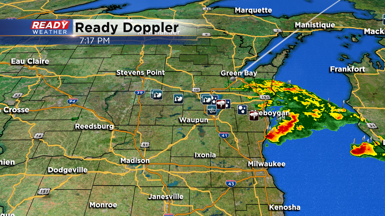
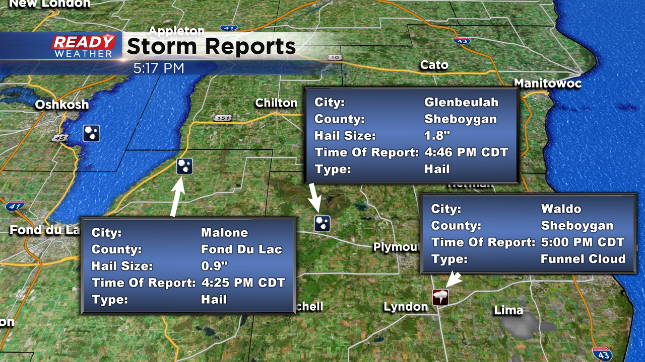
Showers and storms turned severe late this afternoon in Fond du Lac and Sheboygan counties.
We had several hail reports in these counties with the largest of golf ball size in Glenbeulah. Additionally, we had a report of a funnel around Waldo. The storms dropped about a half inch of rain and provided gusty winds to near 50mph in Fond du Lac county. Just north of our area peak winds gusts hit 68mph in Oshkosh. All this activity fired in the vicinity of a cool front. This boundary will slowly sink south tonight. Whatever showers push through your area will be much weaker as instability has waned.Moving forward the lake breeze is with us and that looks to provide a very small chance of a hit or miss shower the next two days. Otherwise comfortable temperatures in the upper 70s are with us to end the work work.
Our next better chance for storms returns this Sunday.
I'm meteorologist Rebecca Schuld
Sign up for the CBS 58 Newsletter