Second round of snow arrives Friday night followed by dangerous cold


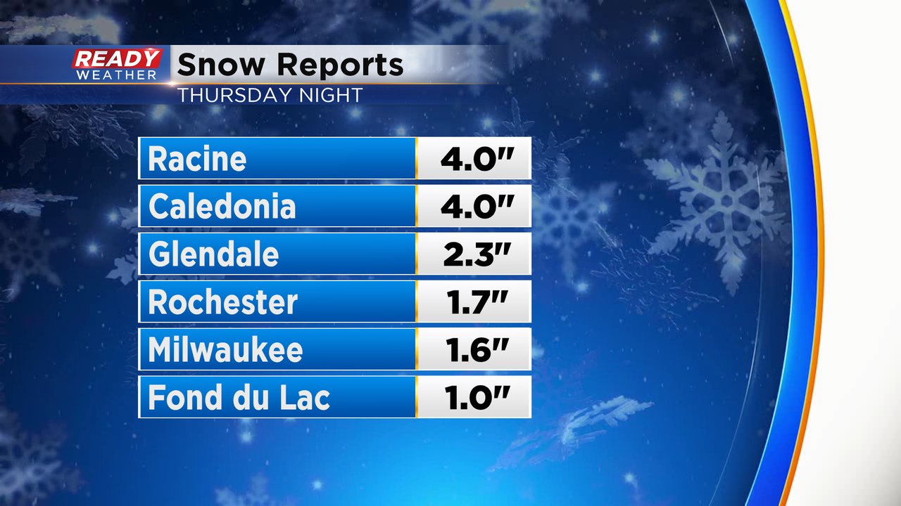
Our first round of snow has wrapped up with most of southeast Wisconsin seeing 1-3" of snow. Racine County was the winner with a couple reports of 4" there. The snow was very fine and slippery and piled up easily. It also caused a number of crashes on the freeways Friday morning and made roads very slick. Expect similar conditions throughout the day Saturday.
We may see a little clearing of the clouds around midday Friday as our first round of snow moves out before the next one rolls in. A few snow showers can't be ruled out late Friday evening but most of the snow with the second round doesn't arrive until after midnight Friday night into Saturday morning.

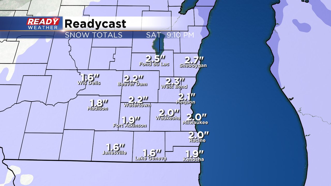
Light snow will linger through most of Saturday morning, the afternoon and start to wrap up around dinner time Saturday. Most of southeast Wisconsin will get another 1-3" of fresh new snow, so pretty similar to the amounts we saw with the first round.
The threats with the second round of snow are similar to the first round. The snow will be light and powdery so no shoveling concerns, but the snow will back roads very slick for driving around most of the day Saturday. The cold air is definitely still in place and the wind might be a touch breezier so expect some blowing snow and reduced visibility.
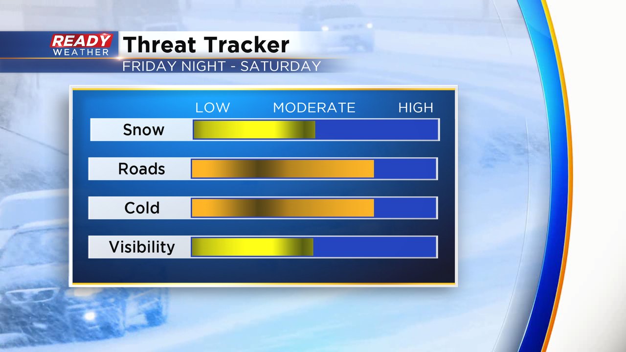
The cold is still going to be a big story for most of the holiday weekend. Wind chills for Friday through Monday will stay below-zero all of those days. By Saturday morning wind chills will be as cold as -20, but Sunday and Monday mornings will be even worse with wind chills to -30 those days. Wind chills below -20* is when it starts to become dangerous with frost bite settling in on exposed skin with 15-30 minutes. Wind chill advisories are likely both of those days.

Download the CBS 58 Ready Weather app to track the snow with the interactive radar and see how cold wind chills will be where you live with the hour-by-hour forecast.