Recapping the near record heat and looking ahead to persistent storm chances


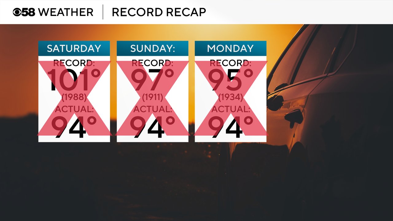
The extreme heat is done! For the last three days the high temperature has reached 94 degrees. It came the closest to tying a record on Monday, but still fell a degree short of the record 95 set back in 1934.
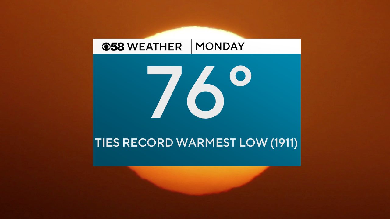
While we didn't break any record highs we did break and tie some record warmest lows. Sunday we broke the record for the warmest low for the date when the low only dropped to 78. And on Monday the low for the day only dropped to 76 which ties the record warmest low set back in 1911.
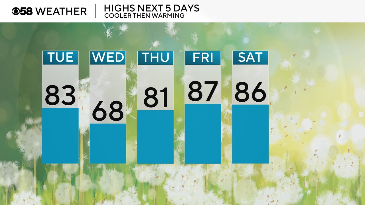
Tuesday will still be warm with highs in the low 80s but not as hot as the weekend. Wednesday is the day we see the real relief with highs in the upper 60s lakeside and low 70s inland with comfy humidity. Then some of the warmth in the 80s returns for the end of the week into the weekend.
We had some severe storms Monday evening in our northern counties with the cold front that started our relief. That front has now stalled across Wisconsin and will bring us continued chances for showers and storms most of this week.
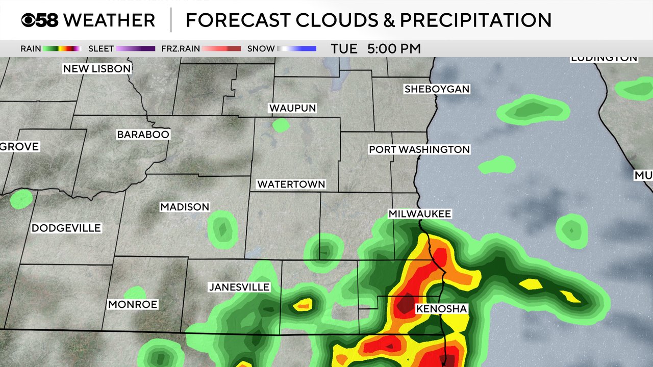
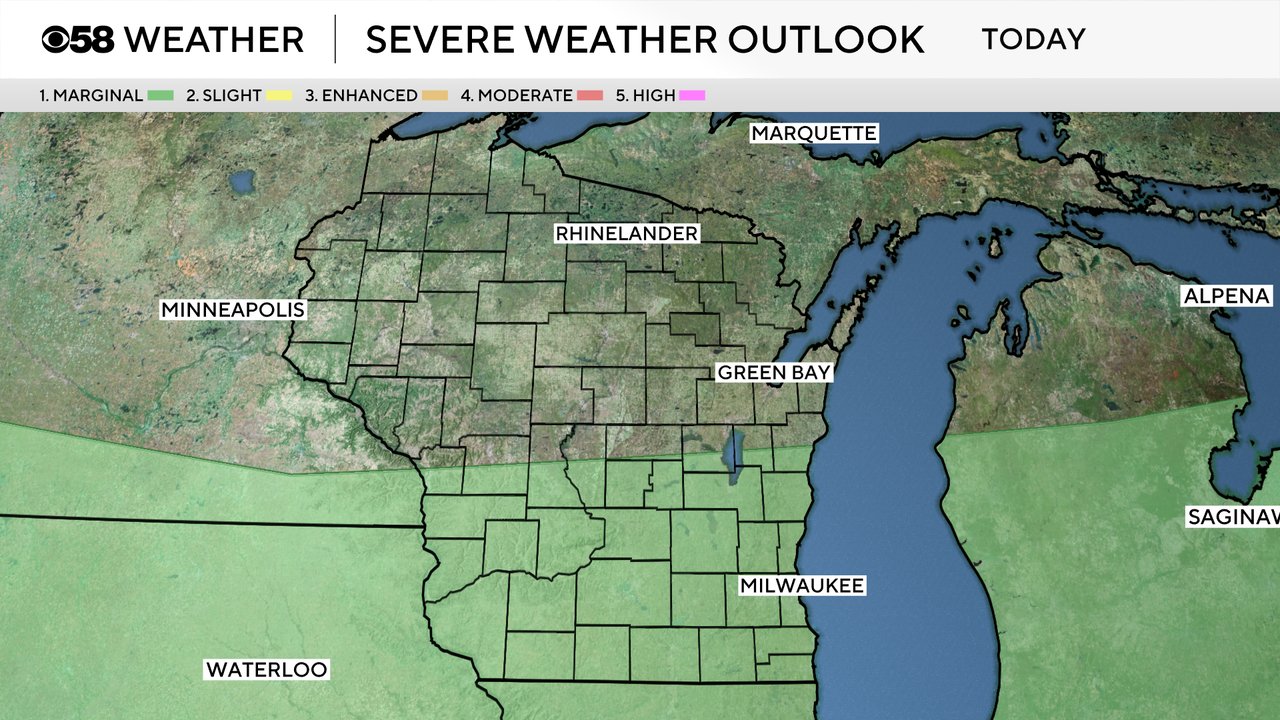
A few storms that form Tuesday, especially in the afternoon and evening, could be on the stronger side. A Level 1 Marginal Risk for strong to severe storms is in place. That's a trend that will continue the rest of the week where any storms we see could be strong.
Download the CBS 58 Weather app to track the dropping temps and continued storm chances.