Rain and thunder late Friday changes to snow Saturday morning
Quite weather is expected tonight through early afternoon Friday, but rain will push in from south to north between 3-6 pm. Some snow is possible initially in Fond du Lac and western Sheboygan counties, but it'll change to all rain fairly quickly as warmer air moves in during the evening.
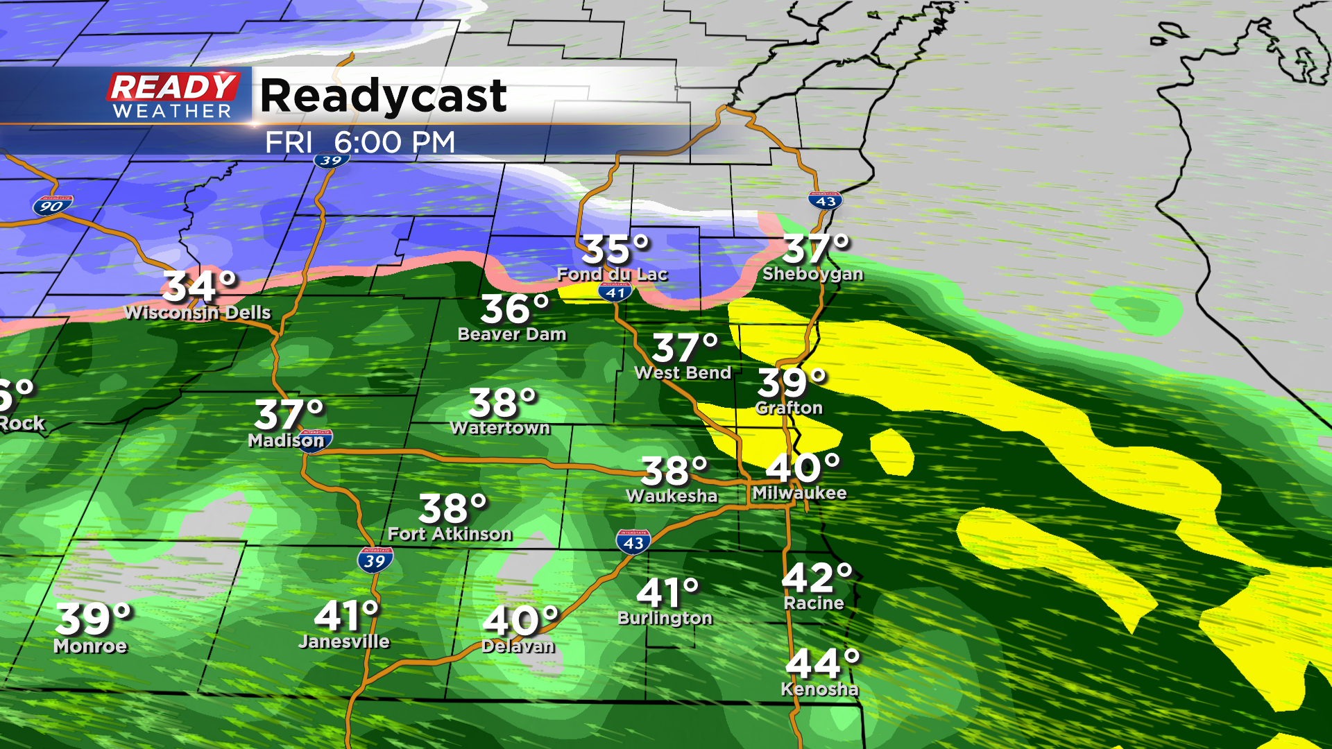
All rain is expected Friday evening with a few rumbles of thunder possible. There could be some locally decent downpours as well.
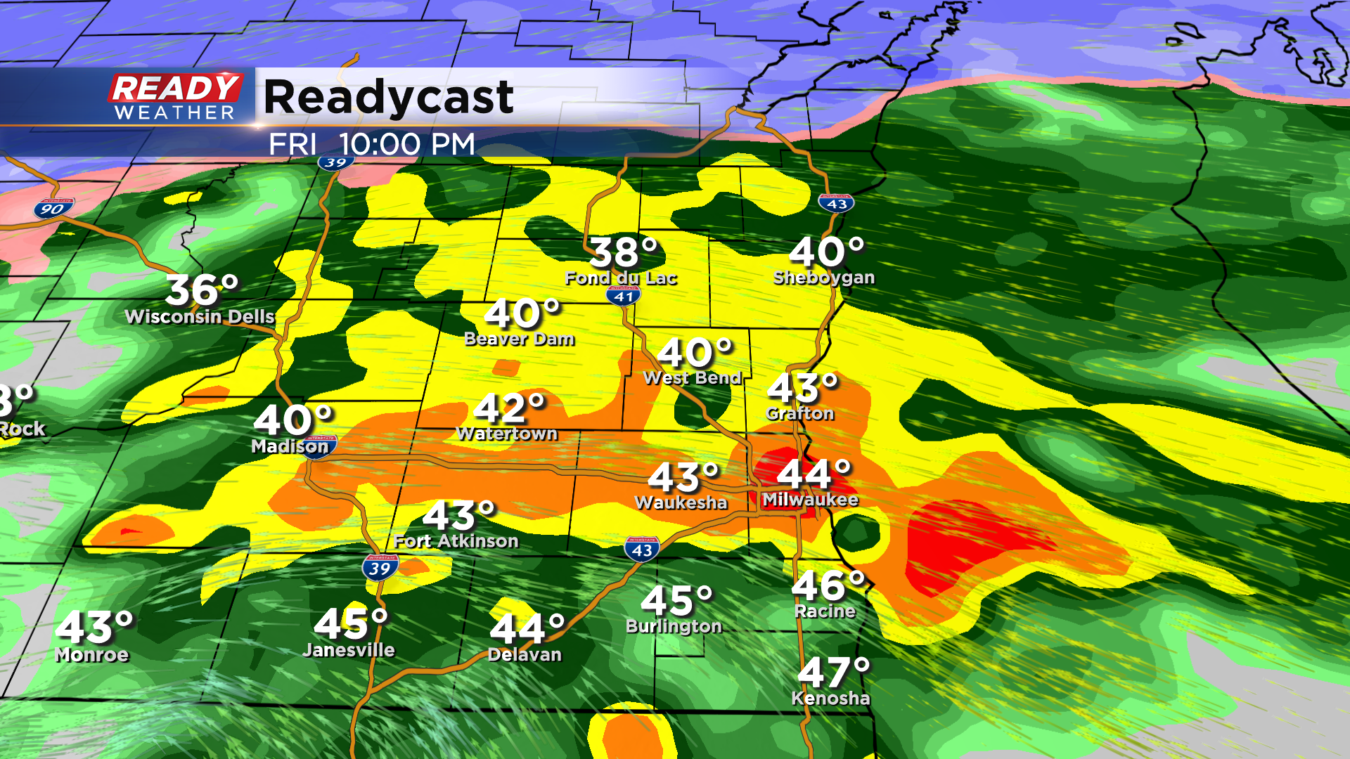
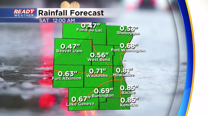
Rain showers will become a bit lighter and more scattered Friday night as the low pressure center tracks right across southeast Wisconsin. Between .40-.80" of rain is expected.
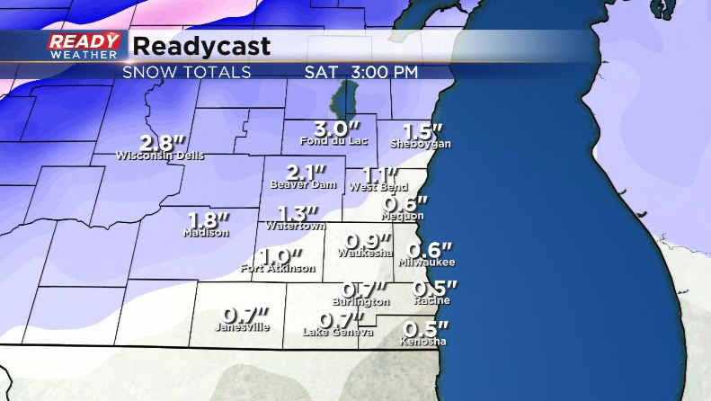
Colder air wraps in behind this system Saturday morning, changing the rain to snow from NW to SE. This change over looks to happen around sunrise Saturday. Snow showers continue through the morning before tapering off by early afternoon.
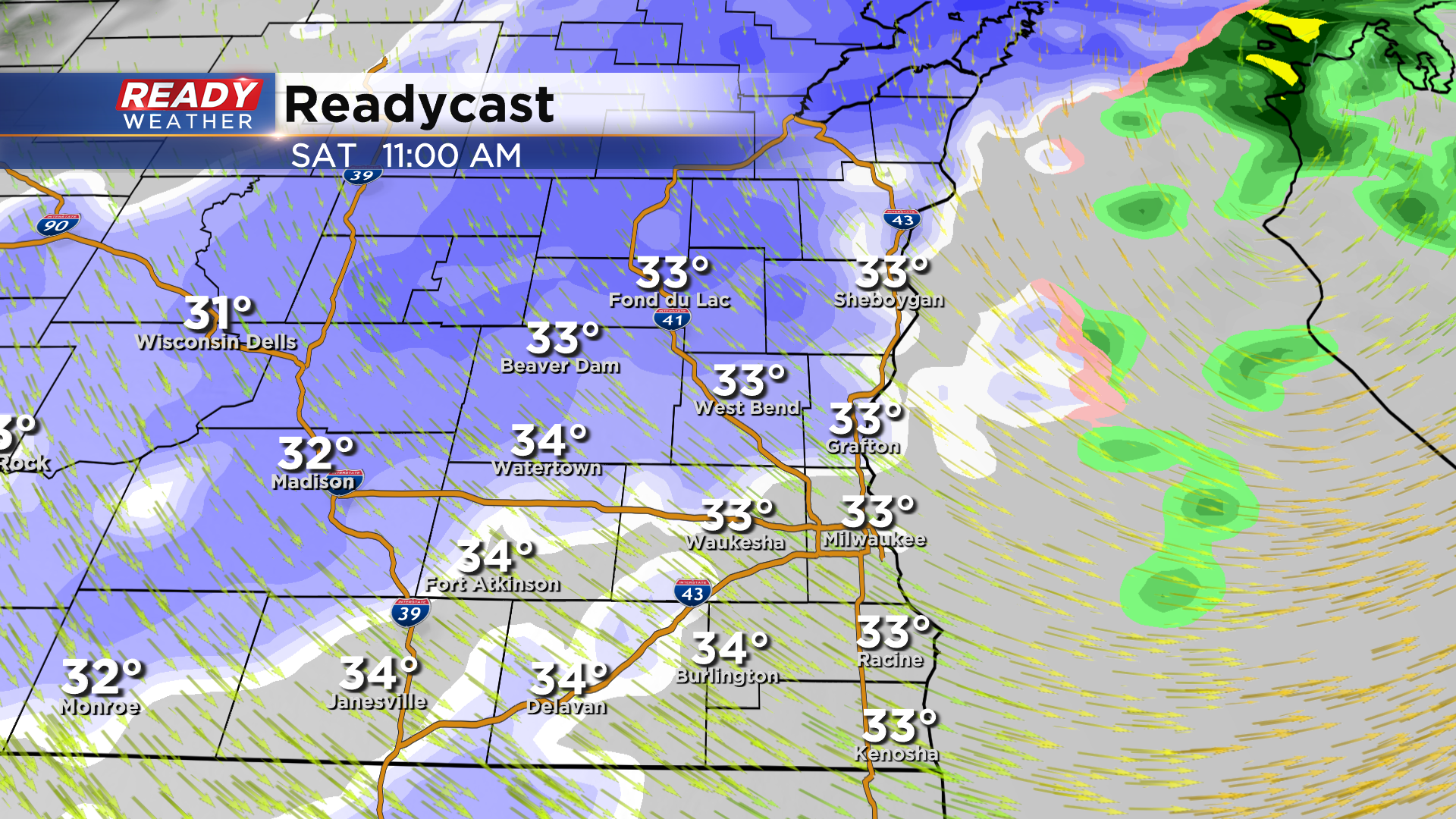
The best chance at minor accumulation of 1-3" Saturday morning will be northwest of Milwaukee with the best shot at 3" near Fond du Lac. Folks in western Fond du Lac county could see isolated up to 4". A half inch or less is expected Milwaukee southward.
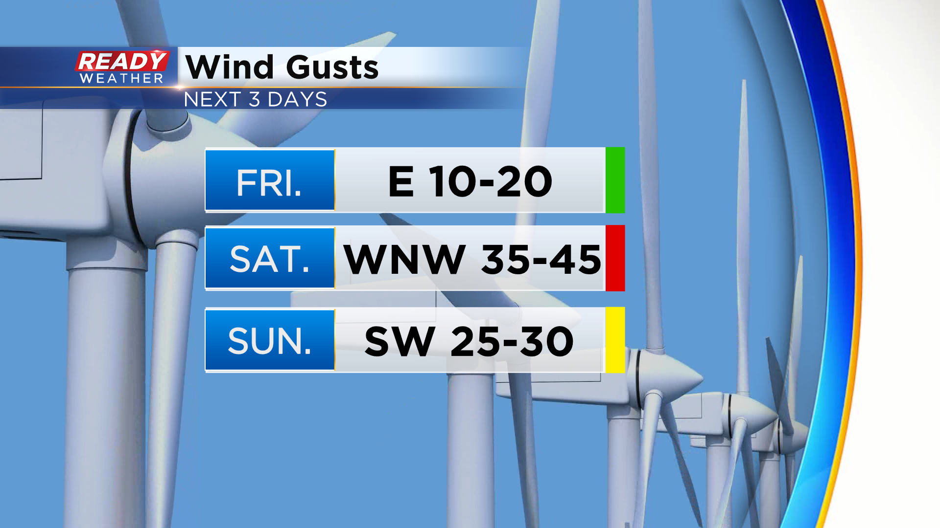
Wind will also crank up and gust between 35-45 mph on Saturday with a few gusts possibly approaching 50 mph. Wind won't be as strong on Sunday, but we'll still have gusts up to 30 mph.
Temps go on a nice warming trend into early next week. Download the CBS 58 Ready Weather App to track the radar.
