


Updated: 9:06 a.m. Dec. 3, 2021
The accumulating rain and snow from Friday morning has wrapped up. A few pockets of drizzle and flurries will be possible through the rest of the morning with some filtered sunshine possible late this afternoon. Viewer photos and reports show that roads stayed just wet across almost all of southeast Wisconsin with accumulation staying to the grass and cars. New reports show up to 1.5" of snow fell in our northern counties with Dodge County seeing the most.

The next chance for rain/snow is on Sunday with little to no snow accumulation expected right now.
------
Updated: 7:10 a.m. Dec. 3, 2021
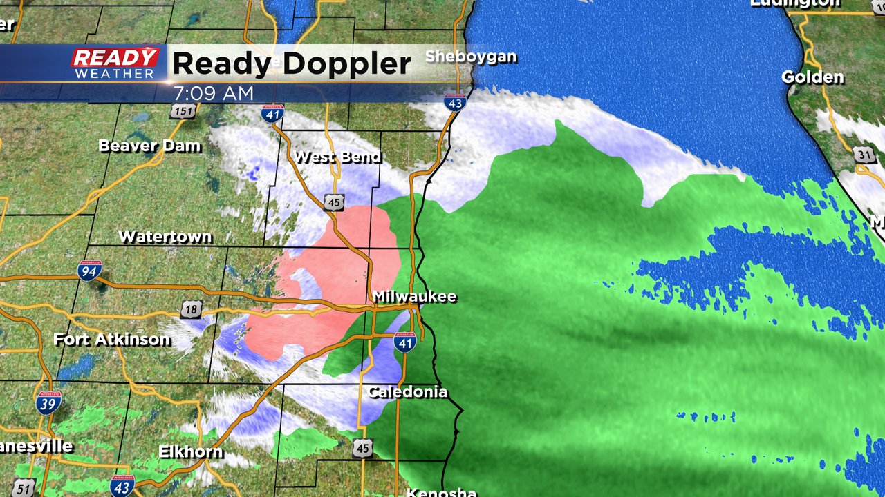
The light rain and snow is coming to an end in southeast Wisconsin with our western and northern areas already seeing the snow come to an end. Still dealing with a wet rain/snow mix in the Milwaukee and Waukesha areas that should wrap up by 8:30 a.m. A few flurries and pockets of drizzle may be possible through the rest of the morning. Some light snow accumulation has been reported.
------
Posted: 5:10 a.m. Dec. 3, 2021
The rain and snow showers we've been talking about most of the week have arrived in southeast Wisconsin. The precipitation started a little after 1 AM with some snow and rain showers falling. As of 5 AM most areas along and south of I-94 are reporting just rain with northern counties seeing all snow.

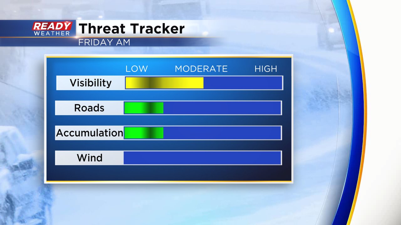
DOT cameras in northern counties are showing just wet roads even with snow showers and some slushy accumulation on the grass. A few areas in the Waukesha/Milwaukee metro areas could get a few tenths of an inch of snow. Northern counties could get up to 1.5" of snow on grassy surfaces and some slushiness on the roads.

The mix will impact the morning commute but the impacts are fairly minimal. A few moderate areas of snow could lead to some reduced visibility.
Download the CBS 58 Ready Weather app to track the rain and snow.