11 AM Update: Accumulating snow ends early this afternoon
Updated 11:00 a.m. January 25, 2020
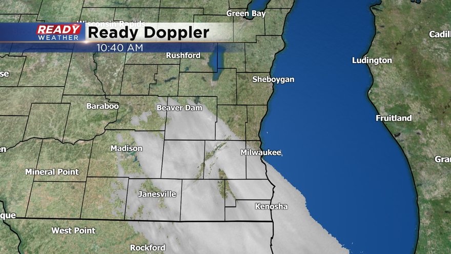
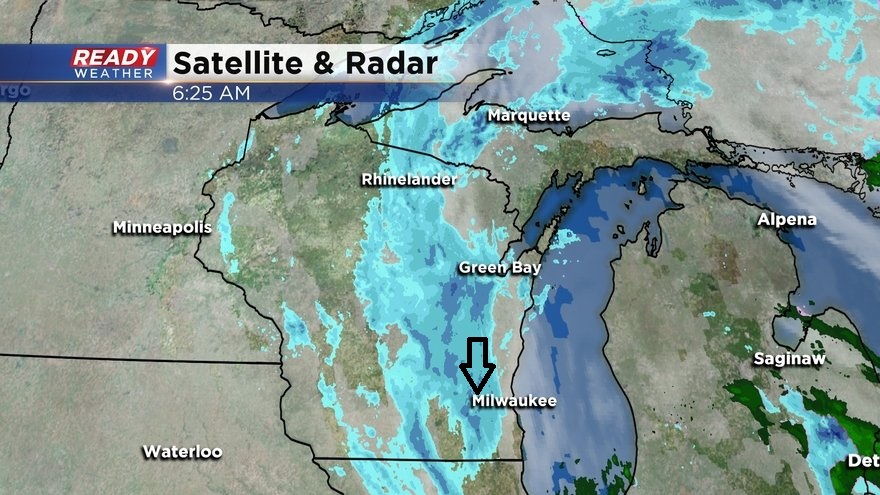
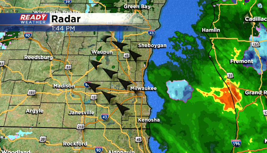
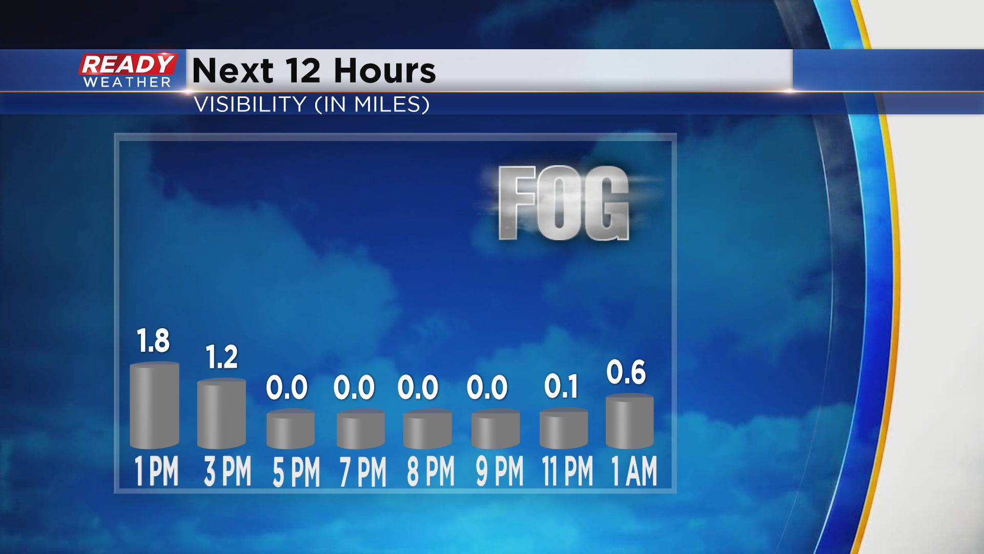
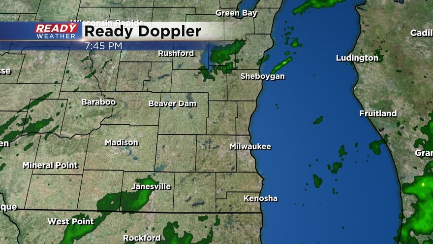
This area of light to moderate snow continues to work through southeast Wisconsin and should exit the area between 12 and 2 p.m. Up to an inch of additional accumulation will be possible. The accumulating snow has come to an end for places like Cedarburg to West Bend and northward through Sheboygan and Fond du Lac counties. Additional flurries and fog will be possible through the afternoon and evening.
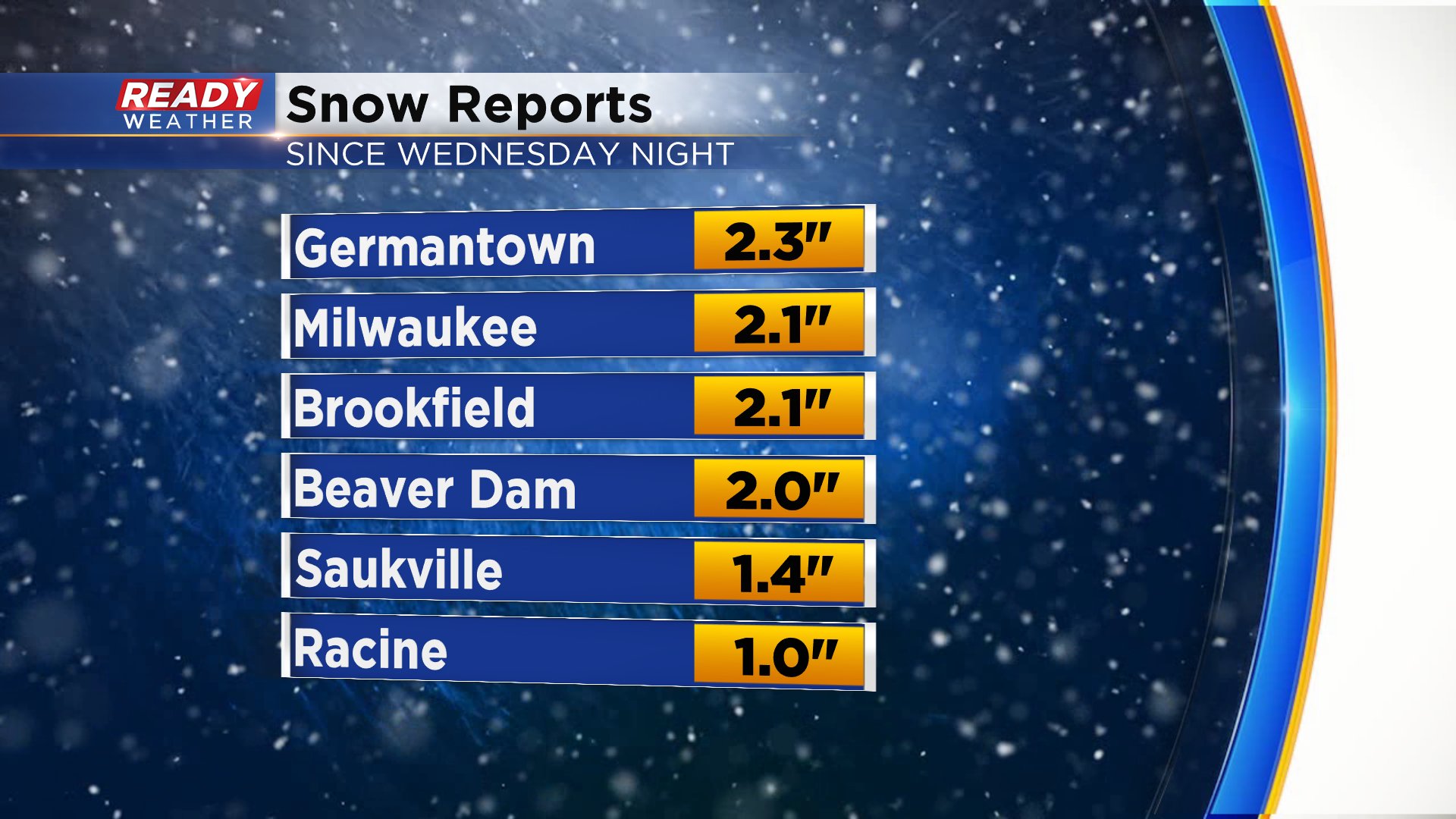
Here are a few more snow totals:
St. Peter: 4.5"
Oconomowoc: 4.5"
Theresa: 4.0"
Richfield: 4.0"
Rochester: 4.0"
Horicon: 3.9"
Jackson: 3.8"
Kewaskum: 3.8"
Lake Geneva: 3.2"
Menomonee Falls: 3.2"
Merton: 3.0"
Elkhorn: 3.0"
Pleasant Prairie: 3.0"
Belgium: 2.5"
Franklin: 2.5"
Plymouth: 2.2"
----------
Updated 9:00 a.m. January 25, 2020
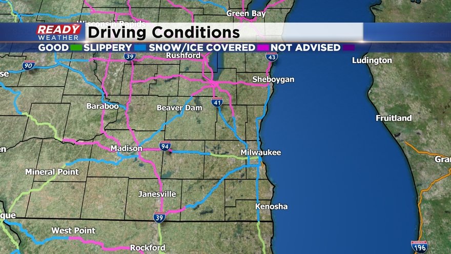
Snow is currently coming down at a moderate clip across portions of Jefferson, Waukesha, Dodge, Walworth, and western Racine and Kenosha counties, so the Winter Weather Advisory has been extended until noon in those counties. The accumulating snow will come to an end after this band pushes through, but flurries and drizzle will linger for the remainder of the day.
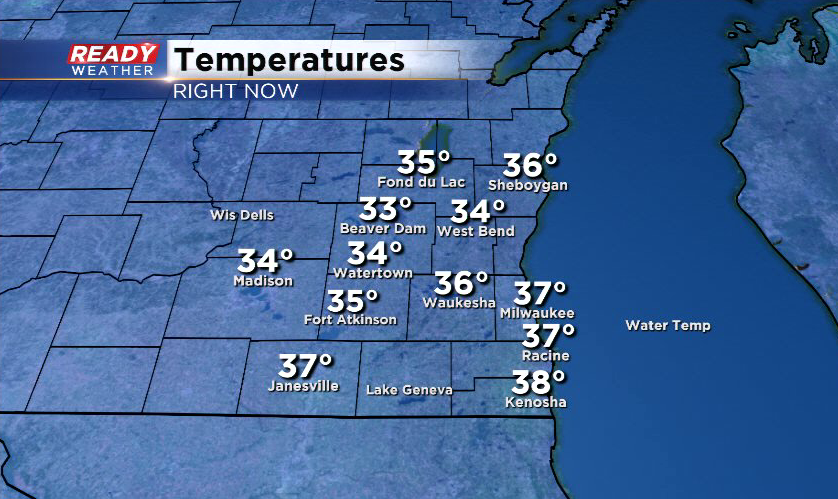
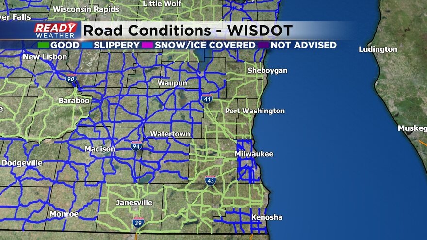
Temperatures there are still hovering around the freezing mark, so expect travel impacts through midday. I-94 in Waukesha county is snow covered and it has lead to multiple accidents near Waukesha and Pewaukee.
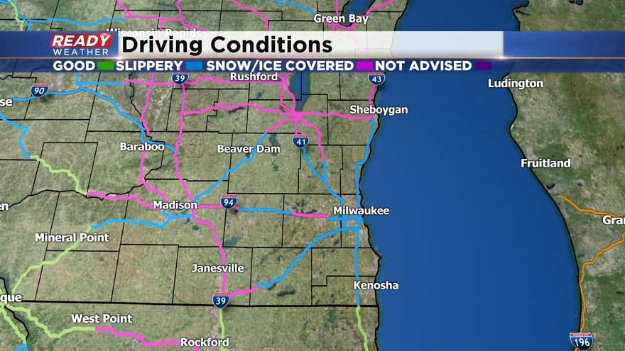
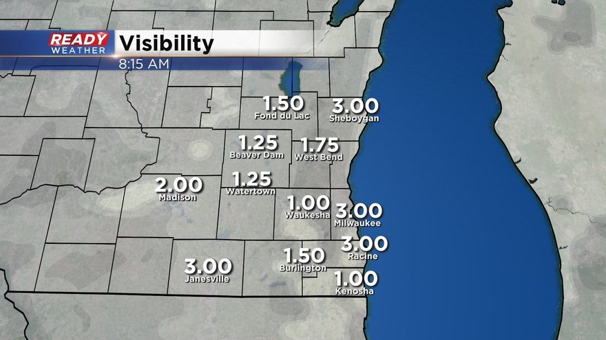
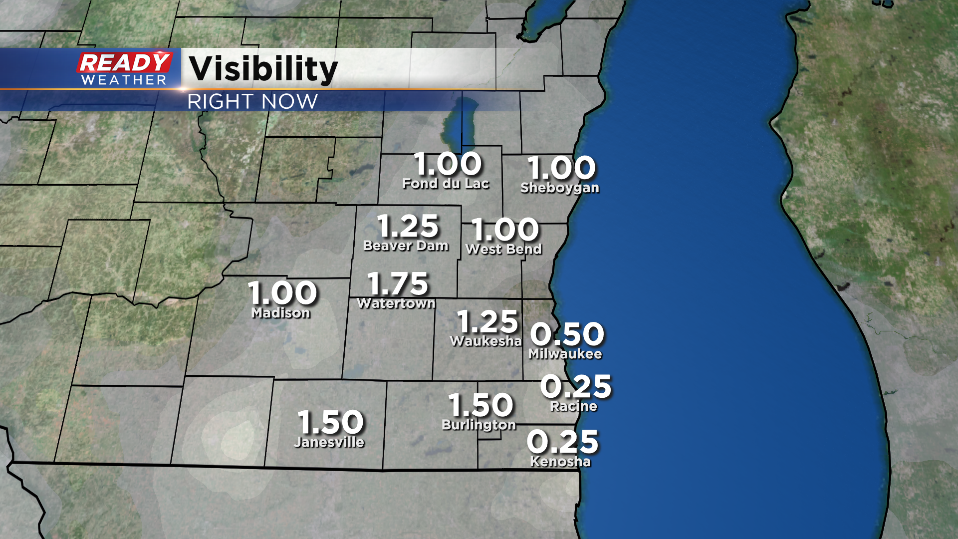
Visibility is also being reduced to a mile or less at times with this band of snow, so make sure you leave extra space between you and the car in front of you and remember to turn on your headlights!
Here are a few more snow totals:
Ripon: 4.5"
Taycheedah: 4.5"
Johnson Creek: 3.5"
Fond du Lac: 3.0"
Elm Grove: 2.5"
Racine: 1.5"
West Allis: 1.0"
--------------------
Updated 6:45 a.m. January 25, 2020
Snow will continue to push through the area this morning, with an additional inch or two of accumulation expected in our western counties. While most of the accumulating snow will end this morning, there will be some lingering snow showers early this afternoon that'll push through Jefferson, western Waukesha, Walworth, and western Racine and Kenosha counties which could drop another quarter to half inch of wet slushy snow. Areas along the lake from Milwaukee northward may not see any additional accumulation today.
Temperatures continue to sit around or just above the freezing mark this morning, which is keeping main roads from being completely snow covered. Most major roads in southeast Wisconsin are reporting slippery stretches, while side streets and less traveled roads are covered in slushy snow. Roads are not expected to get any worse.
Only a few snow reports to pass along early this morning:
Sullivan: 2.0"
Elmwood Park: 1.5"
Milwaukee: 0.8"
-----------------------------------------------------------------
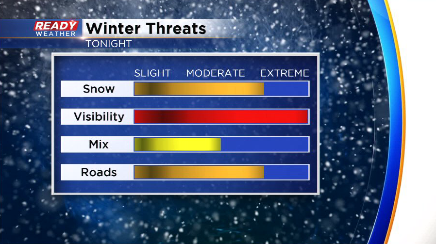
No changes to the going forecast. Plenty of snow will continue to fall across southeastern Wisconsin. Thankfully surface temperatures will remain in the lower 30s, so while slick roads are possible, main highways and interstates shouldn't be snow covered. Side roads are an issue and will pose the greatest threat.
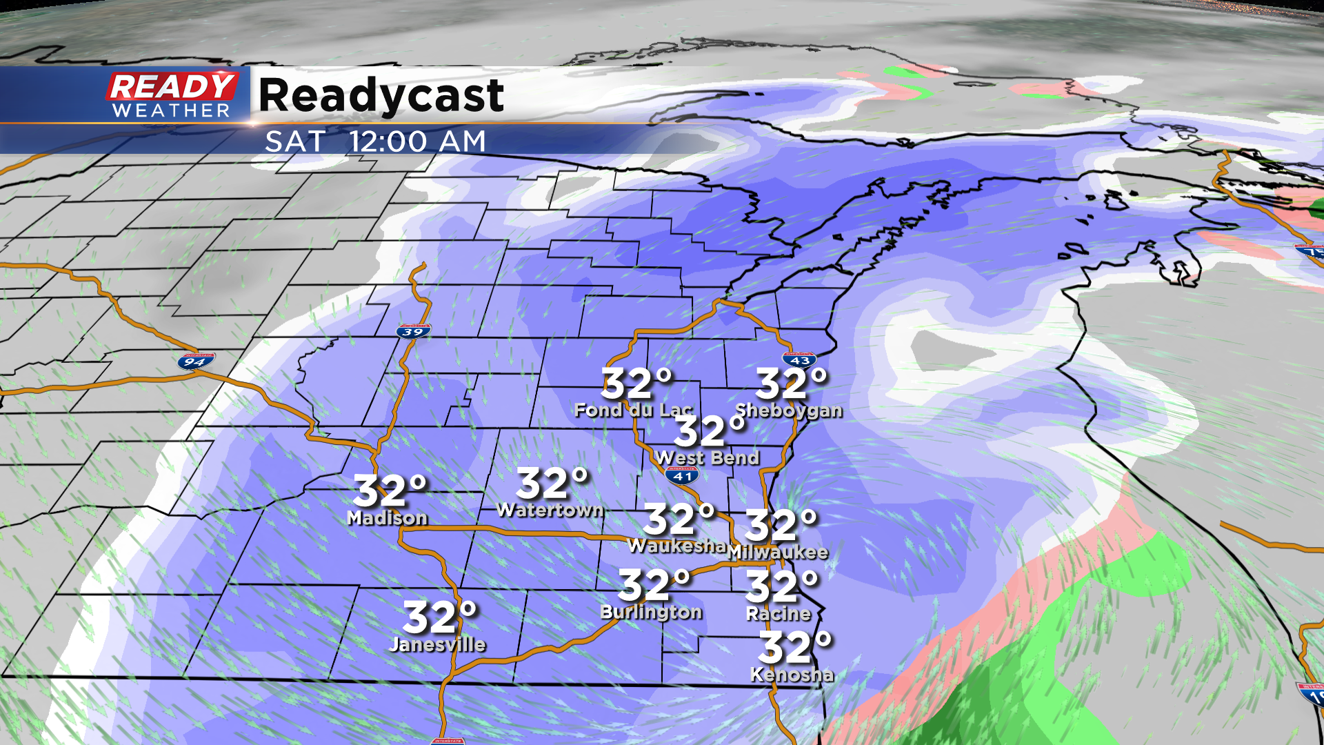
Snow will persist overnight into Saturday morning with another 1" to 3" of snow overnight.
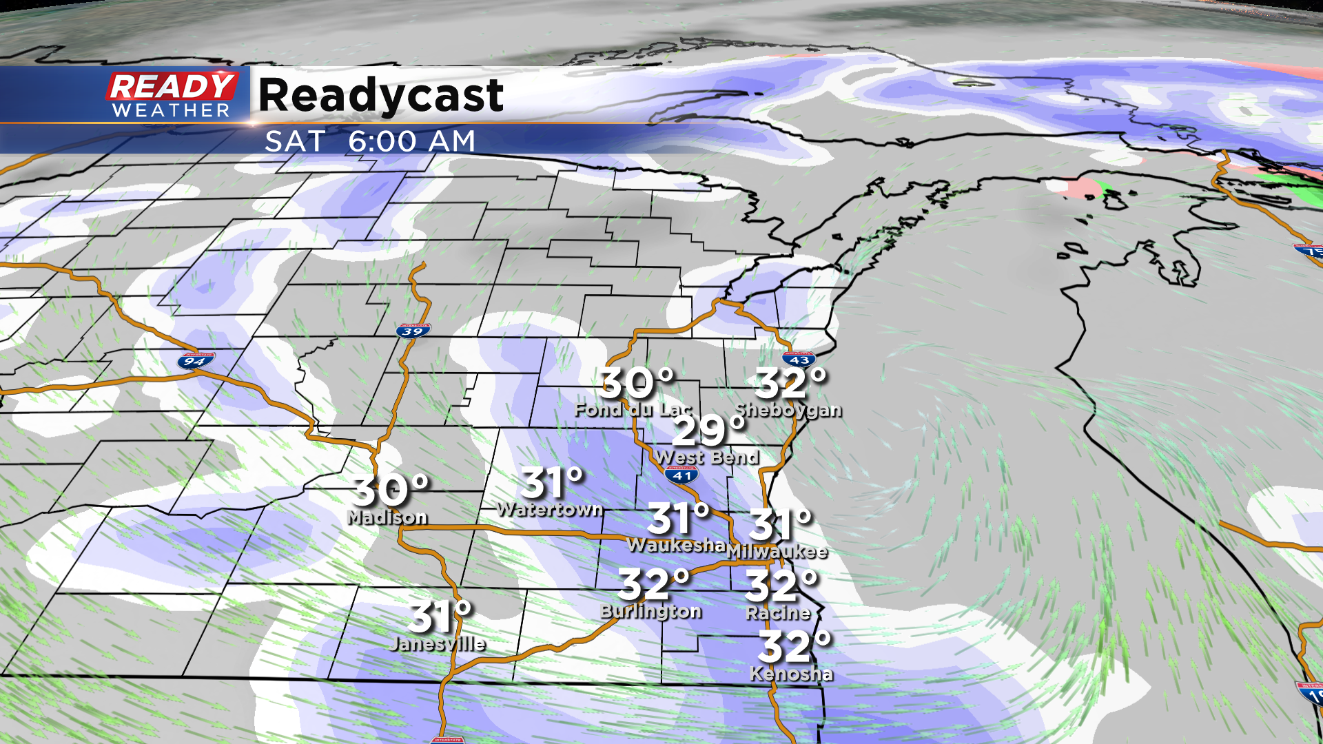
Snow should move out between 7 am and 9 am on Saturday. Flurries could linger into Saturday afternoon.
_____________________________________________________________________________________________________________
Updated 4:18 p.m. January 24, 2020
Rain continues to push onshore from Lake Michigan and has been mixing with some big snowflakes in the Milwaukee area as of 4:10 p.m.
The forecast is still on track for the rain to mix with and change over to snow over the next 1-3 hours with the complete change over taking the longest along the lake.
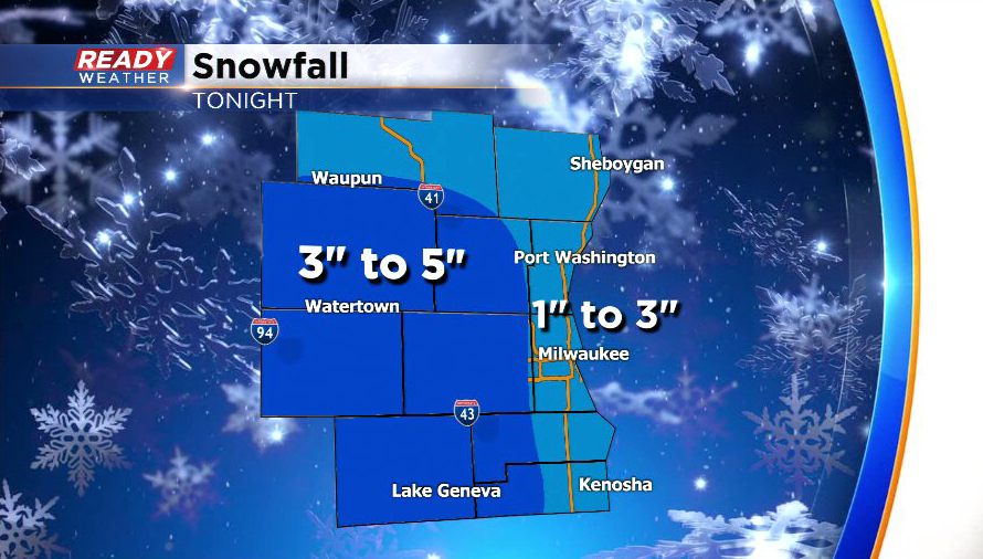
We're still expecting the highest snow totals to remain away from the lake, with 2-3" likely around Milwaukee. The most likely places that could see 4-5 inches would be in southern Jefferson, Walworth, southern Waukesha, and western Kenosha and Racine counties.
Once the change-over to snow happens, it'll be a heavy, wet snow that could come down at a moderate to heavy clip at times, especially before midnight. This will continue to keep visibility very low, and will likely lead to hazardous conditions on the roads.
----------
Updated: 2:00 p.m. January 24, 2020
After a break in the precipitation, the next round is about to move into southeast Wisconsin.
It'll likely begin as all rain as current temperatures are sitting in the mid to upper 30s, but will change over to a rain/snow mix then all snow by late afternoon and early evening. The rain/snow mix may linger a bit longer near the lakeshore due to warm lake temperatures and easterly winds. Watch out for slick spots during the evening commute away from the lake.
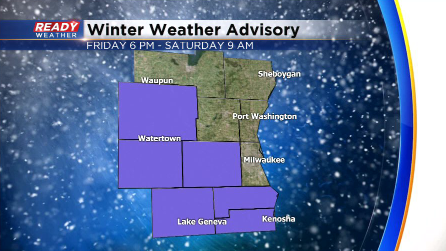
We're still expecting between 2-5" of snow tonight through Saturday morning, but the best chance to see the higher totals will be in the counties under the Winter Weather Advisory and away from the lake. Dodge county is now included in the advisory.
-----------
Updated: 11:40 a.m. January 24, 2020
We're seeing a break in the precipitation at this time. But plenty of moisture still looms.
---------
Updated: 9:48 a.m. January 24, 2020
Dry air has now moved into southeast Wisconsin. Expect some flurries and drizzle throughout the rest of Friday with another round of moderate snow Friday evening into Saturday. Temperatures are hovering around or just above freezing so most roads will just stay wet or slushy but some sidewalks and untreated side streets could be slick at times.
Road conditions across southeast Wisconsin are mostly reported as just wet however some western and northern freeways are reported as slippery or snow covered. Use caution when out driving. It only takes a little bit of snow and slush to spinout your vehicle.
------
Updated: 8:04 a.m. January 24, 2020
Light to moderate snow and rain/snow showers are currently moving through southeast Wisconsin. Some spots, especially inland and north, are waking up to an additional inch or so of snow but the precipitation stayed mainly rain or mix near the lake and around Milwaukee. Some dry air is starting to move in from the south so expect little to no additional snow accumulation after 9 a.m. Friday through the evening. Some flurries or drizzle is still possible.

Another round of mix and snow is still on track for Friday evening through Saturday morning where 2-5" of snow is possible.
------
Posted: 5:05 a.m. January 24, 2020
Snow started to move back into southeast Wisconsin after midnight Thursday night into Friday morning. The snow has been mixing with rain at times especially in the Milwaukee metro and areas south. Some areas just seeing the snow could get up to 1" of new snow.
Temperatures Friday morning are at or above freezing so any roads treated with salt should remain just wet or slushy but sidewalks and other untreated surfaces could get slick and maybe a touch icy.

Most of the accumulating snow so far with this storm came Wednesday night into Thursday morning little to no additional accumulation during the day Thursday. Snow totals so far have been very in line with the forecast with 1-2.5" across all of southeast Wisconsin.
Expect rain and snow showers to continue for most of Friday. Similar to Thursday little to no additional accumulation is expected from late morning into the early evening but then snow mixing with a touch of rain starts to move back in Friday evening.

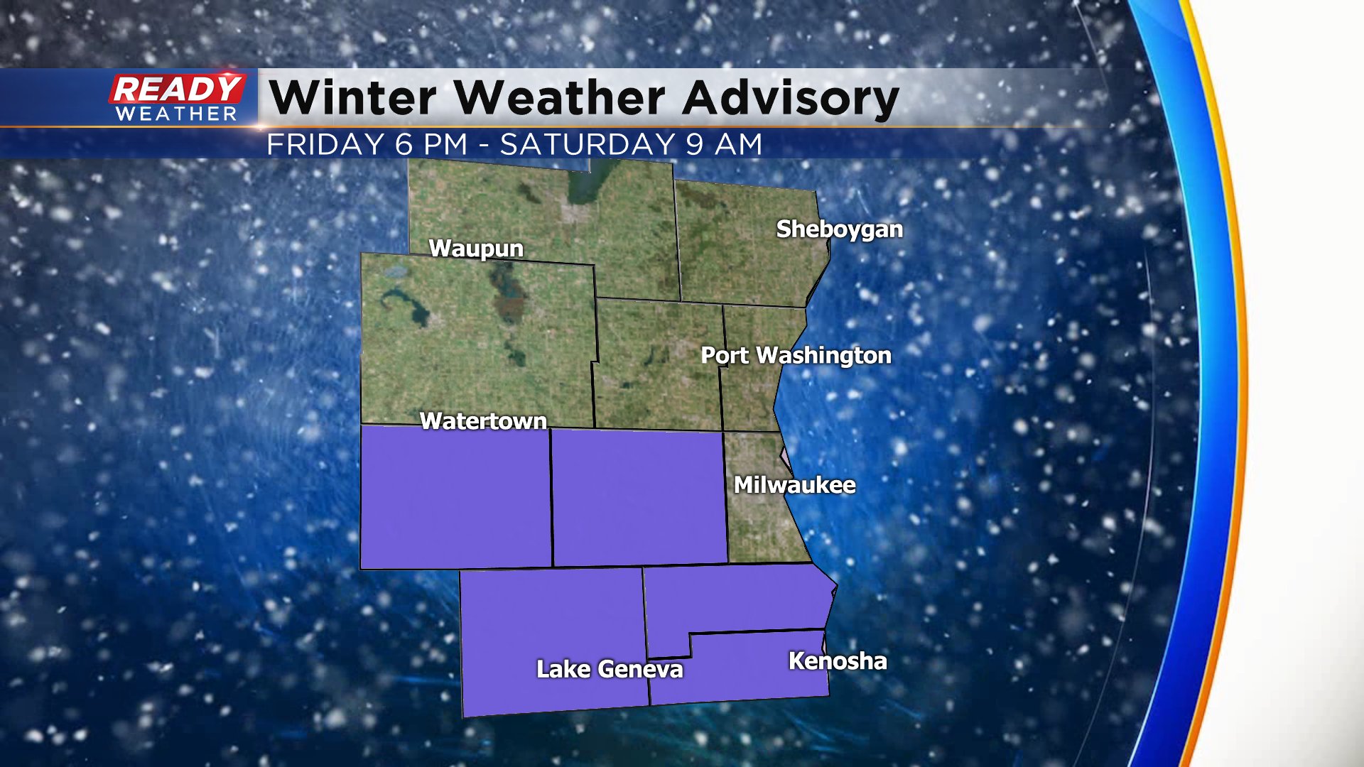
A winter weather advisory has been issued for a few select southern counties. Waukesha, Jefferson, Walworth, Racine and Kenosha Counties are under the advisory and have the best chance to see some moderate snow Friday evening into Saturday morning. The advisory starts at 6 p.m. Friday and lasts until 9 a.m. Saturday.
Additional snowfall from Friday into Saturday with range from 2" to 5" across all of southeast Wisconsin.

Download the CBS 58 Ready Weather app to track the snow and see who is seeing the rain/snow mix.
