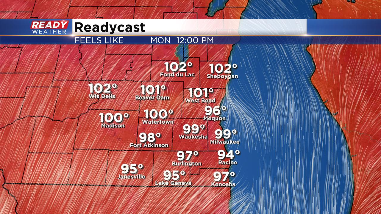
Prolonged heat starts Monday with heat indices close to 100°


We had another 90° day over the weekend before a lake breeze kicked in. The high hit 91° in Milwaukee on Saturday and then 80° on Sunday. That 91° was the fourth time we hit the 90s this month which is the average number of 90° days during the month of July. Looking at the current forecast, we have at least four more chances to see the 90s just this week alone.

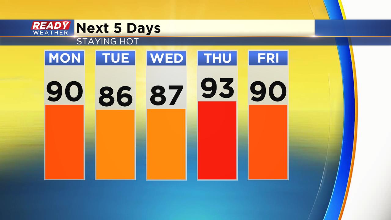
Highs on Monday will likely hit either side of 90° with a breeze out of the southwest bringing in the warm air gusting to 25 mph.

After a brief break from the intense humidity over the weekend, tropical dew points are back the next few days. Dew points will hover around 70° the next three days and show no real signs of going down until next week.

Once you combine the heat and the humidity it could feel close to 100° in a few isolated spots. Make sure to drink plenty of water if you are outside and take some breaks. Check in on elderly and those without AC and monitor the time your pet is staying outside. Never leave a child or pet inside a car during heat.
The heat really isn't going anywhere the next few days. We may see a touch of a lake breeze on Tuesday and Wednesday but it will still be warm in the upper 80s. Thursday into the weekend could be the warmest of the year with mid-90s for highs not out of the question.
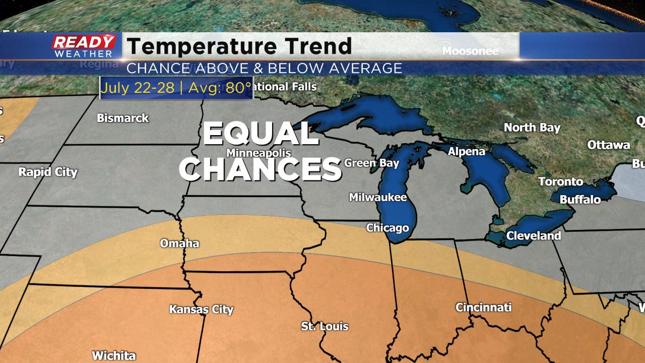
The hot pattern does finally look to break going into next week when low 80s return. The current temperature trend for the last week of July has equal chances for both above and below average temperatures.
Download the CBS 58 Ready Weather app to see what the temp and heat index is where you live and track any pop up storms that develop because of the heat.