Plenty of warmth for the waning days of summer, followed by rain, then much cooler


MILWAUKEE (CBS 58)--Just a few more days to go until Fall, but Mother Nature isn't rushing things. Look for us to get into the 80s today, especially away from the lake. It'll feel warmer as well with more humidity.
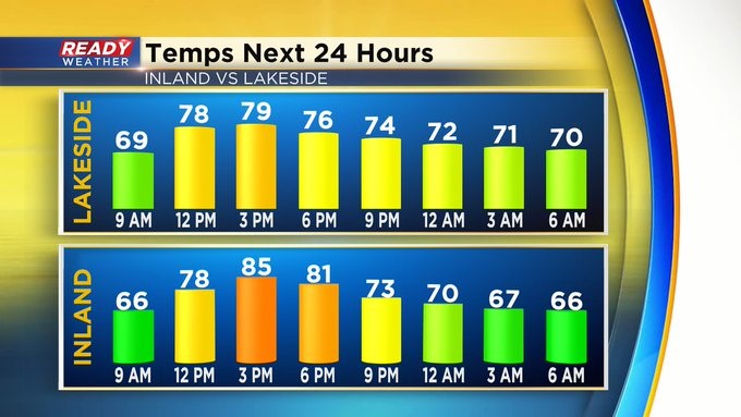
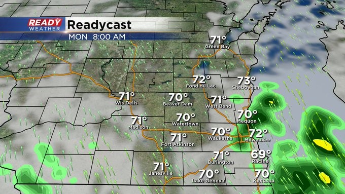
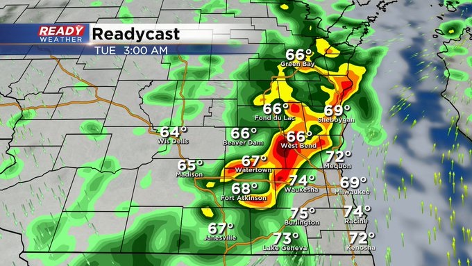
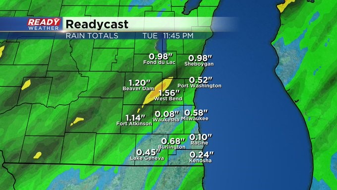
The changes start to happen on Monday as moisture moves up from the south, and a cold front works in from the west. Look for some scattered showers Monday morning with the chance in the afternoon as well. And possibly some storms too. The best risk of widespread rain and thunderstorm activity will be overnight Monday into Tuesday as the strong front begins to move into the area. Rainfall amounts will be between a half an inch and inch. Showers should clear Tuesday afternoon and then it turns much cooler by Wednesday, the first day of Fall. Expect highs then in the 60s! A little milder by the end of the week with fairly quiet conditions too.