


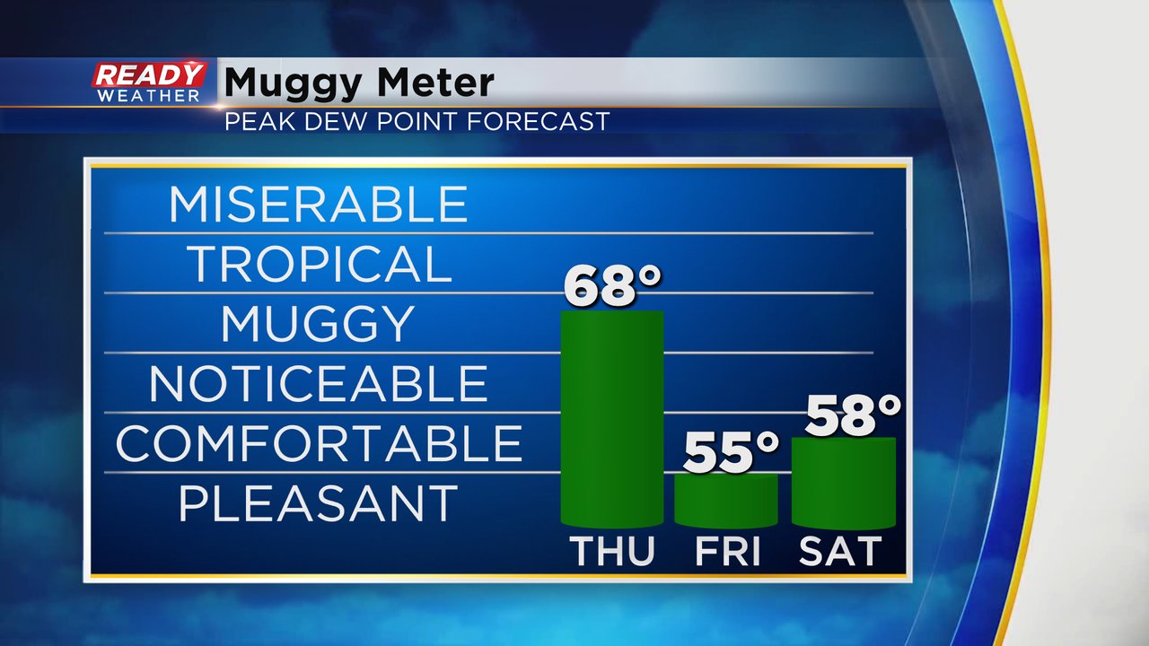
One last day of heat and one last storm chance. Even with some storms over the last few days, our heat hasn't gone anywhere. Highs on Wednesday will still hover around 90* but it's the humidity that's still super high. Dew points on Thursday are better than Tuesday or Wednesday but still very high in the upper 60s. A cold front that arrives Thursday evening will finally drop the humidity to very comfy levels for Friday and Saturday.
No heat advisories for Thursday but when you combine the hot temps and the still high humidity it will still feel like the low to middle 90s for most.

The cold front that will take away our heat and humidity going into the weekend does come with a chance for storms. A few showers and storms could pop along that front as it moves south across our area this evening. Communities south of I-94 and especially near the IL border have the best chance to see those storms.
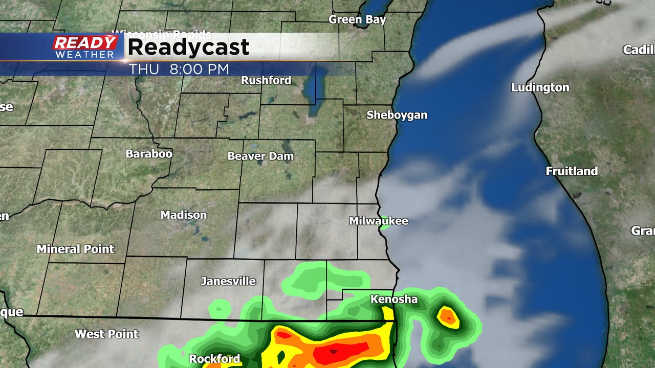
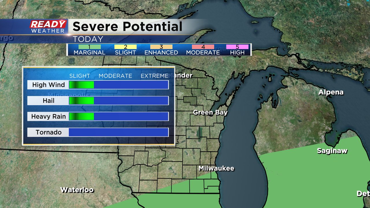
Thanks to all of the heat and humidity still in place on Thursday, some of the storms that do form could be strong with some gusty wind, small hail or brief downpours. The tornado risk is practically zero. A few areas south of I-94 are still in the marginal risk (level 1 of 5) for severe weather.
Download the CBS 58 Ready Weather app to track any storms that form and see when the cool down arrives where you live.