Early Evening Update: Storms lifting out of Illinois being watched for rotation
Updated: Wednesday, May 25th 6:45 pm:
The warm front is currently sitting along the Wisconsin/Illinois border, which is creating localized spin in the atmosphere. Storms interacting with the warm front near Beloit are showing signs of rotation, which has prompted a Tornado Warning for far SW Rock county.
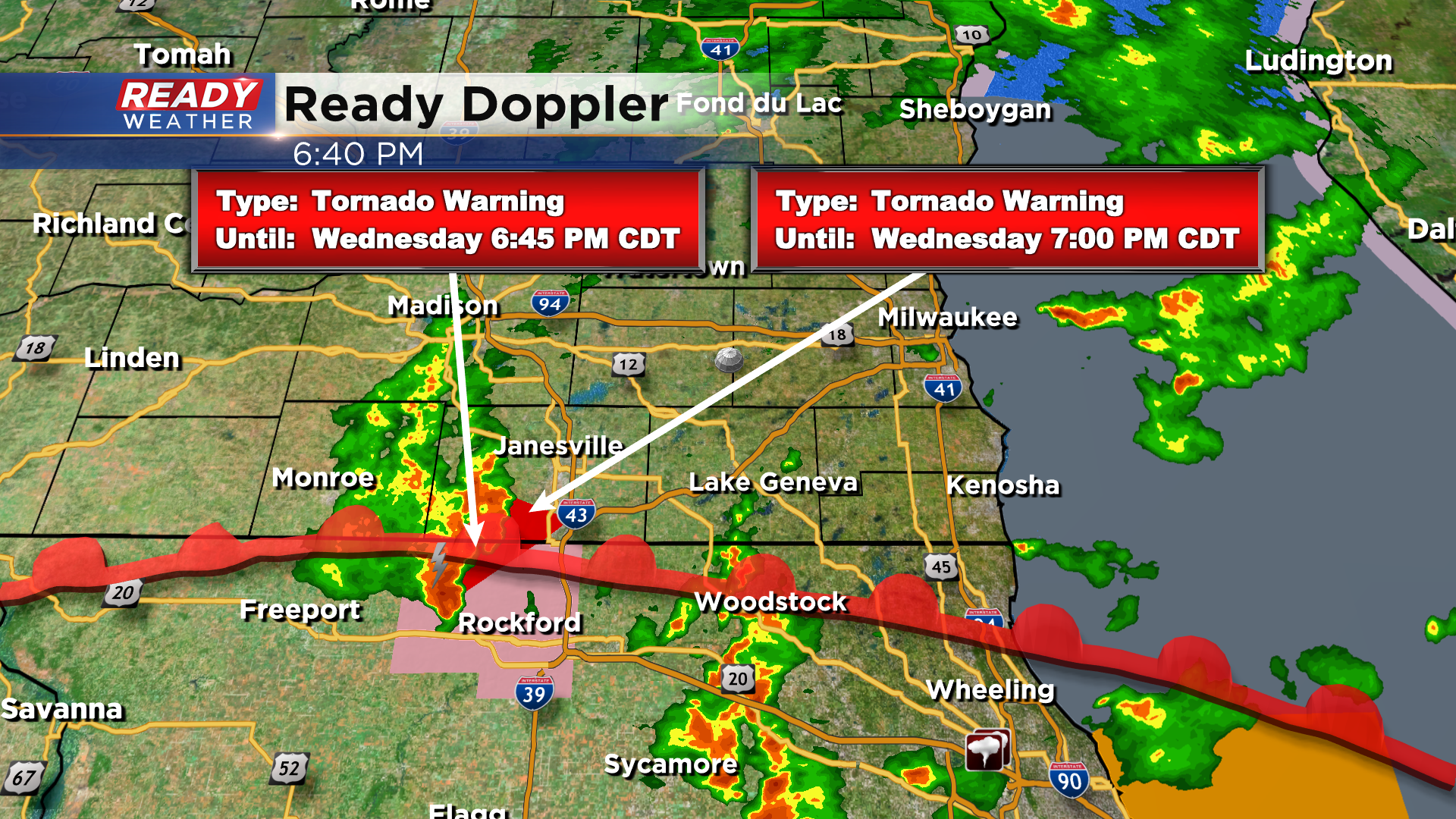
We'll continue to watch the storms lifting out of northeastern Illinois towards southeast Wisconsin for any potential rotation over the next couple of hours as they track over the warm front.
-----------------------------------------------------------------------------------------
High pressure kept us dry the last few days, but rain has returned across southern Wisconsin as a large area of low pressure spins over the southern plains.
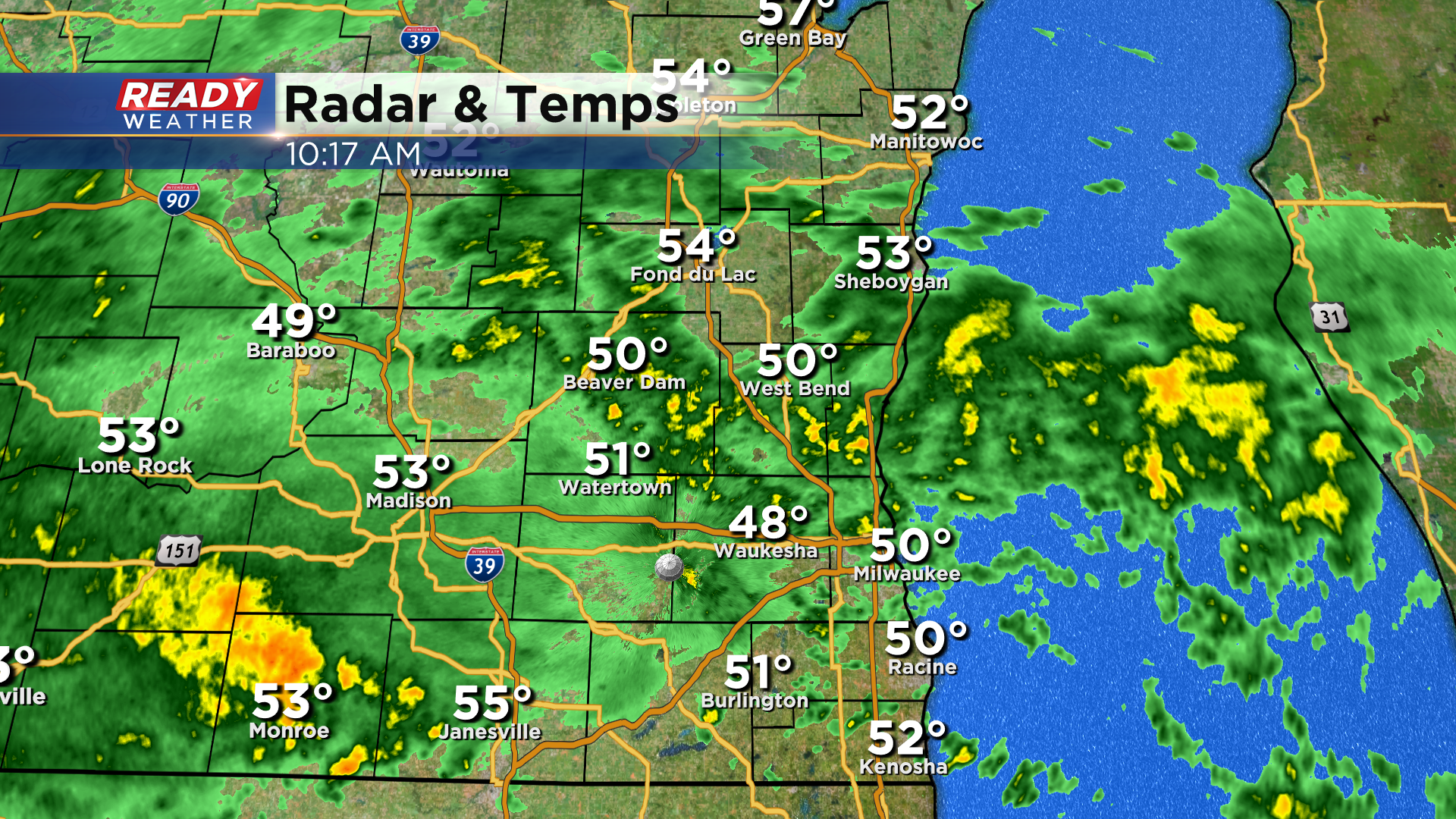
This low pressure system won't make much eastward progress today, so it'll continue to send waves of showers and isolated storms into the badger state.
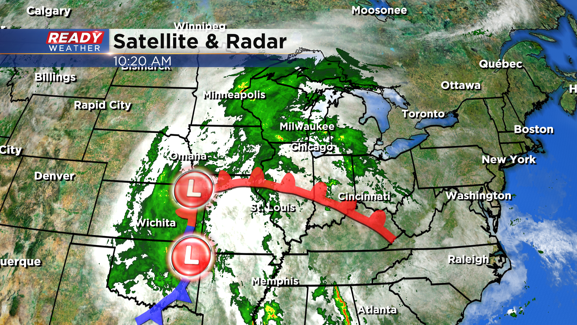
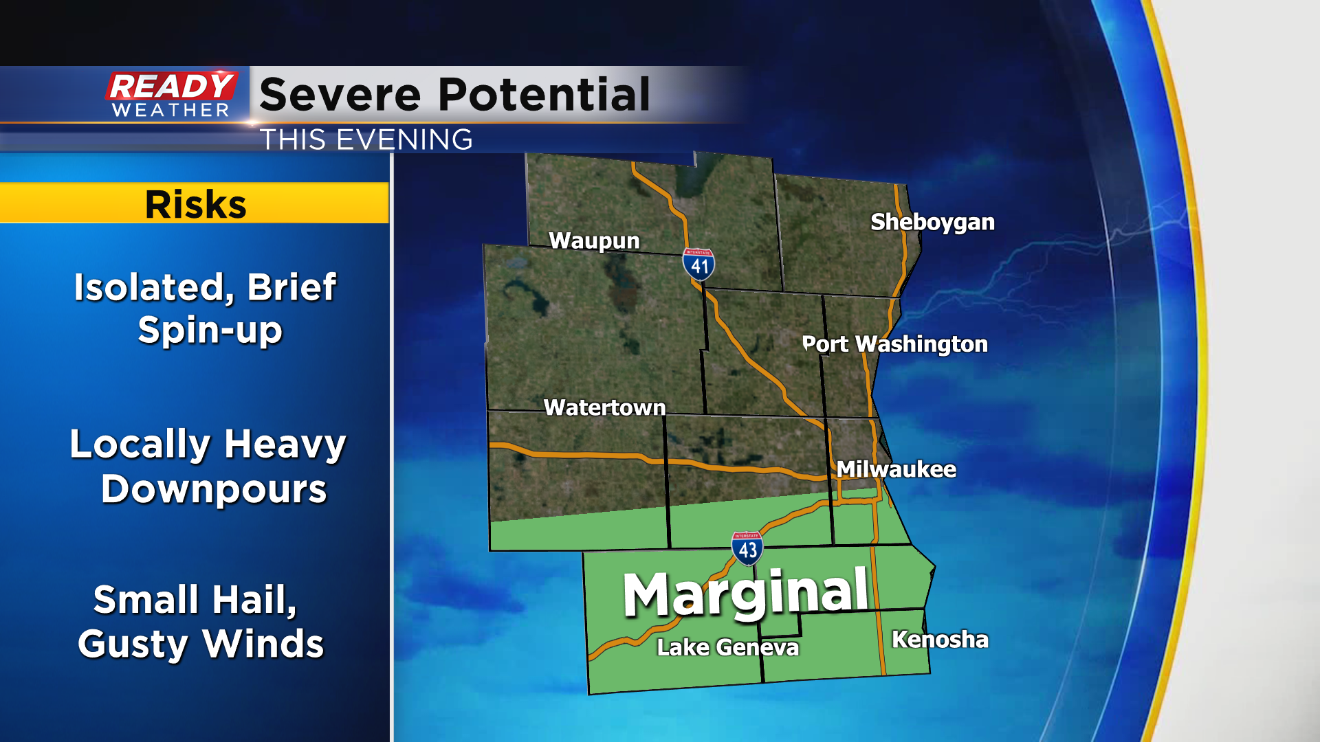
By the evening, this system will have drifted due north into NW Missouri, which will push a warm front into and eventually through southern Wisconsin. This shifts our winds to the south and southwest, bringing warmer and more humid air into SE WI tonight through the first half of Thursday. We'll be watching to see if a few stronger storms develop along the warm front this evening along and south of I-94. While hail and strong winds won't be a big threat, heavy downpours and a brief spin-up are possible as winds shift with the front. A level 1, Marginal Risk, is in place for areas south of I-94 for this threat.
A break in the rain and storms is expected late tonight through most of Thursday morning. We'll remain on the warmer and more humid side during this time as a stationary front sits from NE to SW across central Wisconsin.
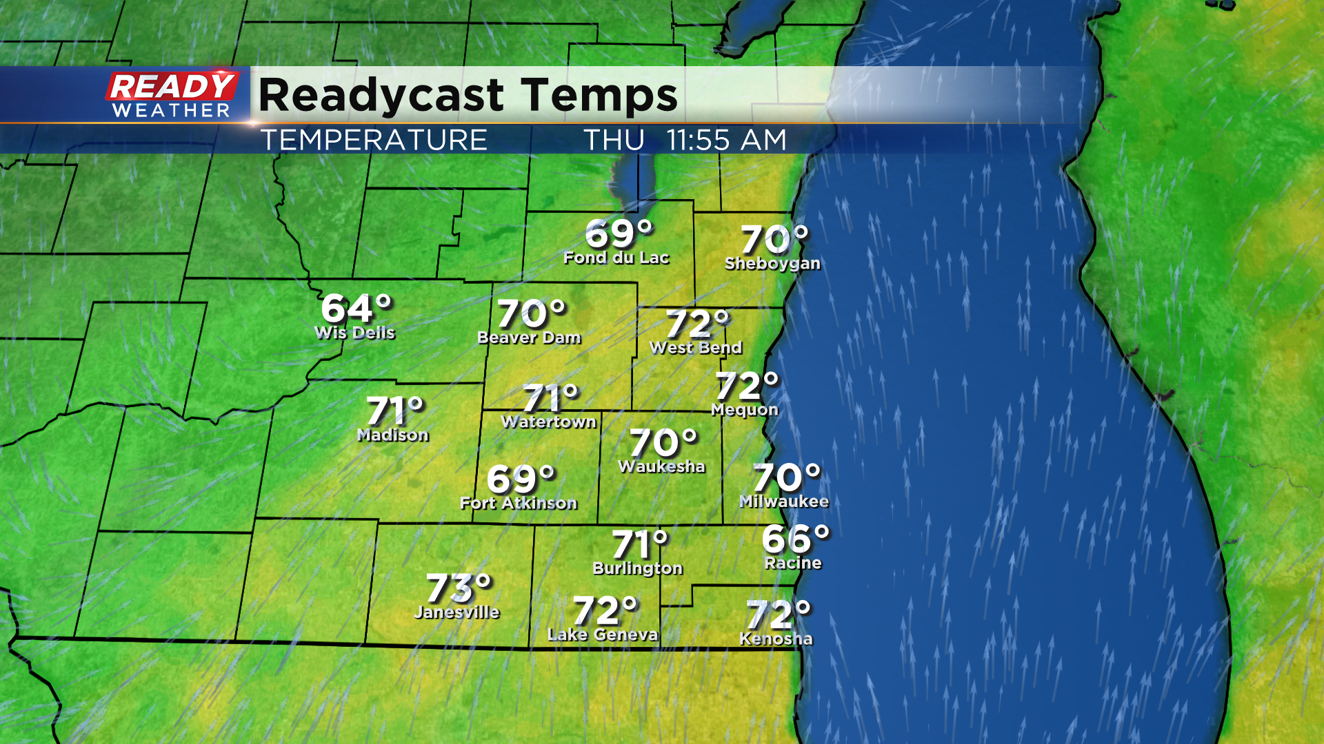
That front will slowly cross SE WI Thursday afternoon as the low pressure system tracks into Illinois, generating more scattered showers and storms.
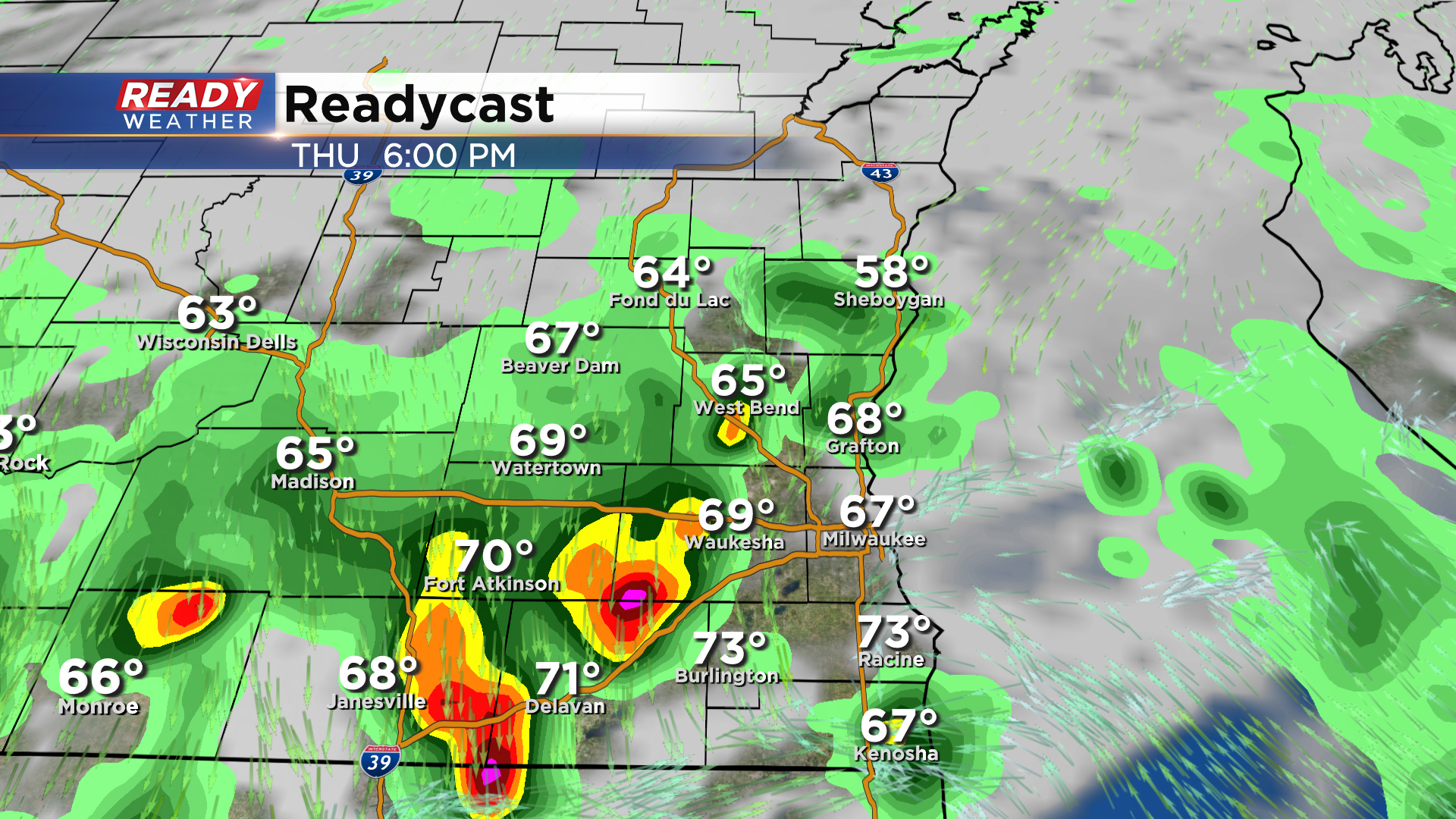
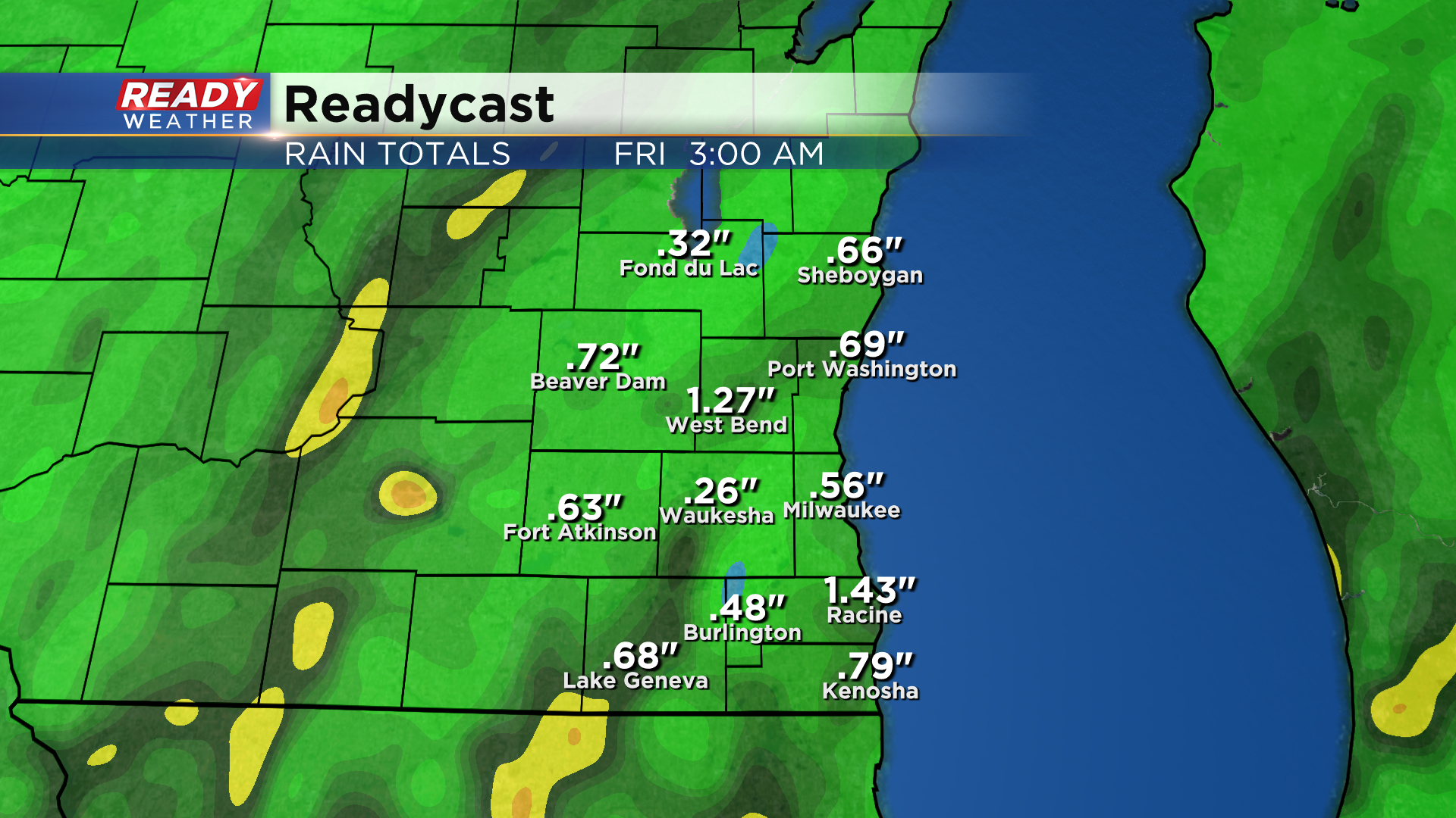
Rain wraps up for most of the area late Thursday night, but a few lingering showers can't be ruled out across far SE WI Friday morning. Overall, .30-.75" of rain is expected for most of the area, but locally higher rain totals of 1-1.50" are possible in areas that see thunderstorms.
Once we get through this soggy period of weather, drier and eventually warmer conditions return throughout Memorial Day weekend. Download the CBS 58 Ready Weather App to track the showers and storms.
