Not As Nice to Start The Shortened Workweek
All our fabulous weather is going by the wayside as a cold front slowly works in from the Upper Midwest over the course of the next 36 hours. Look for the chance of showers and thunderstorms today, but the risk really increases by pre-dawn Wednesday.
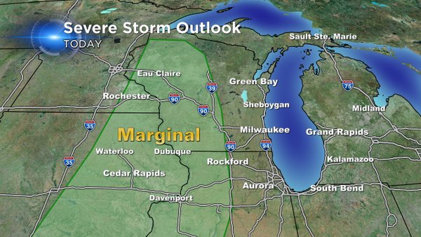
There's a marginal risk of severe weather today mainly west of the viewing area. It expands for all of us tomorrow, mainly during the morning and early afternoon. The biggest threats would be hail, heavy rain, and high wind. Also keep in mind some of the developing storms might put down some heavy rainfall totals in a short time span.
We quiet down for a bit. And then another system affects us by the weekend. Make sure to download the free CBS58 weather app to keep up with all the weather changes, especially if you were on the go (like many of us were during the holiday weekend.) Also, we want to see some of your holiday photos. You can send them via the weather app or email them to [email protected].
