Late Evening Update: Severe Thunderstorm Warnings being issued for large hail


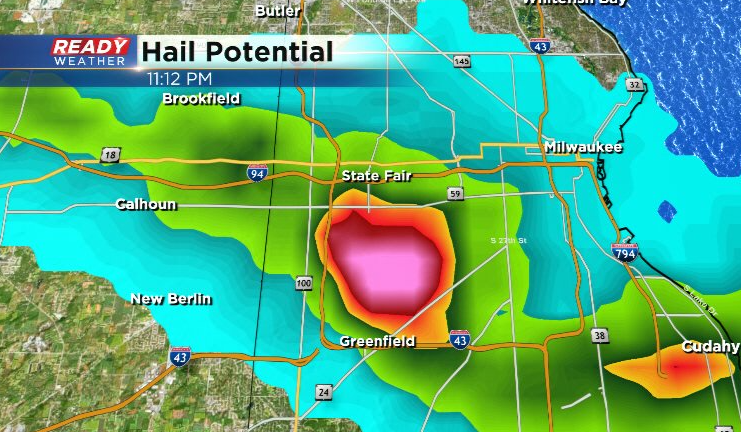
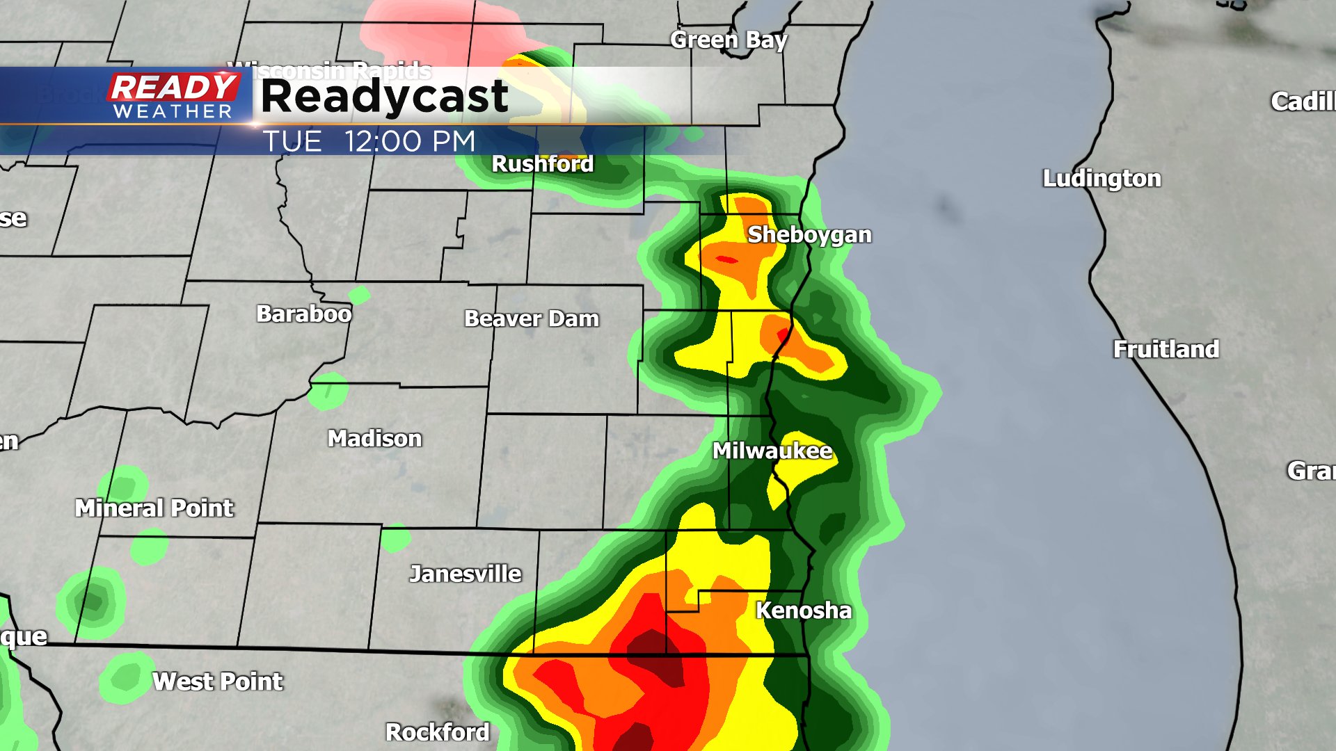
Updated: Tuesday, April 4th 11:14pm:
A Severe Thunderstorm Warning has been issued for all of Milwaukee, Waukesha, Ozaukee, and Washington counties until 11:45pm as storms are racing NE at 50 mph.
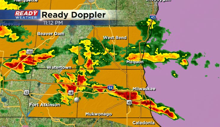
Hail core is currently tracking towards West Allis and the north side of Milwaukee.
-----------------------------------------------------------------
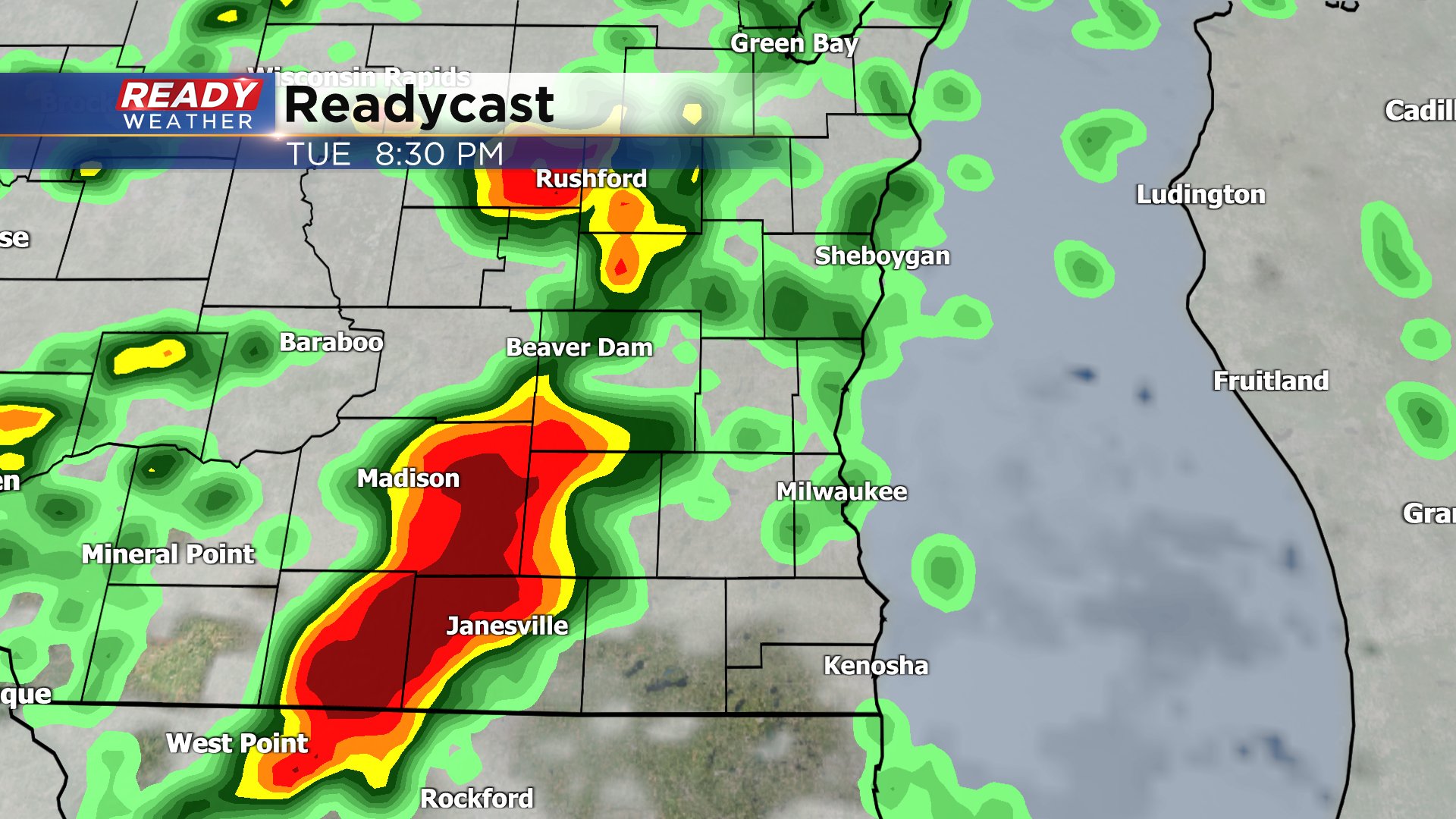
Updated: Tuesday, April 4th 10:17pm:
Severe Thunderstorm Warning has been issued for western Jefferson and far southern Dodge counties until 11pm. Quarter to half dollar sized hail is possible with this storm racing to the NE at 50 mph.
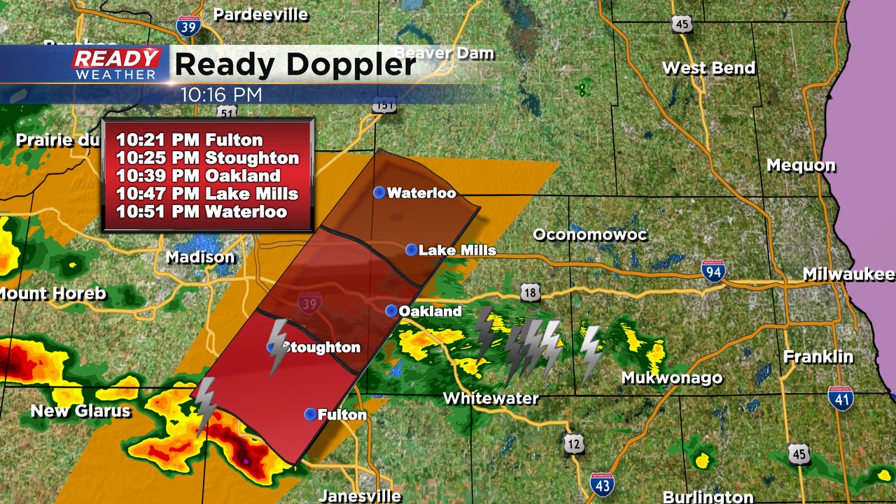
Additional storms are beginning to fire and will also pose a hail risk as we remain north of the warm front.
----------------------------------------------------------------------------
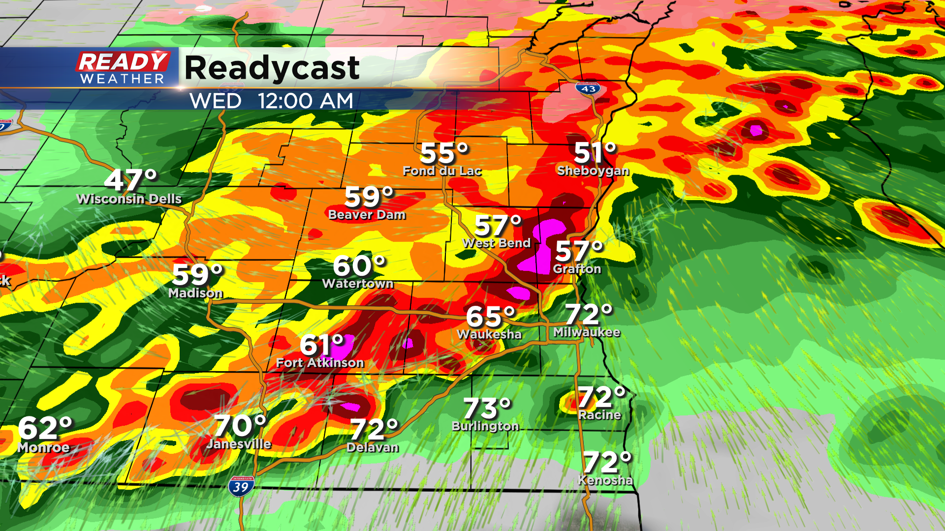
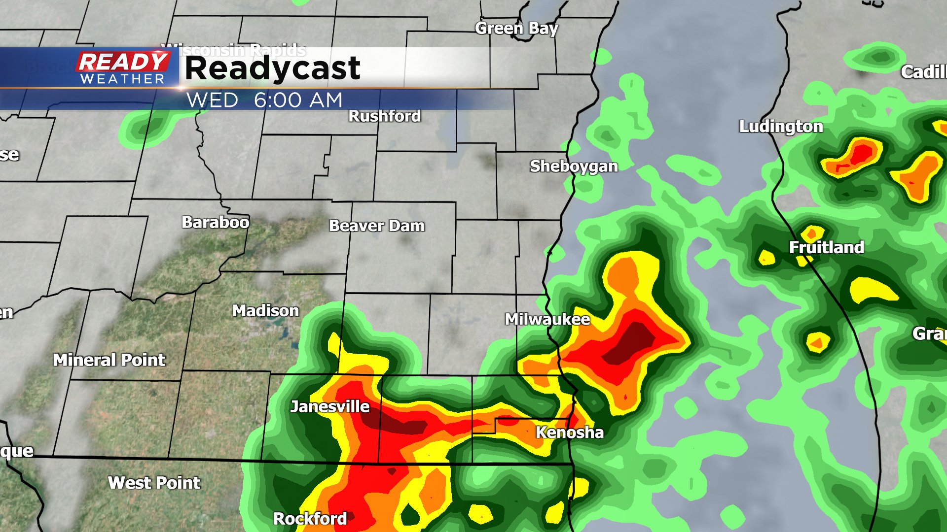
Updated: Tuesday, April 4th 9:00pm:
We're continuing to watch storms that are beginning to fire along the warm front in NW Illinois. It continues to look like the best chance for severe weather tonight will be to our west within the Severe Thunderstorm Watch, but we'll have to see what these storms near the warm front do as they get closer to southern WI.
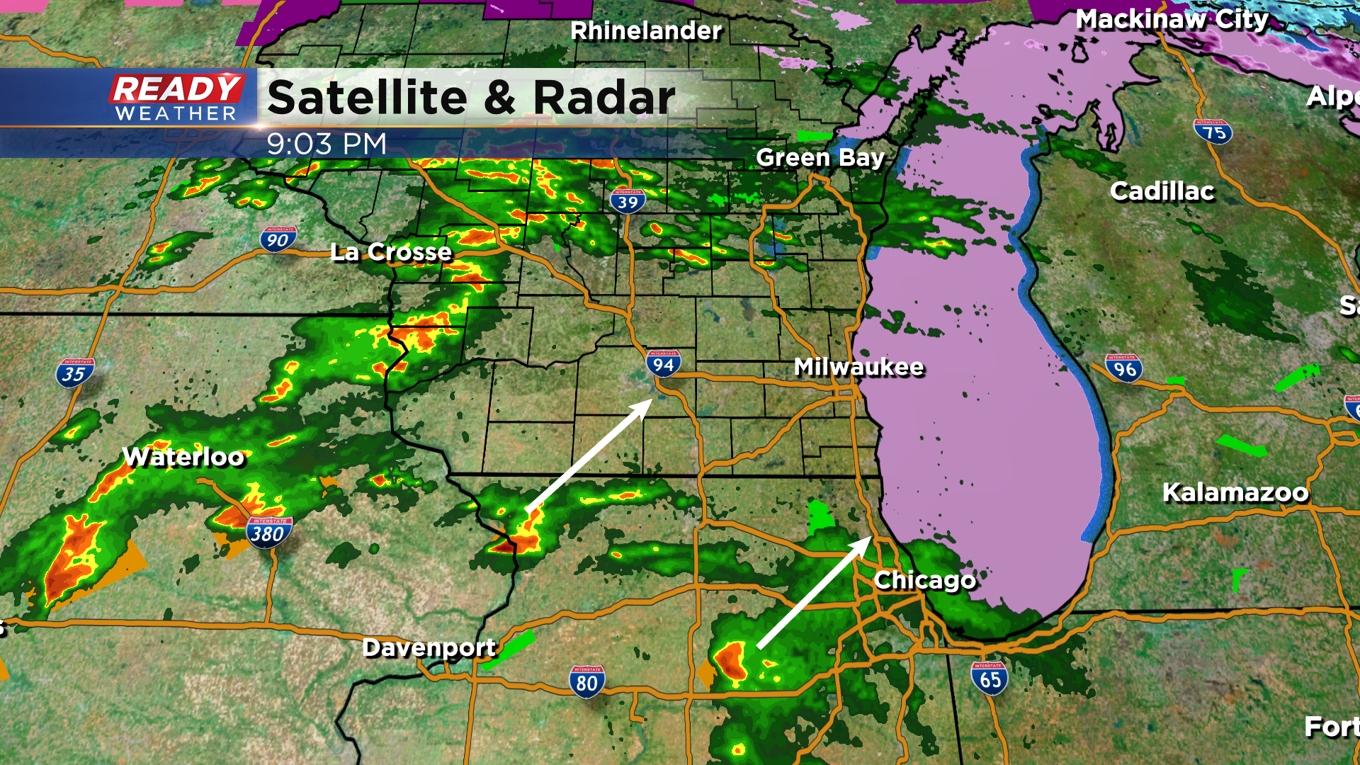
We are still expecting storms to fill in closer to midnight, but their severity is still in question. Multiple storms tracking over the same locations overnight could lead to flash flooding.
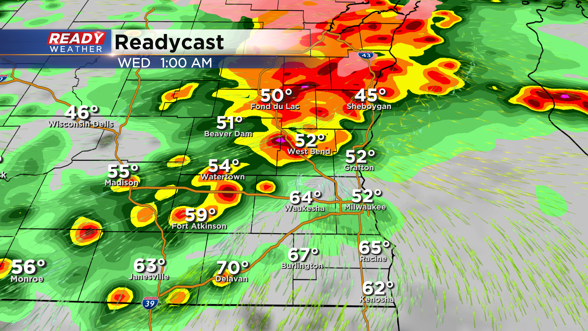
Models continue to hint at areas along and north of I-94 having the best chance at flooding. A Flood Watch remains in effect area-wide into Wednesday morning.
--------------------------------------
Updated: Tuesday, April 4th 6:45pm:
A Severe Thunderstorm Watch has been issued for southwest and south central Wisconsin through 1am. This watch has been issued primarily for large hail in late evening storms. Hail could be as large as tennis balls.
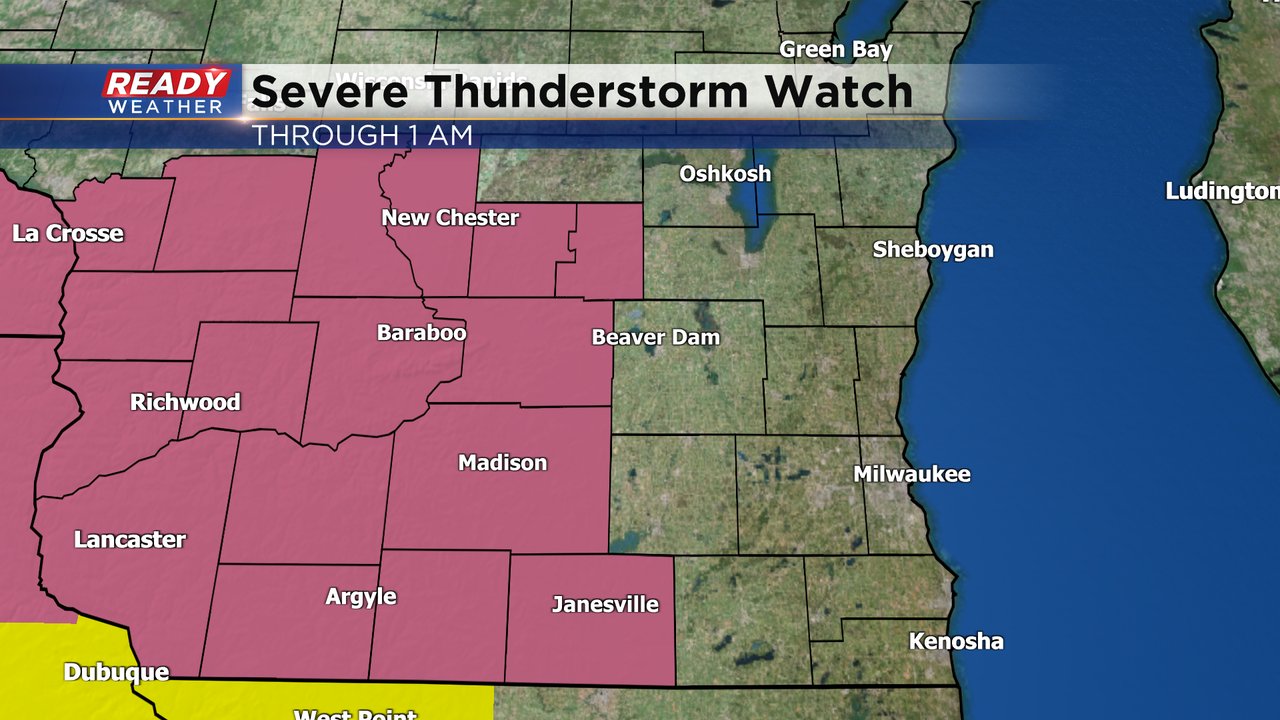
While southeast Wisconsin isn't included in the watch right now, we could see counties added to the watch later this evening based on storm trends. Storms begin to move into our area after 10pm.
---------------------------------------------------------------------
Updated: Tuesday, April 4th 4:45pm:
The first round of thunderstorms has moved out of the area. Many locations saw pea to quarter sized hail as these storms tracked through.
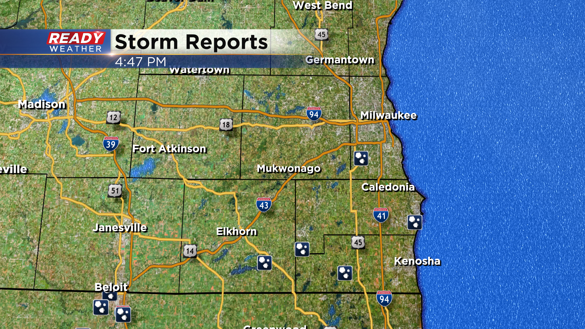
We are in between rounds of storms right now and will be quiet for the next several hours. We're keeping an eye on areas to our west as storms are developing in Iowa and Missouri. A Tornado Watch is in place in these areas and into NW Illinois.
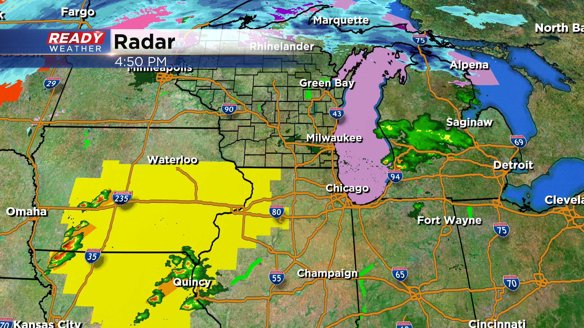
As the warm front lifts closer to southern WI, scattered thunderstorms are expected to develop and impact southeast Wisconsin between 9pm-2am.
Damaging winds and hail are threats with this round, along with isolated tornadoes near and south of the warm front which is expected to be near or south of I-94. Download the CBS 58 Ready Weather App to get any warnings sent to your phone. Do not rely on outdoor sirens to wake you up as they're not meant to warn you indoors.
----------------------------------------------------------------
Updated: Tuesday, April 4th 2:25pm:
A Severe Thunderstorm Warning is in effect until 2:45pm for Walworth county for this hail producing storm.
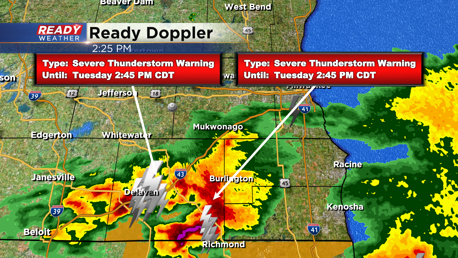
The main hail core is in far SE Walworth county and is tracking towards Slades Corners and Burlington.
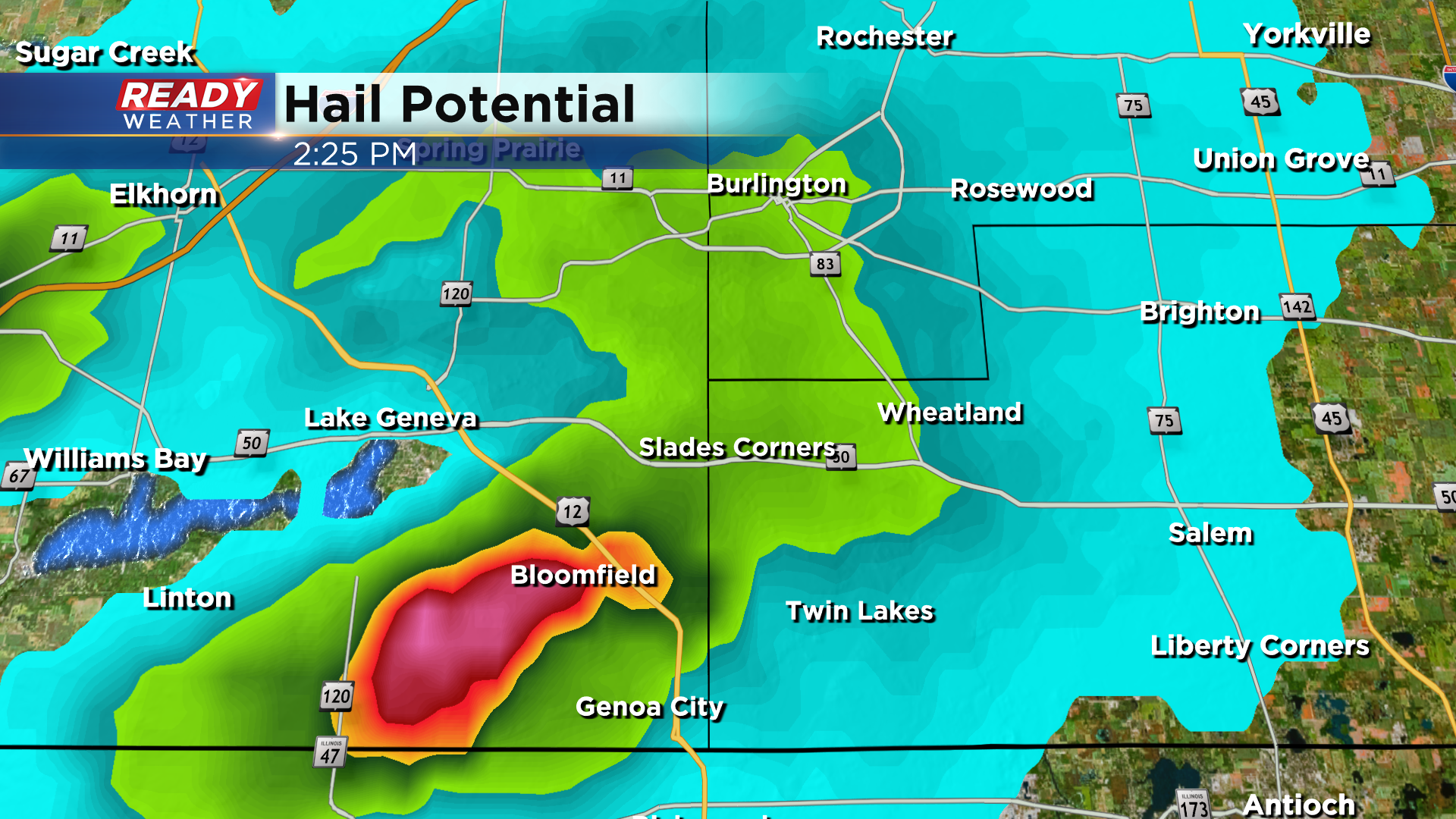
More strong to severe storms are possible late this evening as the warm front moves closer to the area.
-------------------------------------------------------
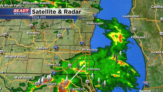
Update: 1:00 pm Apr. 4, 2023
A cluster of showers and storms are moving across the Illinois border right now into southeast Wisconsin. A Severe Thunderstorm Warning is in place until 1:45 pm for Walworth County. Quarter size hail and wind gusts more than 60 mph are possible. An Areal Flood Watch is in place until early Wednesday morning for the entire viewing area. 1-2"+ of rain possible.
___________________________________________________________________________________________________________
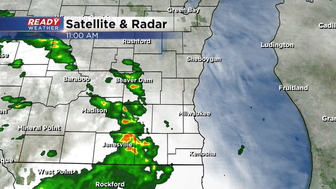
Update: 11:15 am Apr. 4, 2023
Storms are beginning to move into the area from the southwest. We run the risk of storm activity into the early afternoon. Then several other rounds are coming. There's a Severe Thunderstorm Watch until 3 p.m. for areas south of us in Illinois. Heavy rain is possible. Some could see more than an inch in the next day or so. In fact, the Sewerage District wants people to hold off using appliances, like dishwashers and washing machines.
_____________________________________________________________________________________________________________
Updated: 9:32 a.m. Apr. 4, 2023
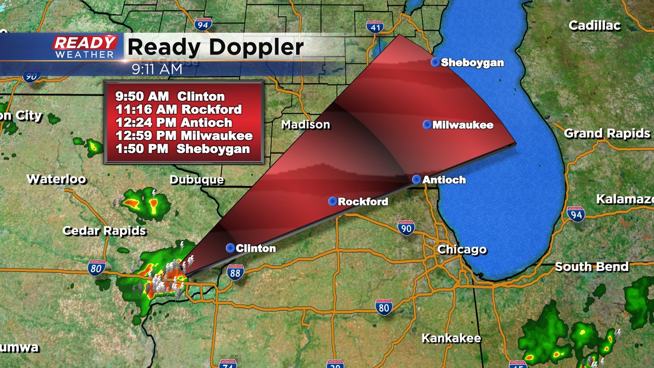
The first round of potentially severe storms is getting started right on time in eastern Iowa. A severe storm is currently located near Davenport and moving northeast. If this storm continues on its current track and speed it would reach Walworth County around noon, hitting Milwaukee around 1 PM and Sheboygan around 2 PM. Large hail will be the main threat with this first round of storms.
The severe threat for the rest of the day remains the same with damaging wind and tornadoes possible this evening and Wednesday morning. Just like last Friday, communities that are south of a warm front have the best potential for damaging wind and tornadoes. Most weather models do not have that warm front reaching the Illinois border until 10 PM or later.
------
Posted: 6:32 a.m. Apr. 4, 2023
Your Ready Weather team has been talking about the potential for another round of severe weather, including tornadoes, for a few days now. This setup is overall very similar to what we had role through southeast Wisconsin last Friday when five tornadoes were confirmed in our local area.
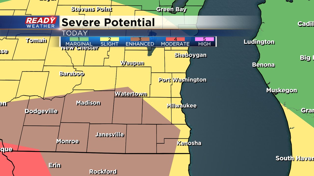
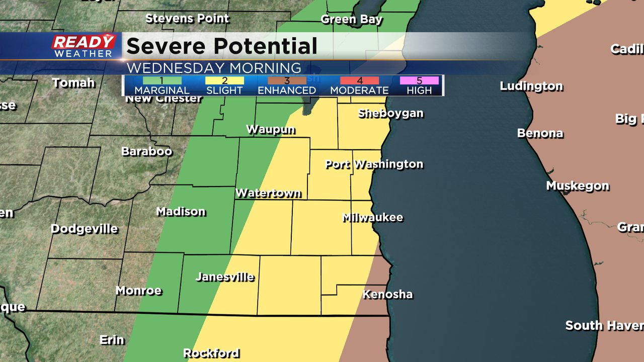
The severe storm potential is very similar to what it was last Friday with a Level 3 Enhanced Risk in place for all of Walworth and Jefferson Counties and parts of Dodge, Waukesha, Racine and Kenosha Counties. The rest of southeast Wisconsin is in a Level 2 Slight Risk.
The first round of strong to severe storms rolls in after 11 AM Tuesday through early afternoon. Large hail will be the biggest threat with this first round of storms.
The second round of storms has the potential to be the strongest and rolls in from late afternoon through the evening hours. 7-11 PM looks like the best time there. Damaging wind, some tornadoes and isolated hail are the main threats.
The last round of storms could roll through during the morning hours on Wednesday. With temperatures warming overnight there is a tornado and wind potential with the last round.
The severe potential doesn't end Tuesday night. The outlook for Wednesday morning also shows a Level 3 Enhanced Risk in eastern Racine and Kenosha Counties then the rest of southeast Wisconsin is in the Level 2 Slight Risk.
Although the threats will change a bit depending on what round of storms we are in, damaging wind overall remains the biggest risk but some large hail is a possibility and a few tornadoes do look possible.
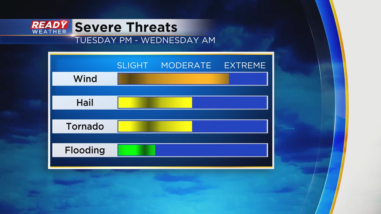
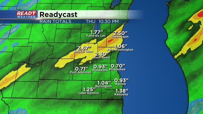
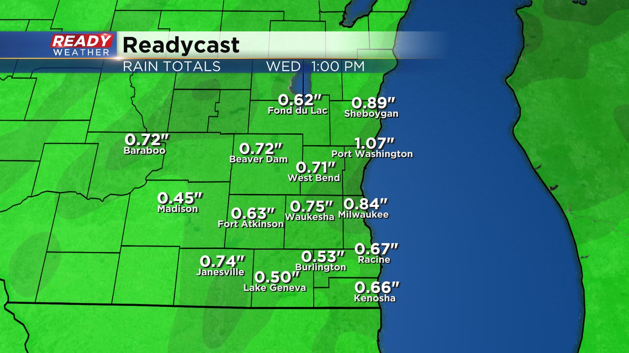
The flooding threat is not very high but expect a soaking rain with 0.50-1.00" of rain possible from midday Tuesday through Wednesday morning.
Download the CBS 58 Ready Weather app to track the severe storm chance and get alerts if watches or warnings are issued.