


Temperatures stayed warm on Monday with most of southeast Wisconsin seeing highs in the 80s - but nothing like the 90s from the weekend. Even though it wasn't as hot it was even more humid. Dew points on Monday rose into the low 70s bringing a tropical feel to the Badger State. Some of that heat and humidity led to spotty showers and storms. Some of you saw big downpours with close to an inch of rain while others didn't get anything besides some sprinkles.

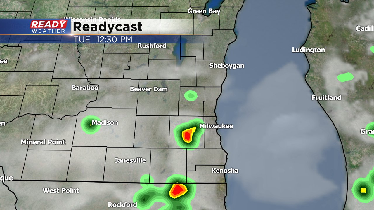
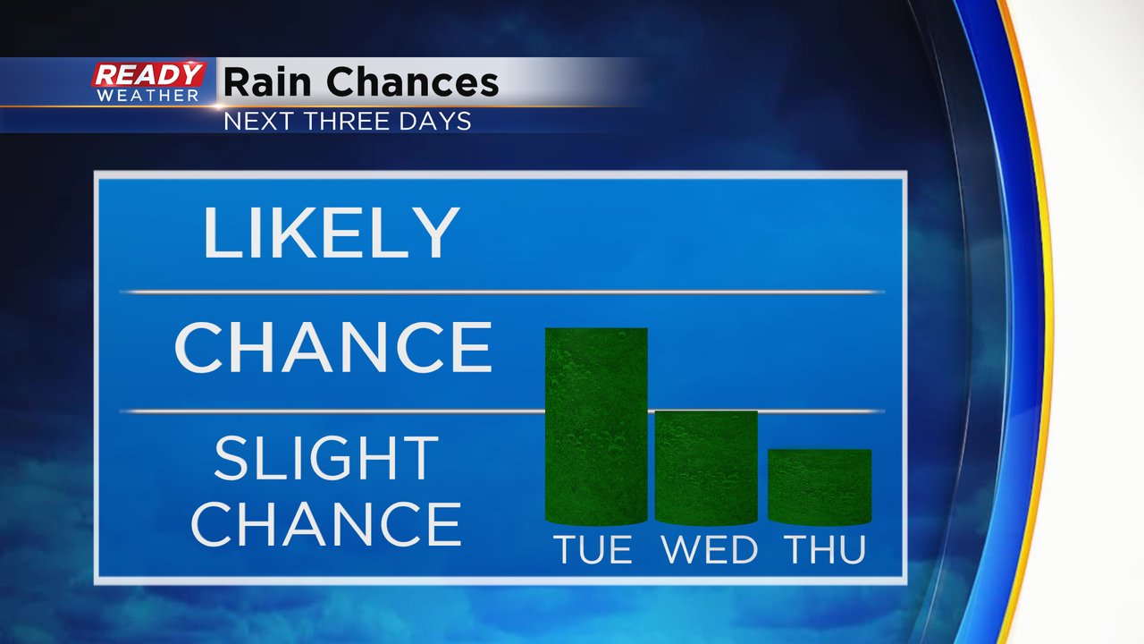
A similar situation will set up on Tuesday with a chance for spotty showers and storms throughout the day. Once again not everyone is expected to see the heavy rain but others could get downpours.
The rain chance becomes more isolated on Wednesday and Thursday overall looks like a dry day. Our next chance for showers and storms is currently Saturday.
The high humidity from Monday will hang around with dew points around 70. It felt downright tropical on Monday and Tuesday will be pretty similar. The humidity will come down a little on Wednesday and Thursday but still muggy with dew points in the middle 60s.

With some of the humidity sticking around, high temps won't move much staying in the low 80s. We could see some lake influence or a lake breeze a few days which may keep temps in check lakeside but overall the above-average temperature trend continues for the foreseeable future.

Download the CBS 58 Ready Weather app to track the temps and any storms that pop up.