More Rain and Storms Wednesday Bring Flood Potential
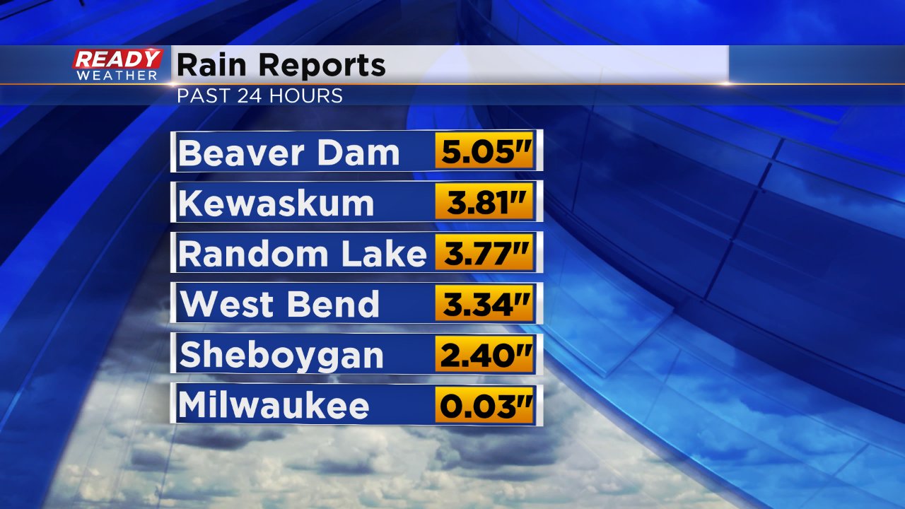
Rain and storms started in northern communities Tuesday evening and the rain has continued off and on all night into Wednesday morning. That rain has brought impressive rain totals in some areas where over 5" of rain has fallen. Most of the rain that has fallen fell north of I-94 so southern areas including Milwaukee, Waukesha, Racine and Kenosha have not received much rain at all.
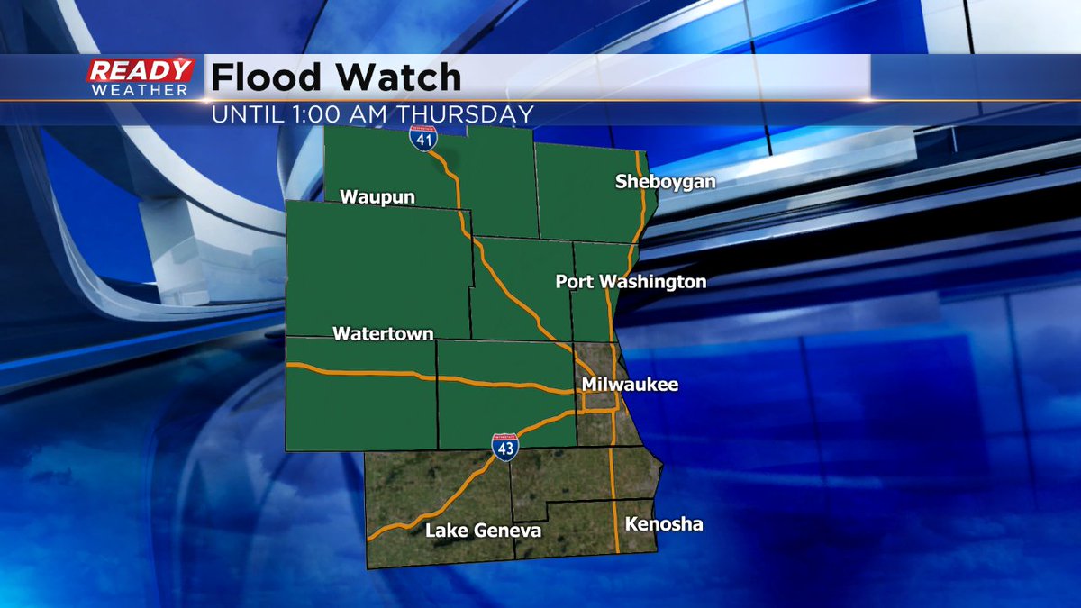
A flood watch remains in effect until 1:00 AM Thursday morning. Another 1-2" of rain will be possible Wednesday. With a soaked ground in northern areas, it will be hard for the soil to absorb Wednesday's additional rainfall.
We have already received some reports of flooding in Dodge County.
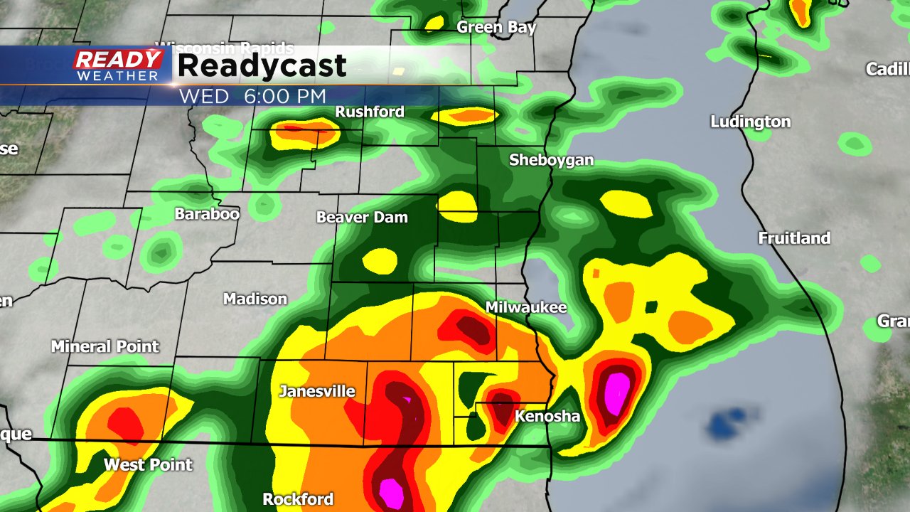
More scattered storms are likely throughout the afternoon and evening with more heavy rain likely at that time. Although not likely, there is an isolated threat for a strong to severe storm.