Humidity returns with some heat and a chance for strong storms Thursday evening


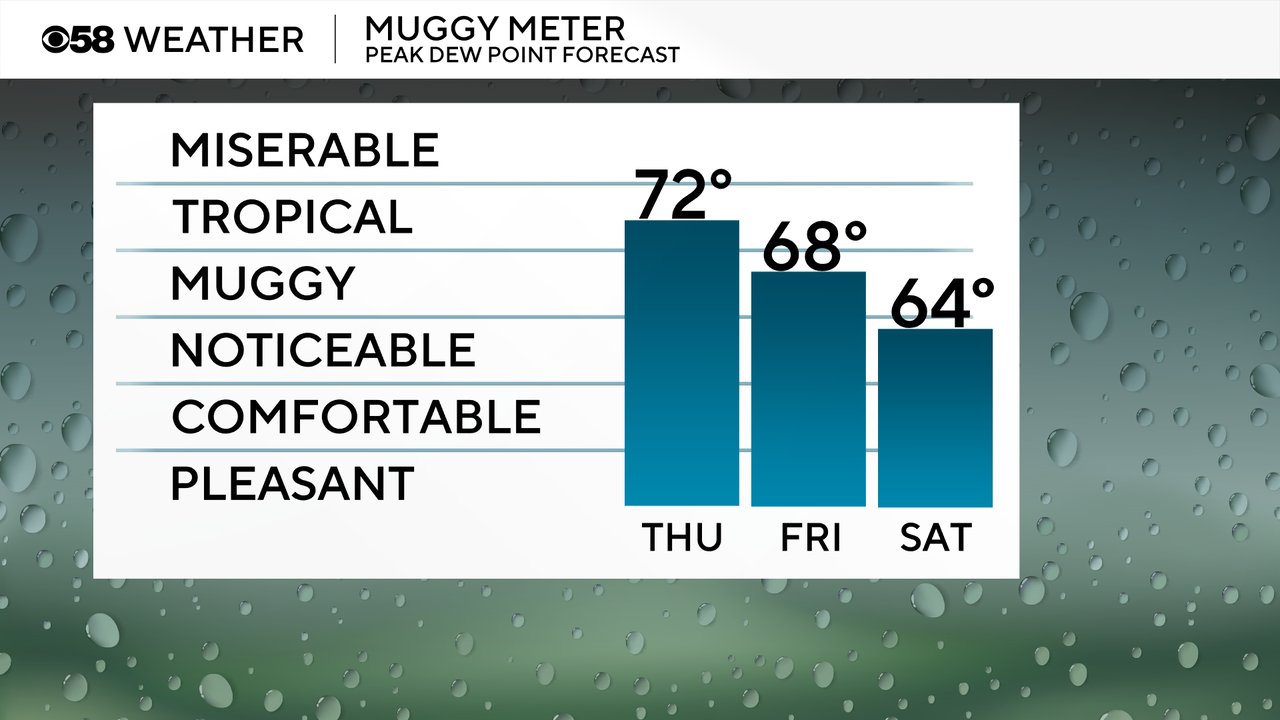
Hopefully you enjoyed a bit of a cooler and less humid day on Wednesday, although some of you were still mild. Dew points rose fast during the overnight hours going into Thursday morning so it is already feeling very humid. And the humidity will stay with us most of Thursday with tropical-level humidity. Friday is still going to be pretty muggy before the humidity relaxes a bit for Saturday.
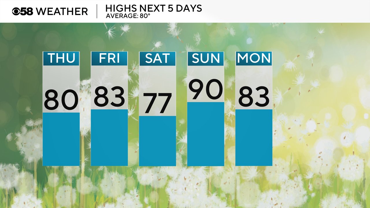
Highs on Thursday will vary greatly depending on where you live. Some northeast areas like Sheboygan and Port Washington may stay in the 70s all day. Milwaukee will hover around 80 but some southern and inland areas could reach the middle to upper 80s.
A front that finally clears out the persistent storm chances since Monday evening arrives Thursday night giving us a chance for showers and storms and then finally drying us out for a bit. A few isolated storms will be possible Thursday mid morning through midday but the better storm chance is from the middle of the afternoon through the late evening.
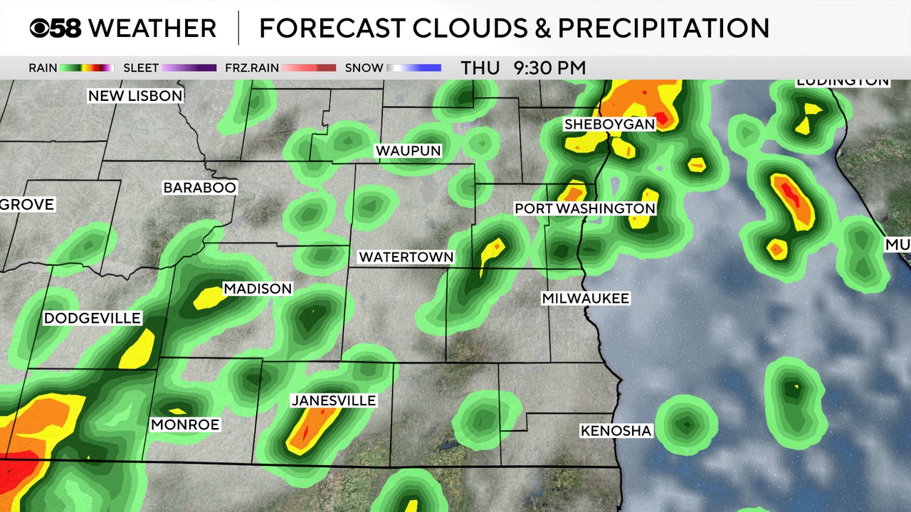
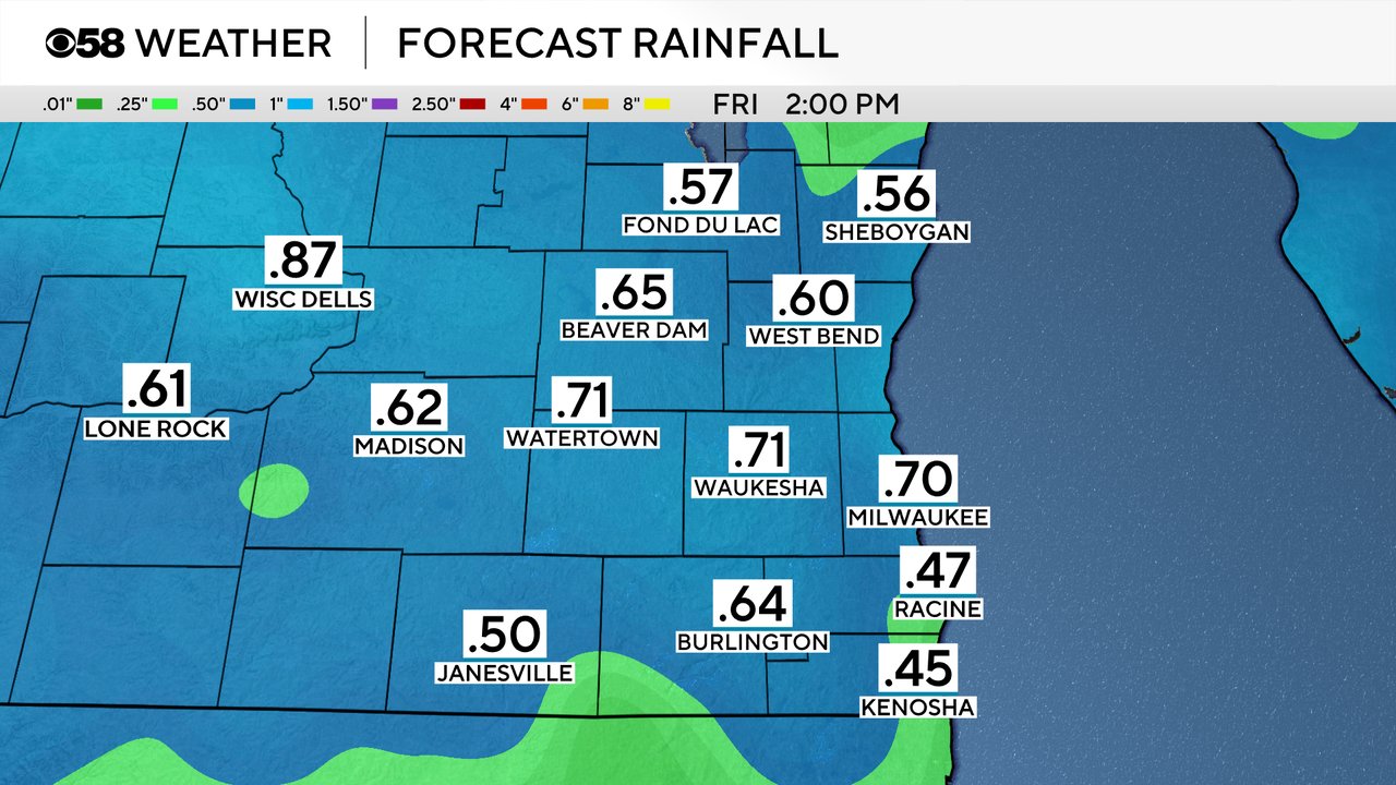
Most of southeast Wisconsin should expect at least some rain on Thursday with stronger storms and downpours possible. Rain totals will range from 0.25-0.75" with over an inch possible in some areas that see stronger storms.
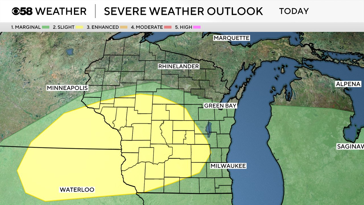
There is also a chance for some stronger storms. A small Level 2 Slight Risk for strong to severe storms has been expanded eastward to include some of our local western counties. The rest of southeast Wisconsin remains under a Level 1 Marginal Risk. Gusty wind will be the primary threat, especially along a line of storms that's possible later this evening. There is an isolated threat for a tornado as well, especially with any storms that form in the afternoon and early evening before the line arrives.
Download the CBS 58 Weather app to track the storms this afternoon and evening as well as how warm temps will get where you live.