Heavy rain comes to an end ahead of more pleasant weekend


Southeast Wisconsin saw some severe thunderstorms roll through Thursday afternoon and evening. The bulk of the heavy rain and storms wrapped up by 11 p.m. but some light showers will linger through mid-morning Friday. As expected, damaging wind was the main threat with multiple trees down and widespread power outages across most of our local area. North Bay in Racine County observed a wind gust of 68 mph.
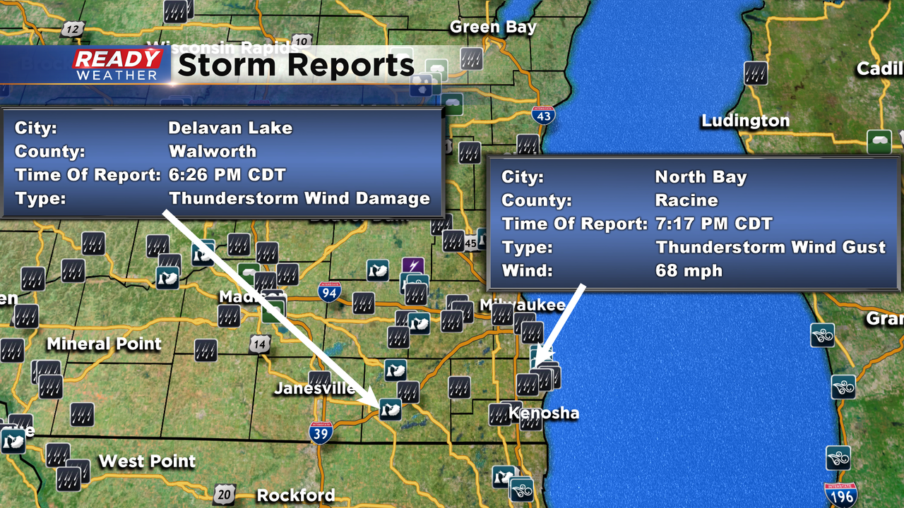
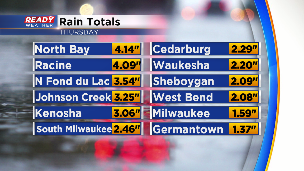
In addition to the severe weather, the storms came with very heavy rainfall. Many spots picked up between 1-4" of rain with highest totals in eastern Racine County. Despite the rain we didn't get many reports of street flooding overnight.
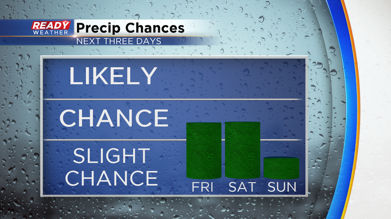
After a couple of days with heavy downpours and storms this week we could use a break from the rain and the majority of us will get it. Just a low chance for some pop up showers and storms Saturday afternoon otherwise things have trended fairly dry for Sunday.
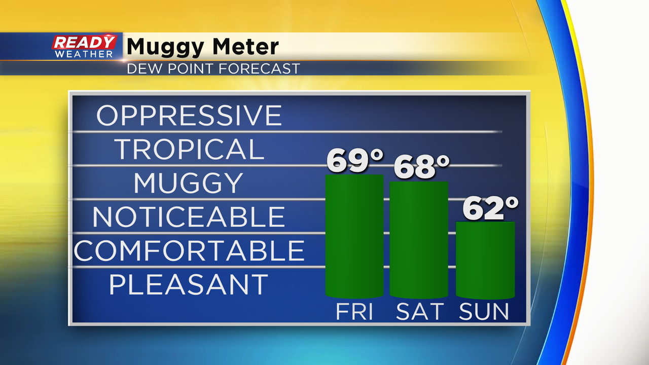
Temperatures won't be as hot the next couple of days but will stay warm in the middle 80s Friday and Saturday. By Sunday the temp drops to around 80 which could end our streak of consecutive 80*+ days but Sunday is also when the humidity really drops so enjoy the comfortable weather there before the heat and humidity return by the middle of next week.
Download the CBS 58 Ready Weather app to track the weekend cool down and return of heat next week with the 10-Day Forecast.