Wednesday Morning Update: Flash flood warnings have expired, steady rain still falling


Updated: 4:58 a.m. October 2, 2019
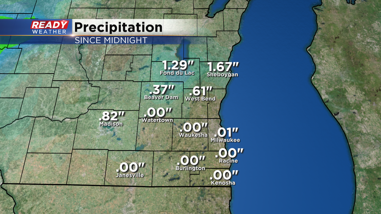
All flash flood warnings have expired. Steady light to moderate rain is still in place across all of southeast Wisconsin. An additional quarter inch of rain will be possible this morning.
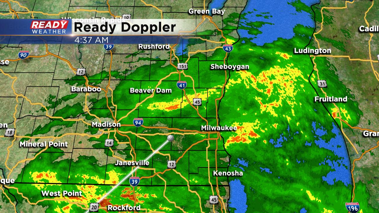
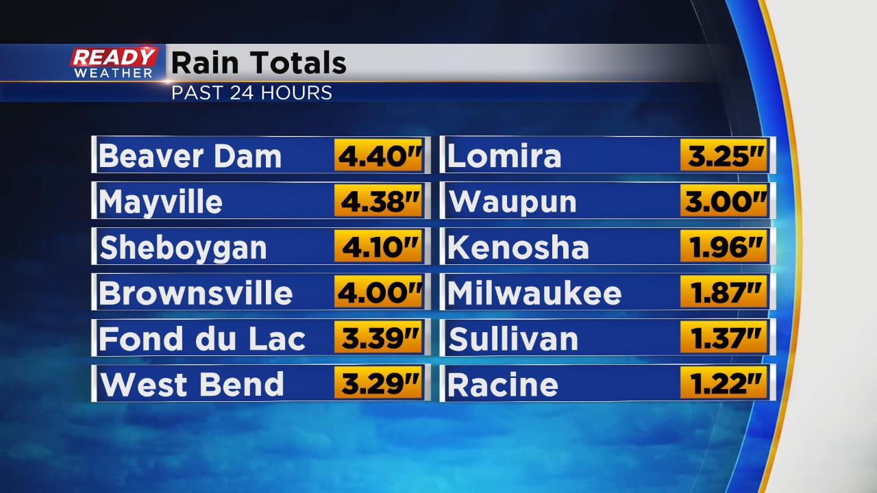
Rain totals since Tuesday are very impressive, especially across our northern communities. 3-5" of rain fell in northern spots, but everyone saw heavy rain with 1-2" in Milwaukee and areas to the south.
------
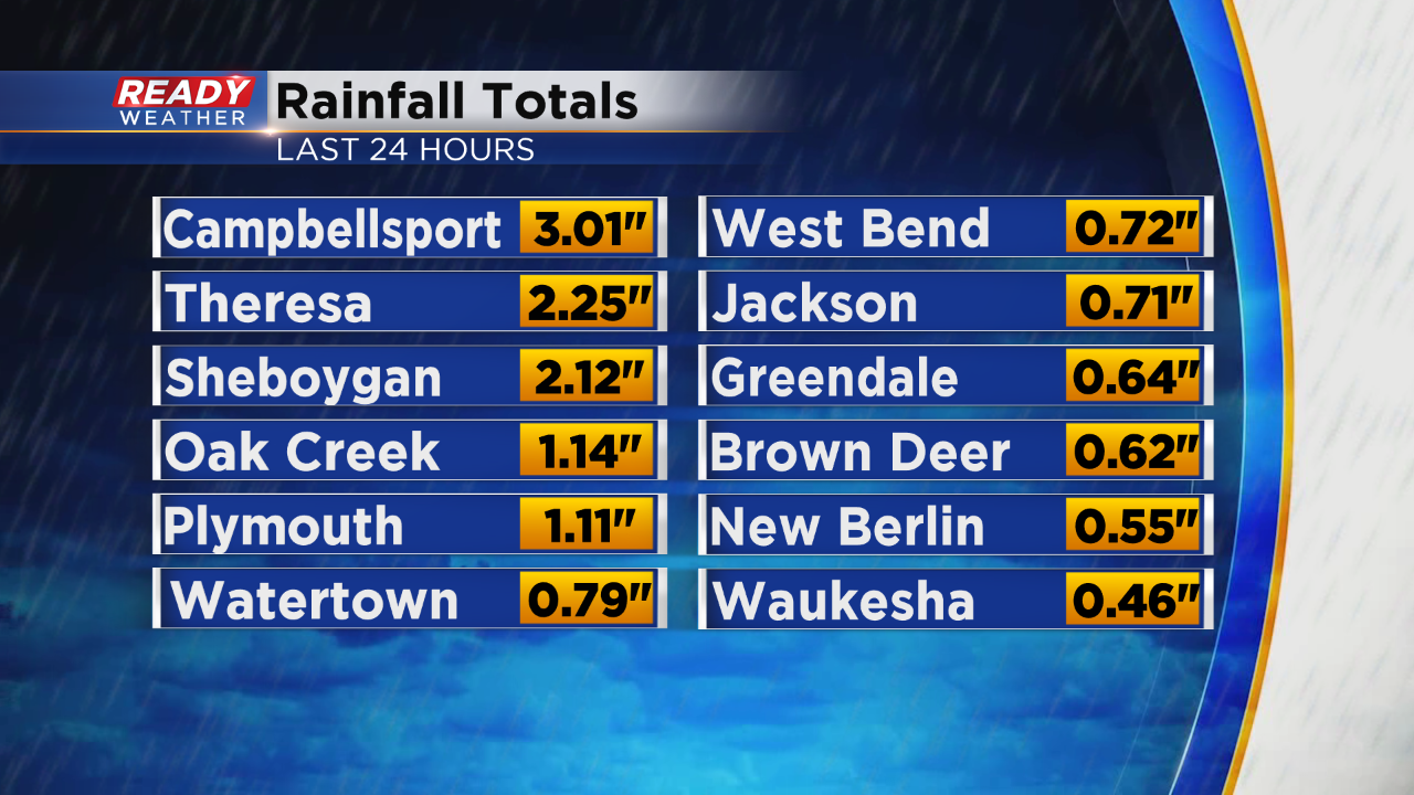
Numerous flash flood warnings have been issued across the entire area. 1" to 3" of rain has fallen tonight causing many flooding issues throughout southeastern Wisconsin.

_____________________________________________________________________________________________________________

Flash flood warnings have been issued for Dodge, Sheboygan, and Fond du Lac counties. Rainfall between 1" to 2" an hour is occurring. Those areas have already been hit hard with rain earlier today. Stay away from flooded areas.
More rain will continue to move south across the entire area. Another 1" to 3" of rain is possible.
The SPC has issued a severe thunderstorm watch for Jefferson, Dodge,and Walworth counties until Midnight. The atmosphere has recovered in those areas. Strong to possibly severe storms could develop over the next several hours within the watch. Those storms will move east and likely weaken as they approach the lakefront.
Hail and damaging winds, along with heavy rain will accompany those storms.
______________________________________________________________________________________________________________

A break from the storms will allow the atmosphere to recharge to our west. More storms are expected to develop later this evening and move back into southeastern Wisconsin. Strong to possible severe storms could ignite across western Wisconsin, These storms will move into our area between 7 pm and 10 pm.
Another 1" to 2" of rainfall is expected into tomorrow morning.
______________________________________________________________________________________________________________
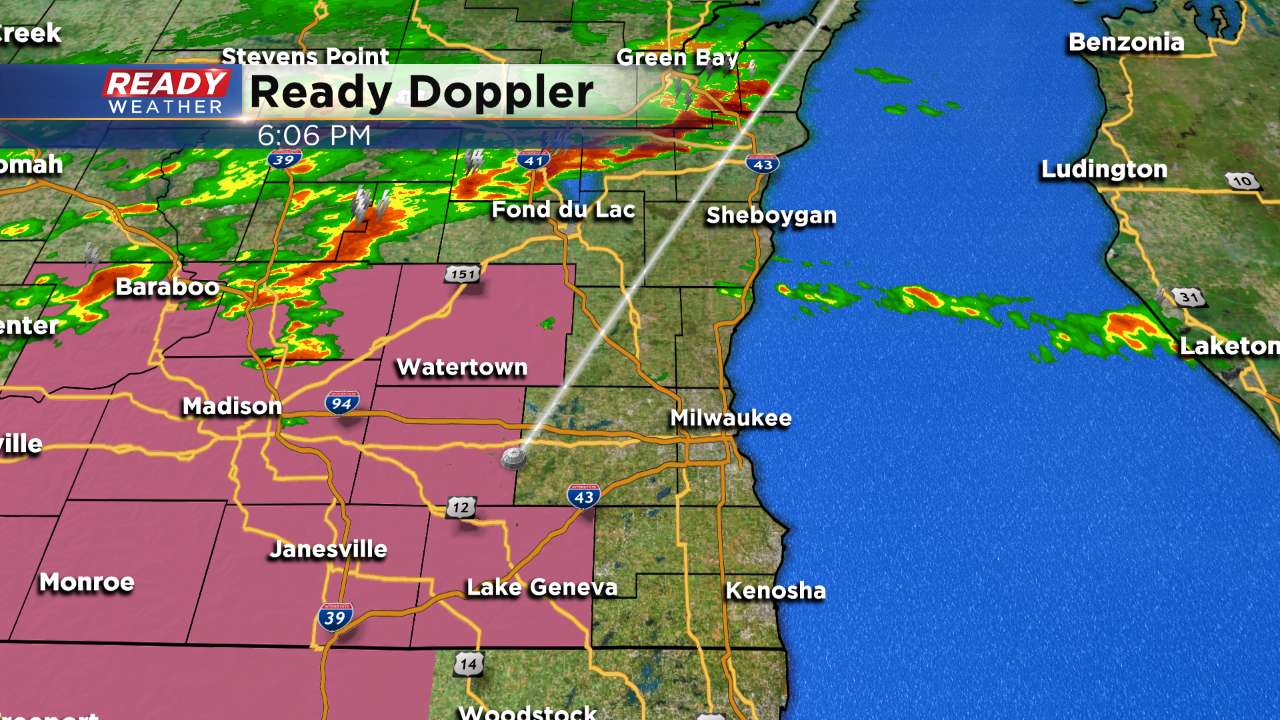
4:00 PM Update:
A lot of reports of heavy rain across the area late this morning into the early afternoon. Some areas picked up 2" to 3". More rain is expected to redevelop this evening, especially after 7 pm.
Another 1" to 2" of rain is expected and that could cause flooding issues overnight.
______________________________________________________________________________________________________________
2 PM Update:
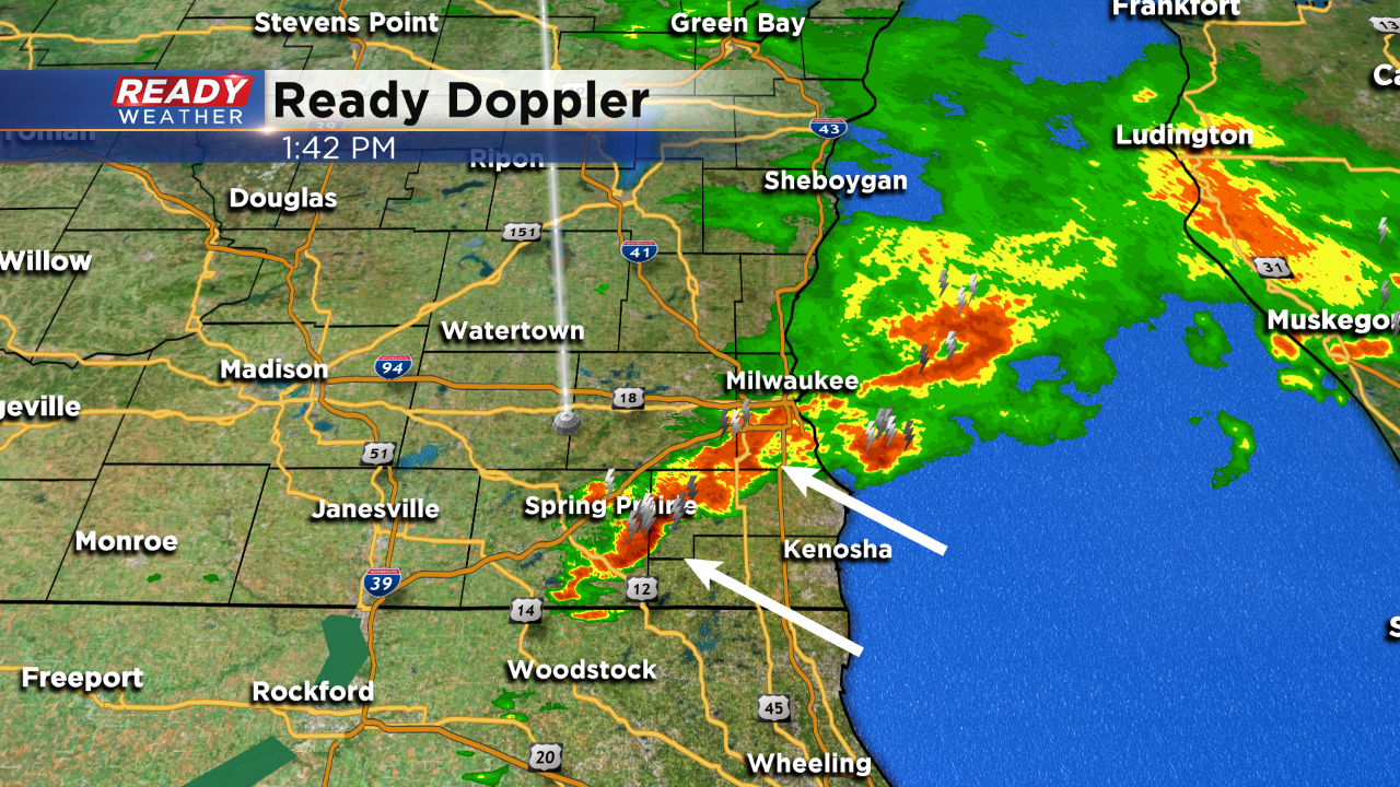
Heavy rainfall continues to fall across southeastern Wisconsin. This last batch will move through by 2:30, and then it looks like a decent break will occur through the early evening.
The models continue to generate more rain and storms overnight ahead of a cold front. An additional inch or so of rain is possible going into Wednesday morning.
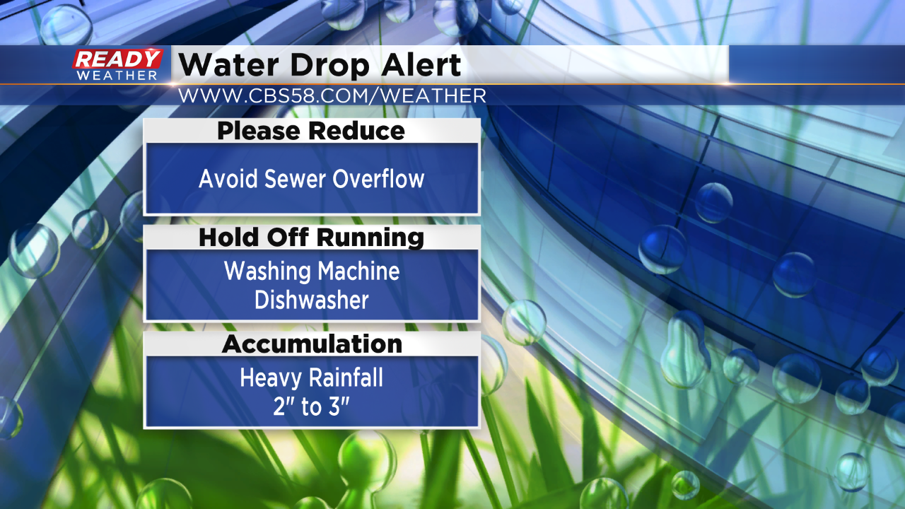
A water drop alert has been issued to help reduce the chance for a sewer overflow. In order to help keep Lake Michigan clean, please hold off on using the dishwasher and washing machine until the heavy rain has passed!
_____________________________________________________________________________________________________________
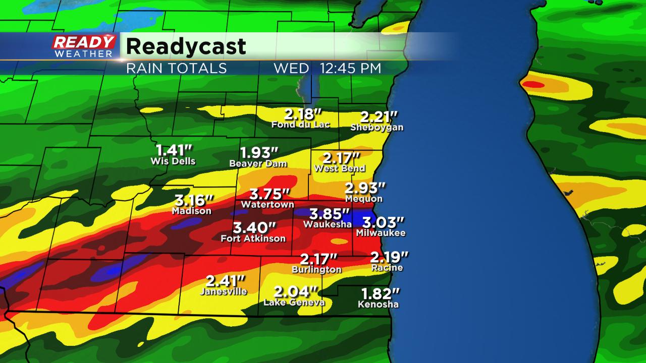
Noon Update: Lot of persistent and heavy rain has set up shop across our northern communities. Check it out:

We've already had a few rounds of showers and storms Tuesday morning and the coverage and intensity of the rain is going to increase throughout the day. Due to the elevated chances for rain and especially heavy rain Tuesday evening into Wednesday morning, a flash flood watch is in effect for all of southeast Wisconsin until 10 a.m. Wednesday.

The heaviest of the rain will likely fall once the sun goes down and the cold front is moving through. Heavy rain will likely last through most of Wednesday morning.

Rain totals will be some of the highest we've seen from one event in a while - which is impressive considering how much rain we picked up in September. In general 1.50-3.00" of rain will be possible and some spots could get even more than that.
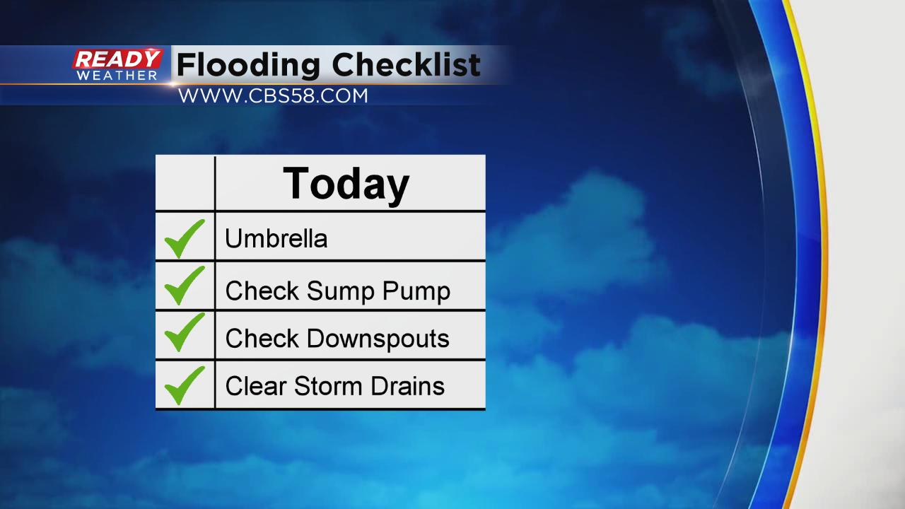
With a water logged ground and river levels already at high levels, flooding is looking more and more likely. When you head out Wednesday morning expect there to be ponding on many area roads and some roads may need to be closed with water over them. Remember to turn around if you encounter flooded roadways. It only takes a few inches of rain to sweep a car away. If you've experienced basement flooding at all over the past 10 years I would recommend making sure your sump pump is working and make sure downspouts are clear and pointed away from your house. If you have a storm drain near your house make sure it is clear of leaves and debris to prevent water from ponding.
In addition to the possibility of flooding, strong to severe storms may be possible. Strong wind and hail may be possible with any storms that develop. The tornado threat is not non-existent, but it is low.

Download the CBS 58 Ready Weather app to track the rain as it moves in and get any alerts as they come in.