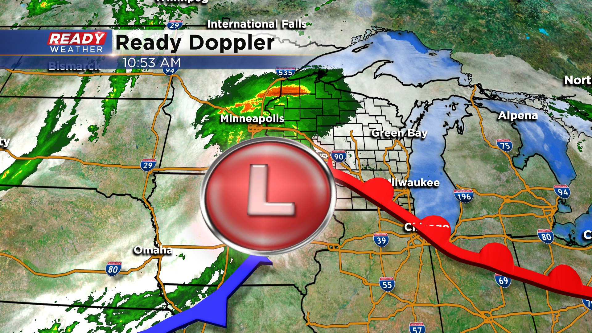
8 PM: More storms are developing.


Additional storms have developed acrossthe area over the last hour. These storms are elevated and should not get up to warning criteria; however, these types of storms can produce small hail, gusty winds, and lightning.
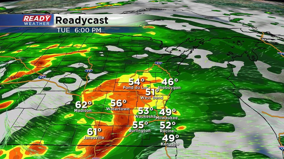
Scattered showers and storms are expected through midnight before it transitions over to rain.
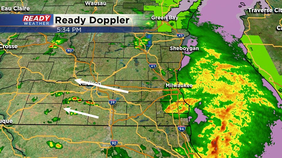
A break from the rain is coming for us by 6 pm. The first batch is moving out. We expect more storms to fire across western Wisconsin over the next several hours. Those are the storms that will have the chance to produce hail and winds.
Storms that do fire in that area will make a run at our area between 7 pm and10pm. The best chance for a strong to severe storm will be across Jefferson and Walworth counties. Once storms move east they will become elevated and weaken closer to the lake.
______________________________________________________________________________________________________________
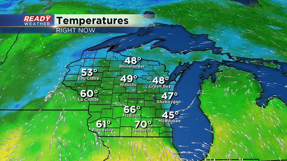
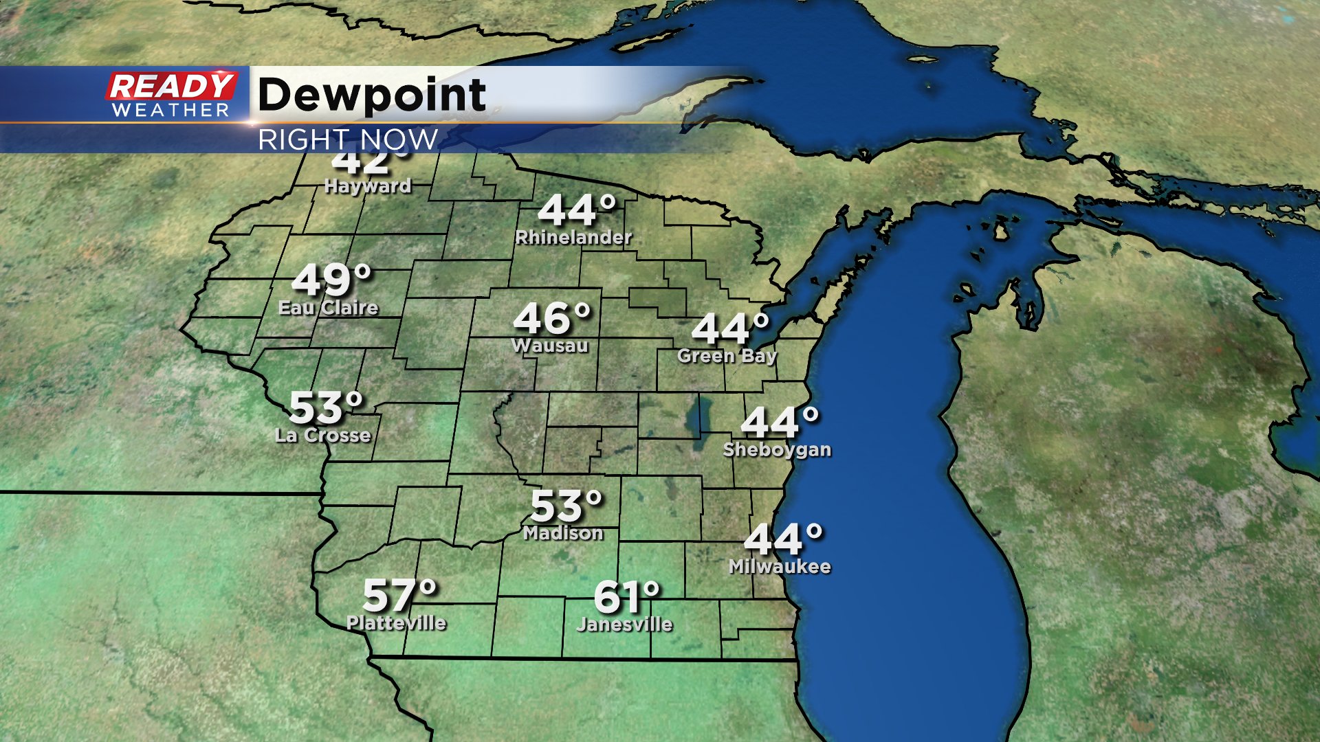
Wow look at the temperature difference from the lake to central Wisconsin! A cool onshore wind has kept fog and very stable conditions across Milwaukee; however, near Janesville and Madison the atmosphere is becomming unstable.
That instability over the next several hours will increase the shower and storm threat across our western counties.
The best chance for any strong to severe storm will be across south-central Wisconsin south of the warm front. As those storms move east they could hold together along the border of IL/WI. That could trigger a strong to severe storm for our western counties. Jefferson and Walworth counties will have the best chance for severe weather before storms become elevated.
As the storms approach the lake they will slowly weaken.
The timing for this will be from 4 PM till 8 PM.
______________________________________________________________________________________________________________
11:00am Update The fog is lifting allowing temperatures to rise. As we continue to deal with a lake breeze, that warmth is really felt best to our western spots. Highs there this afternoon could push well into the 60s, with cooler 50s lakeside. The additional warmth, higher dew points
We are waking up to dense fog in a lot of spots Tuesday morning, otherwise it's a dry start to the day. After a good quarter inch of rain fell in most communities Monday afternoon some more rain is likely Tuesday afternoon and evening. The best chance for some storms is from 3 p.m. to 8 p.m.

Once the rain starts Tuesday afternoon it's going to continue off and on for about 36 hours through most of Wednesday into early Thursday morning. The much better threat for severe weather is in southern states like Texas, Oklahoma and Arkansas but we do have a low threat for an isolated strong or severe storm Tuesday afternoon and evening. There's a slightly better chance for some severe weather west of Madison. In Wisconsin, the focus of any severe storms will be along a warm front. That front is expected to stay south and west of southeast Wisconsin but if it moves into our local area the threat for severe weather could increase.

Regardless of any severe potential, a good soaking rain is likely for most of the area. By the time all of this rain is done early Thursday morning many could pick up over 1" of rain and even higher amounts with thunderstorms. Add that onto the soaking rain we saw Monday and some could see about 2" of rain over the three days.
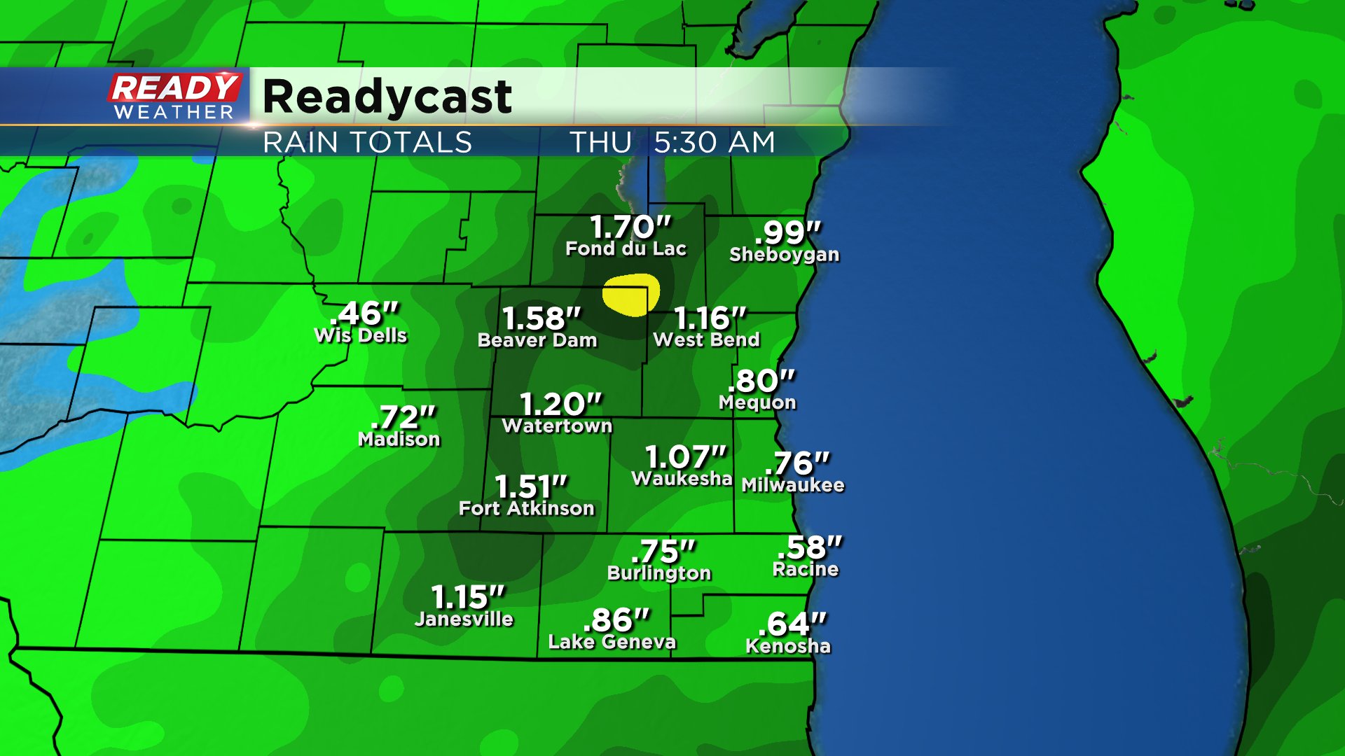
The additional rainfall isn't such a bad thing. We are still about 2" below-average on rain for the month of April which is currently the 14th driest April on record.

Download the CBS 58 Ready Weather app to track the showers and storms. The app will give you alerts if severe weather warnings are issued.