


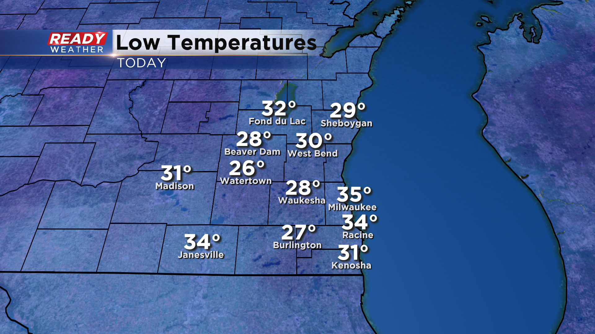
It was a chilly start to the day across southeast Wisconsin with temperatures dropping below freezing unless you were right along the lake.
Temperatures have warmed into the upper 40s to low 50s as of midday under sunny skies, but clouds will start to thicken around sunset as a cold front approaches from the west.
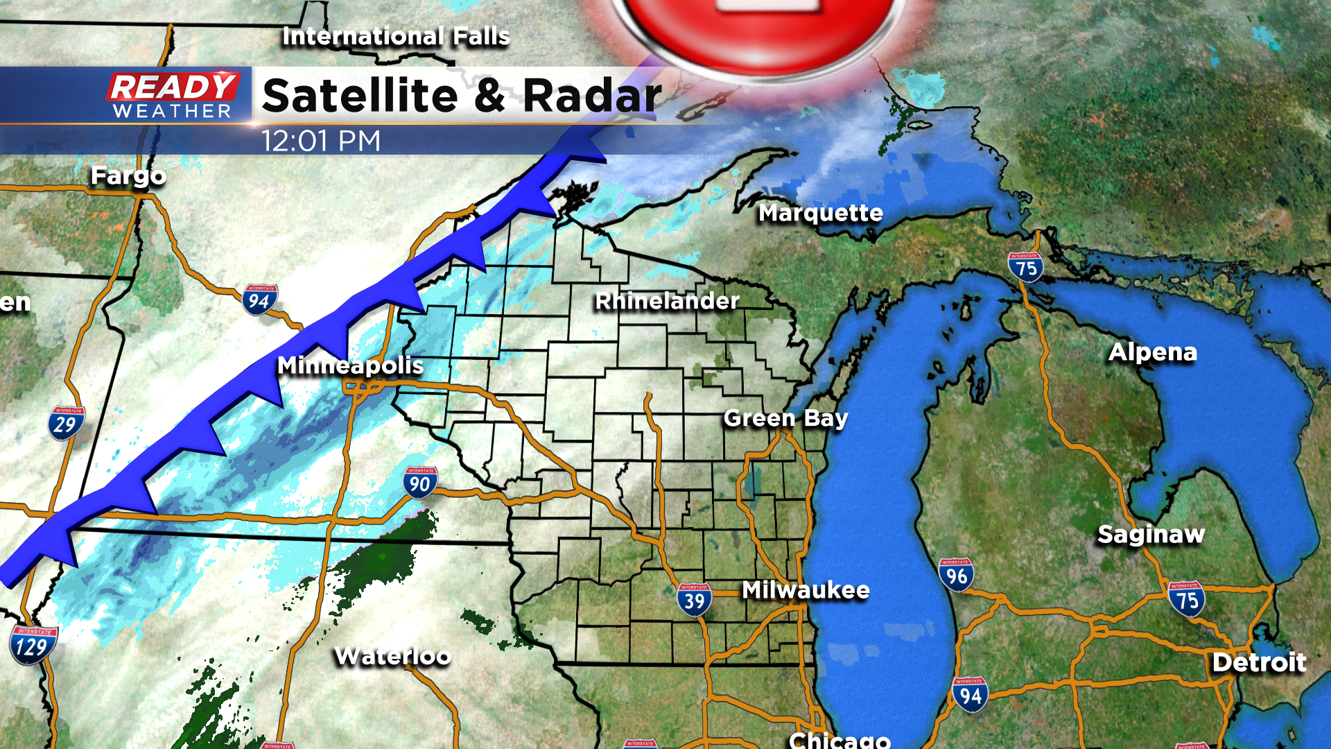
That front will start to bring a few rain showers into the area around or after 9pm.
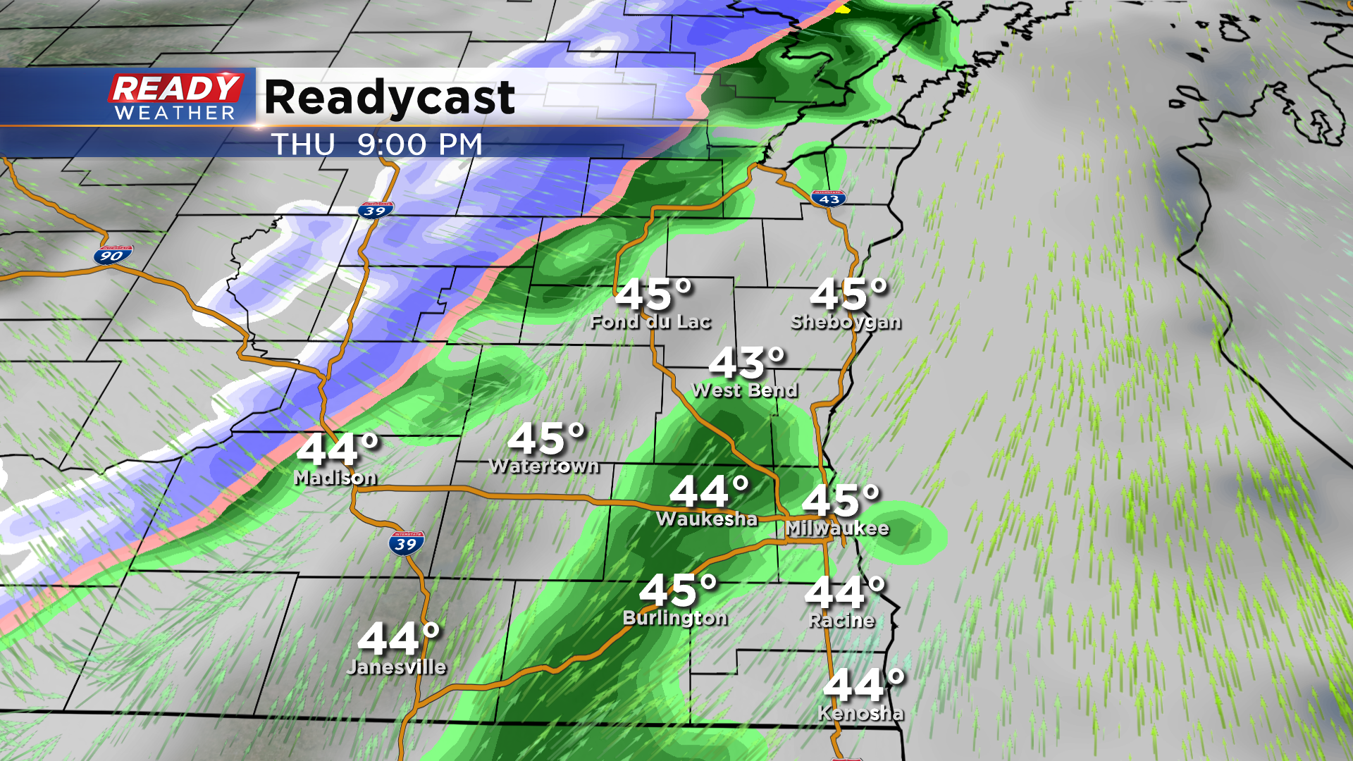
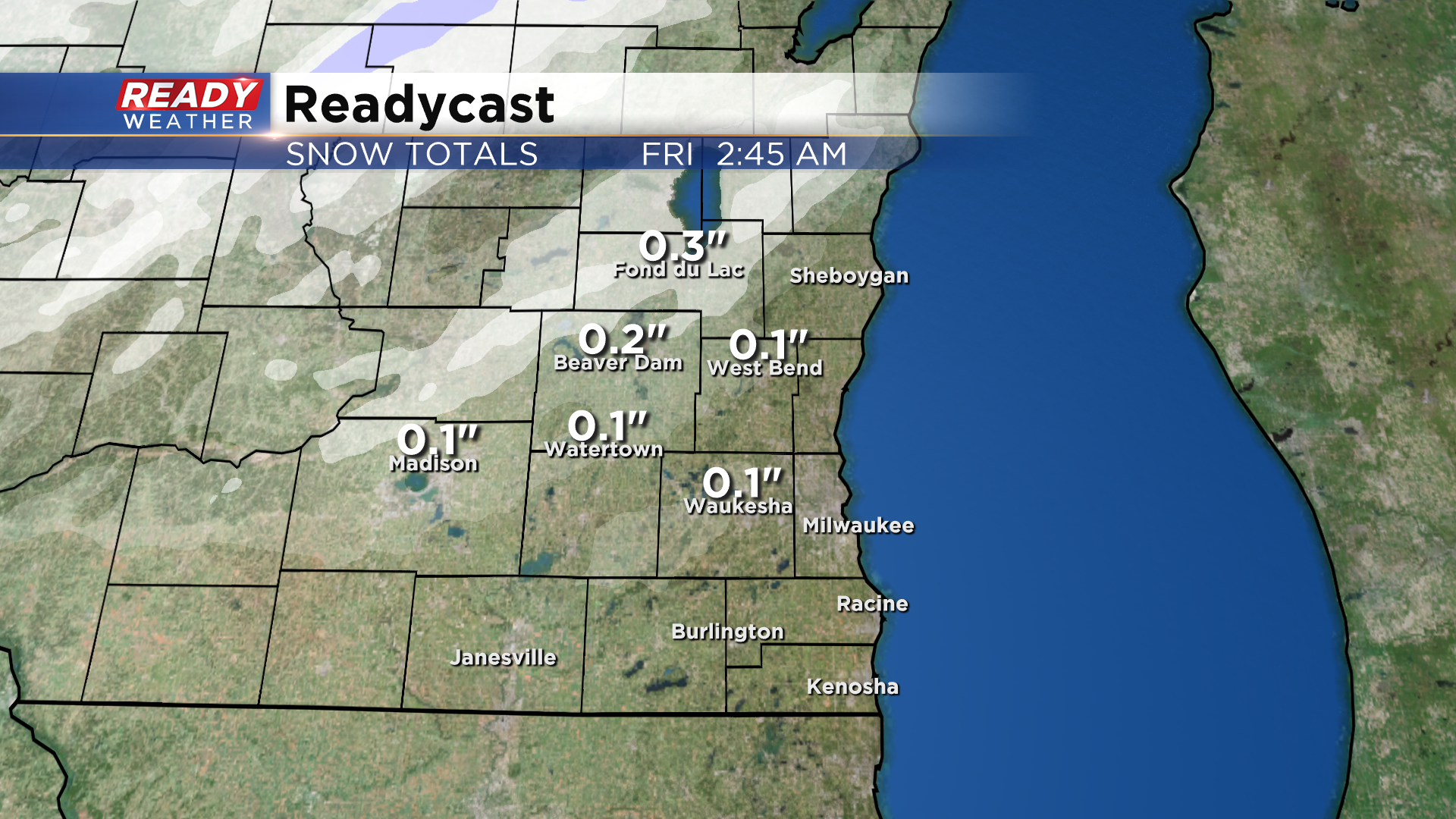
Cold air moving in on the backside of this front will change the light rain showers over to snow showers, primarily northwest of Milwaukee and well away from the lake.
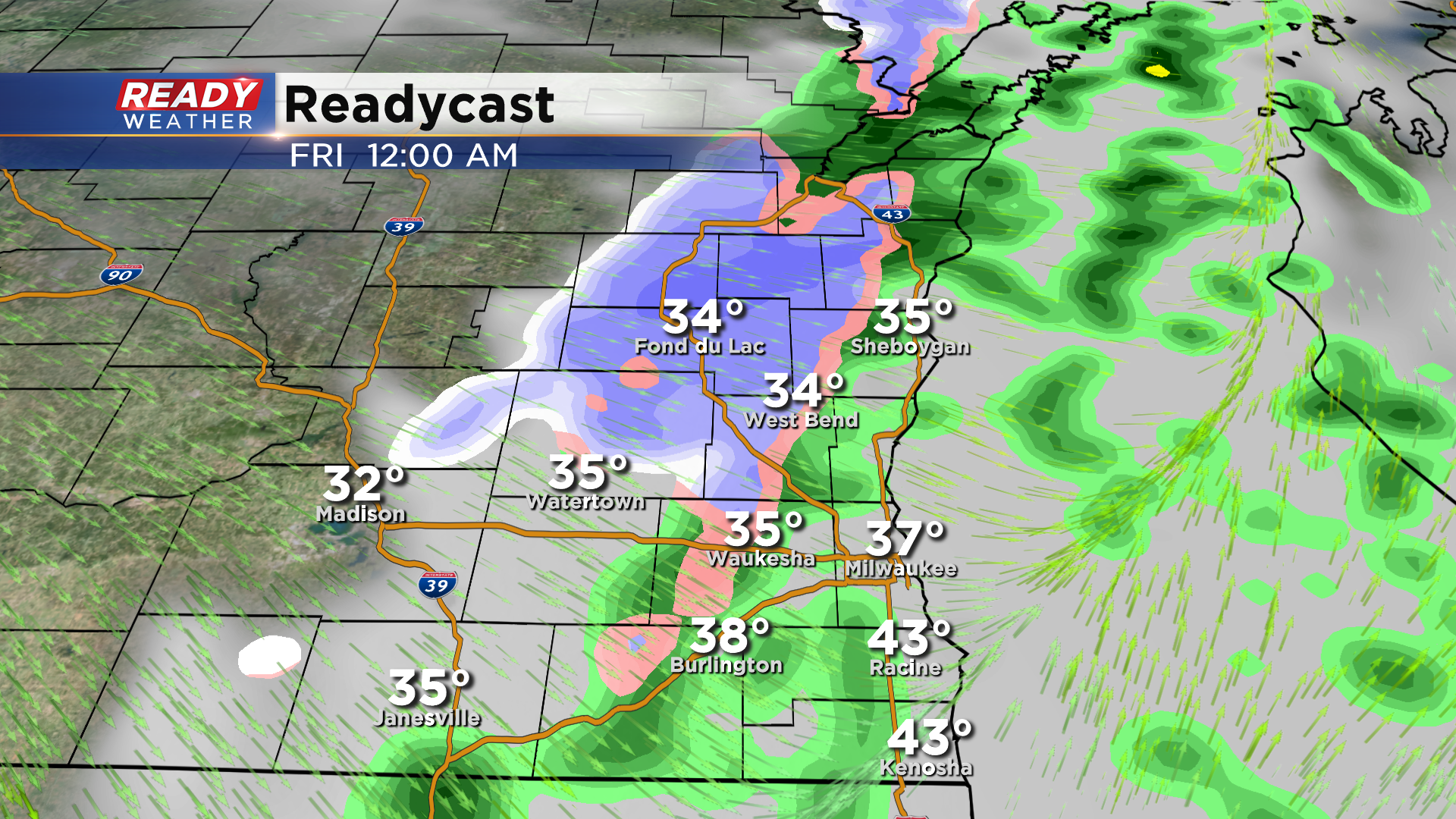
The rain and snow showers will come to an end around 1am as the front clears the area. A coating of snow is possible on the grass near Fond du Lac and Beaver Dam, otherwise no more than a light dusting is expected elsewhere.
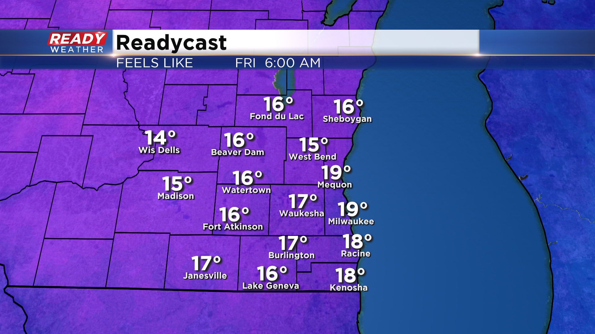
Skies will clear out by sunrise Friday morning, but it'll very cold and breezy. Temperatures will start the day in the upper 20s with feels like temps in the teens.
Temperatures won't make it out of the 30s on Friday, but temperatures will return closer to normal this weekend. See if there's any rain in the weekend forecast by downloading the CBS 58 Ready Weather App.