3pm Update: Earlier cloud cover limiting severe storm threat
Updated: 3pm Saturday, July 24th:
The cloud cover from earlier this morning and a pocket of drier air is limiting our strong to severe storm threat this afternoon. However, we are seeing a few cells pop, primarily south of I-94.
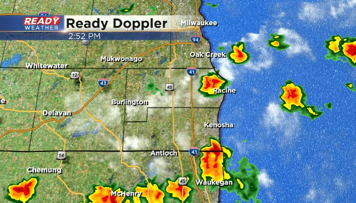
Lightning and downpours are the main threats in these cells. Any showers and storms will exit the area between 5-6 pm with dry weather expected for the rest of the weekend.
-------------------------------------------------------------------------------------------------
Round one of rain and storms dropped anywhere from 1-3" of rain across the northern half of the state, and some of these downpours are tracking across Fond du Lac and Sheboygan counties as of 9 am.
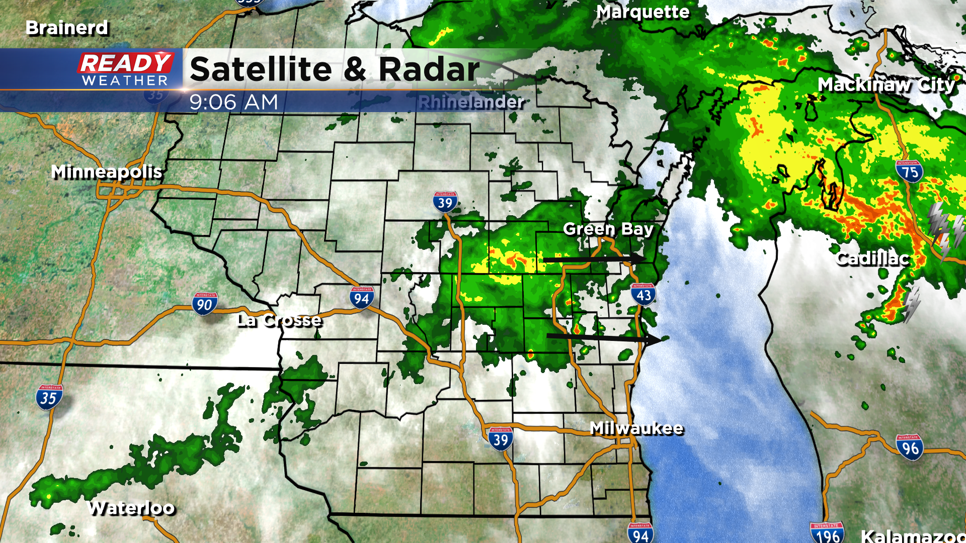
This round of rain and isolated thunder will stay north of I-94 and exit around lunch time. We'll have a break in the action heading into the afternoon, but additional isolated storms will be possible between 2pm -6pm as the cold front works through southeast Wisconsin.
Best chance for additional, isolated storms this afternoon in southeast Wisconsin will be along and south of a line from Milwaukee to Delavan. However, the higher chance for storms will be to our south and east in Illinois and lower Michigan. If storms can pop here, they could be strong to severe depending on how much sun can break through the clouds once round one moves out.
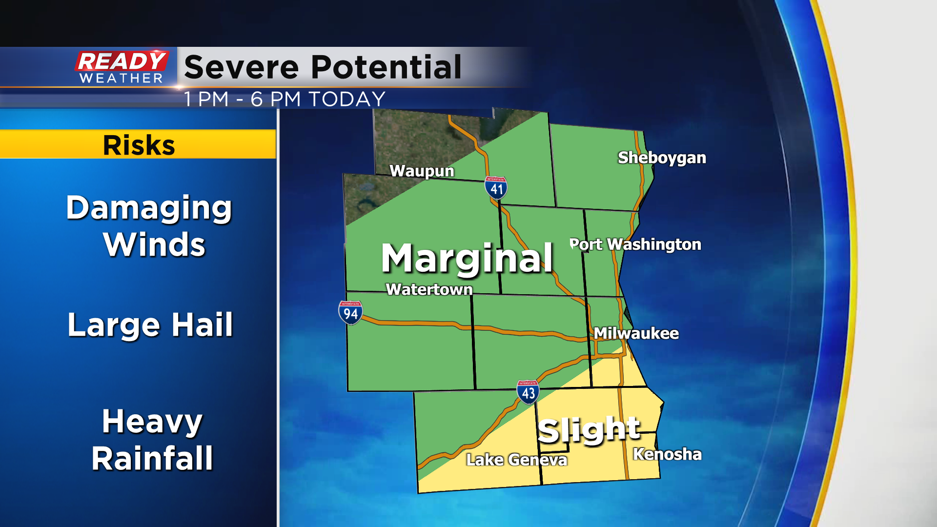
A level 2 of 5, Slight Risk is in place south of a line from Milwaukee to Delavan, with a lower risk everywhere else. Damaging winds and large hail will be the main threats in any strong storms along with torrential downpours. Once storms exit far SE WI around 6 pm we'll be dry for the rest of the weekend.
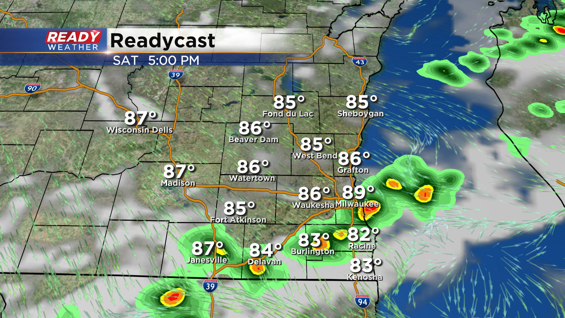
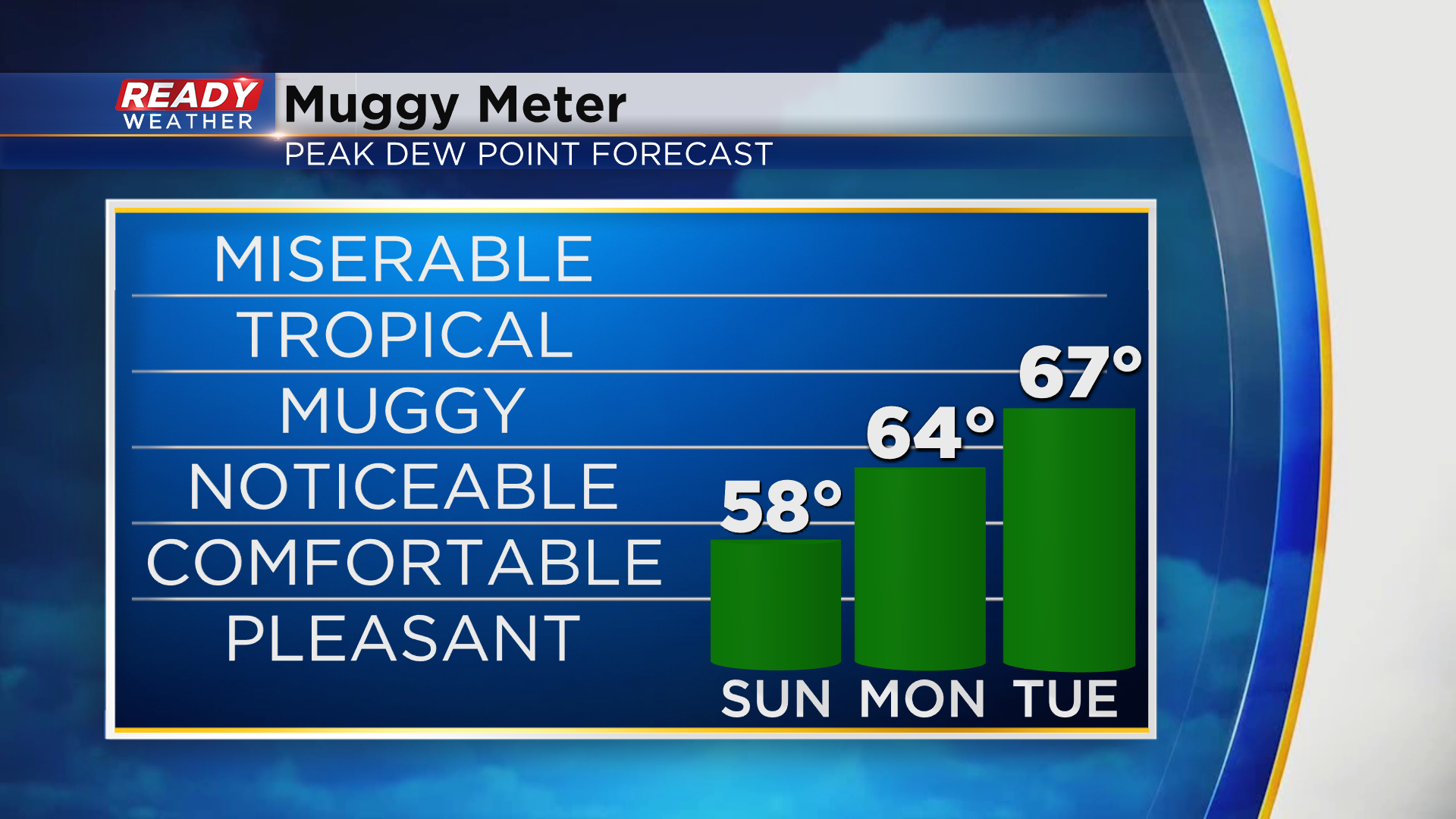
After a hot and humid day today, we'll have a nice break from the humidity on Sunday as dew points drop back into the upper 50s by the afternoon. However, the break from the humid weather will be short lived as it builds back in to start the work week.
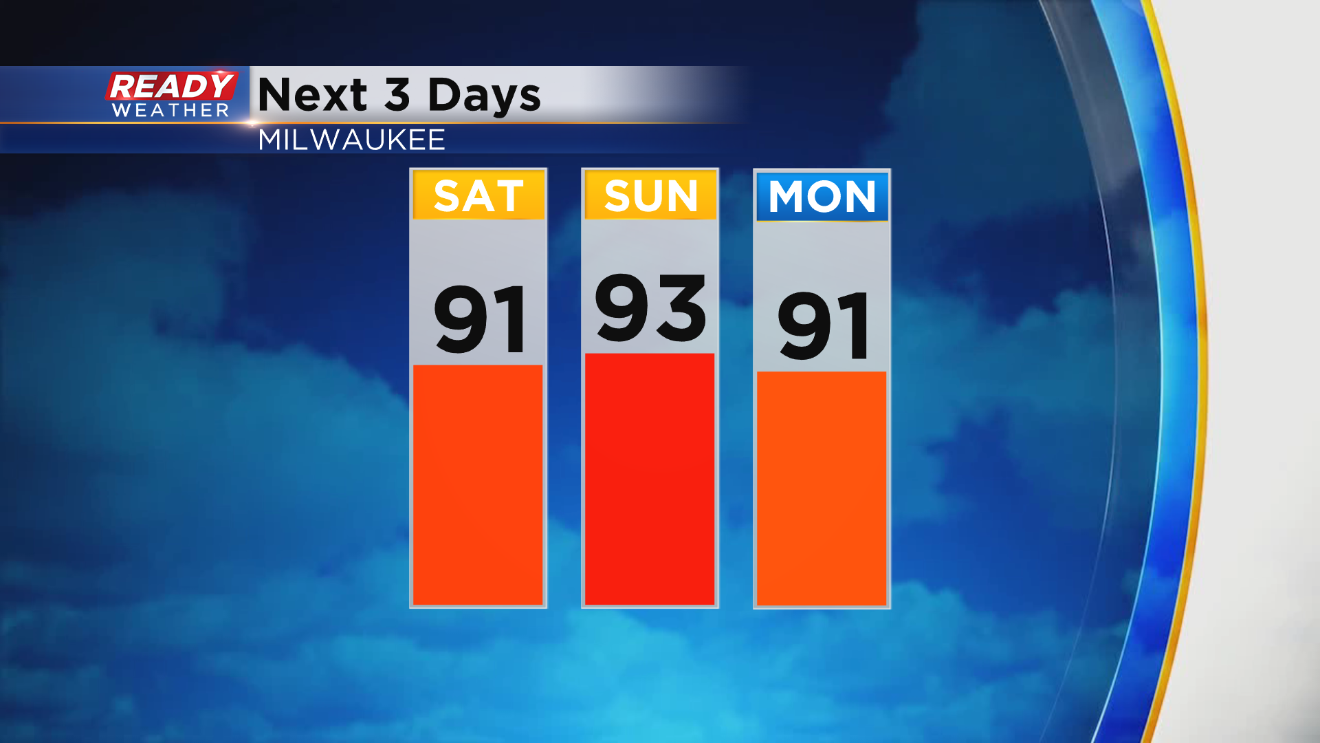
Although we'll have a break from the humidity on Sunday, we won't have a break from the heat for several days. Low 90s are expected once again on Sunday with highs remaining around 90° into the first half of next week.
Download the CBS 58 Ready Weather App to get any warnings sent to your phone and to see when the heat will break.
