Cristobal makes 'landfall' in Wisconsin; more rain and wind Wednesday


Cristobal officially made "landfall" in Wisconsin Tuesday evening making it the first storm to move within the state's borders since 1988 and only the fourth storm in recorded history to do so. Not only did Cristobal enter Wisconsin but it also the first storm to reach the northern part of the state. As of Wednesday morning Cristobal was located in the UP and preparing to move into Canada.

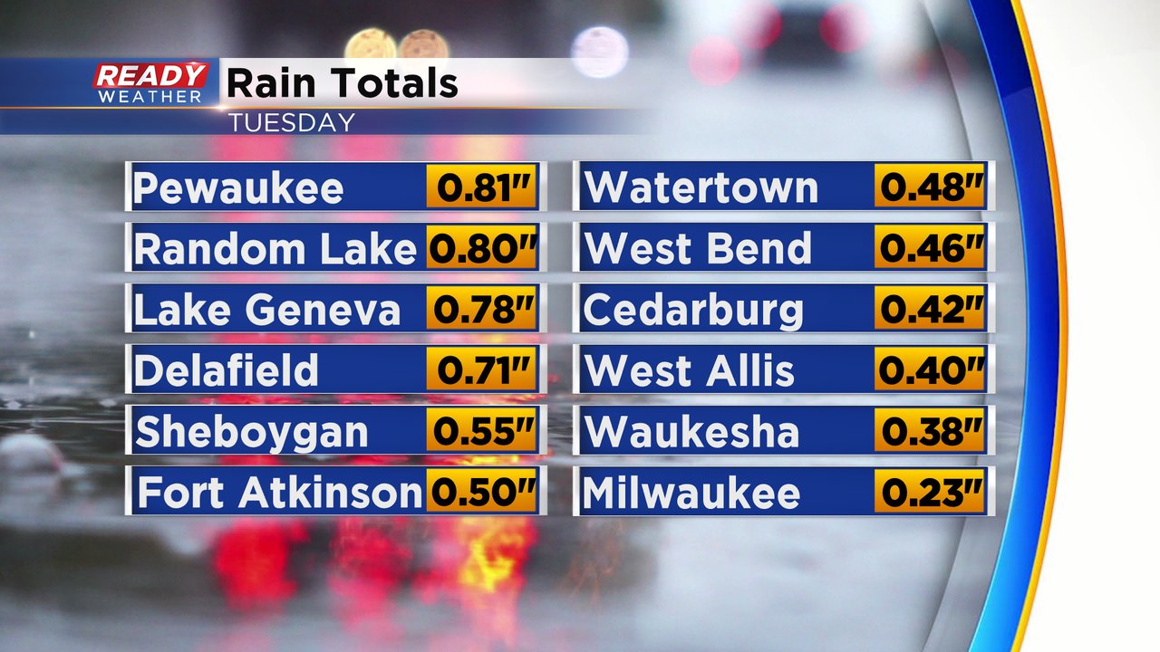
Western Wisconsin and eastern Minnesota saw the heavy rain as Cristobal moved through with up to 5" of rain reported. Southeast Wisconsin saw a soaking rain but everyone stayed under 1" of rain.
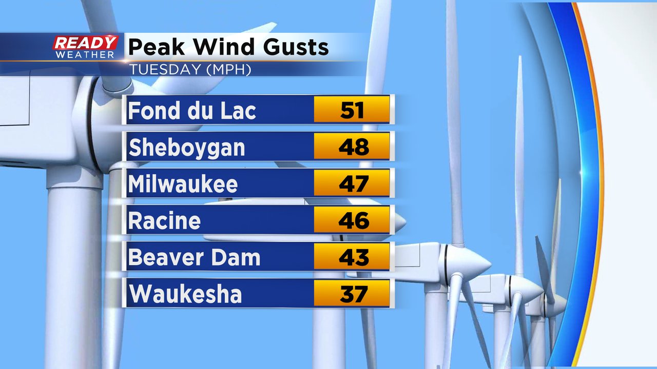
The wind was the bigger story Tuesday with numerous wind gusts above 40 mph and Fond du Lac topping the list over 50 mph. The wind was responsible for numerous downed trees across the area and thousands without power.
The wind will come down Wednesday morning becoming light around lunchtime but then ramp back up Wednesday evening with gusts to 35 mph. Expect a breezy Thursday as well before lighter wind for the weekend.
A last push of rain moved through southeast Wisconsin early Wednesday morning. The rest of the morning stays fairly dry before another low pressure moves in from the west bringing us some scattered showers and isolated storms Wednesday afternoon and evening. If thunderstorms do form they could bring heavy downpours and strong wind.
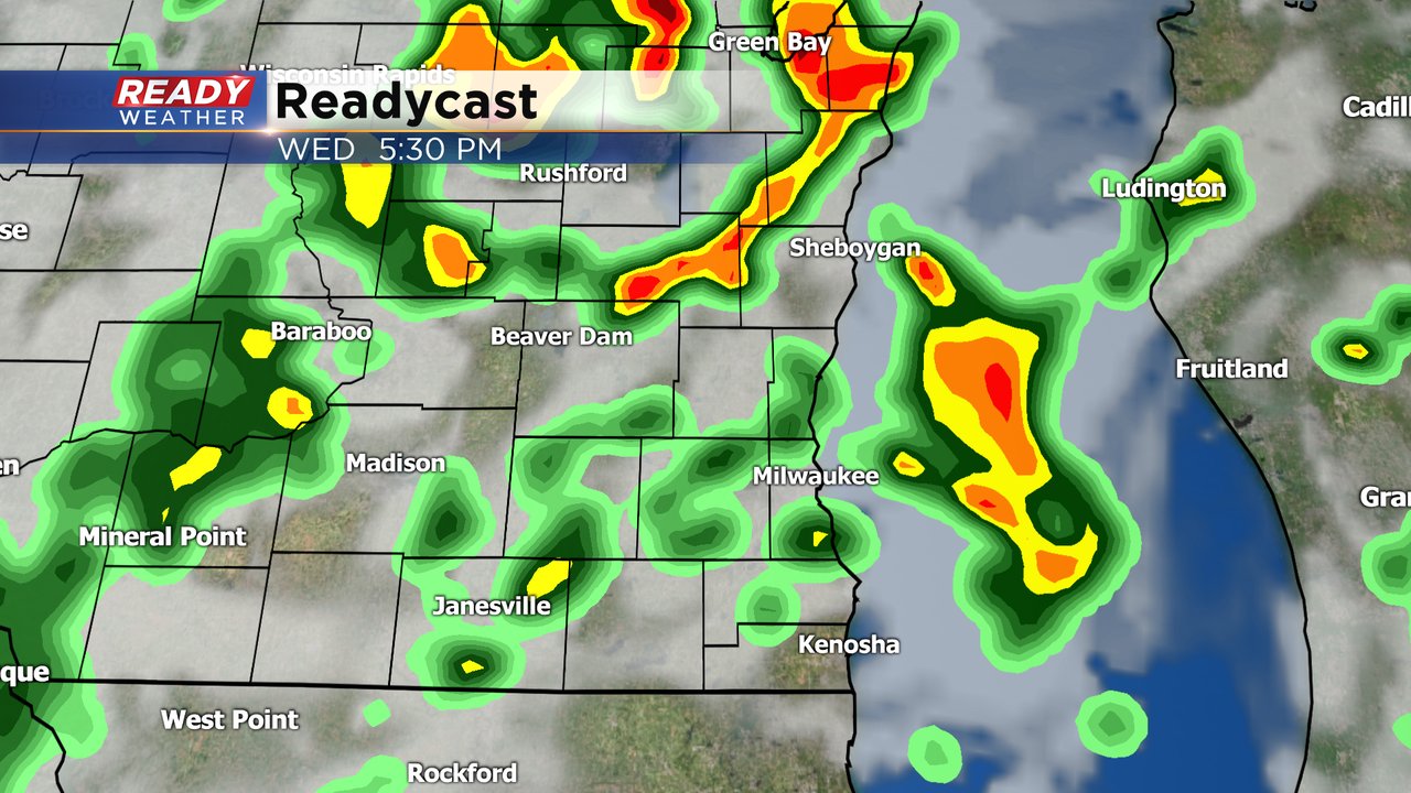
Northern counties have the best chance to see thunderstorms with up to 1" of rain expected there. The rest of southeast Wisconsin can expect around a quarter to half inch of new rainfall.

Download the CBS 58 Ready Weather app to track Cristobal as it moves into Canada and track today's rain chance in Wisconsin.