Coldest air of the season arrives Wednesday morning with dangerous wind chills


The frequent snow chances over the weekend and the beginning of this week are gone and the cold is moving in. Wind chills Tuesday morning are dropping into the -10 to -25* range and will stay below-zero all day with wind chills between -5 to -15 Tuesday afternoon.
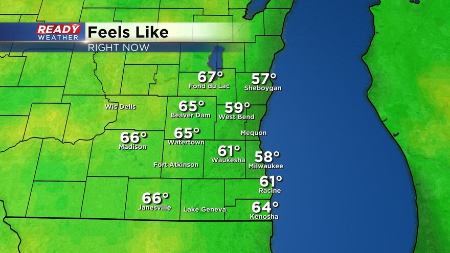
See current wind chills updating with time below:
A wind chill advisory has been issued for a few hours Tuesday morning until noon for three of our western counties: Dodge, Jefferson, Walworth. Where wind chills could hit -20 or colder.

Wednesday morning will likely be the coldest of the season with air temperatures dropping into the single digits below-zero everywhere and even some teens below-zero. Add on a 5-15 mph wind and the wind chills will drop to -20 to -35 when we are waking up Wednesday morning.
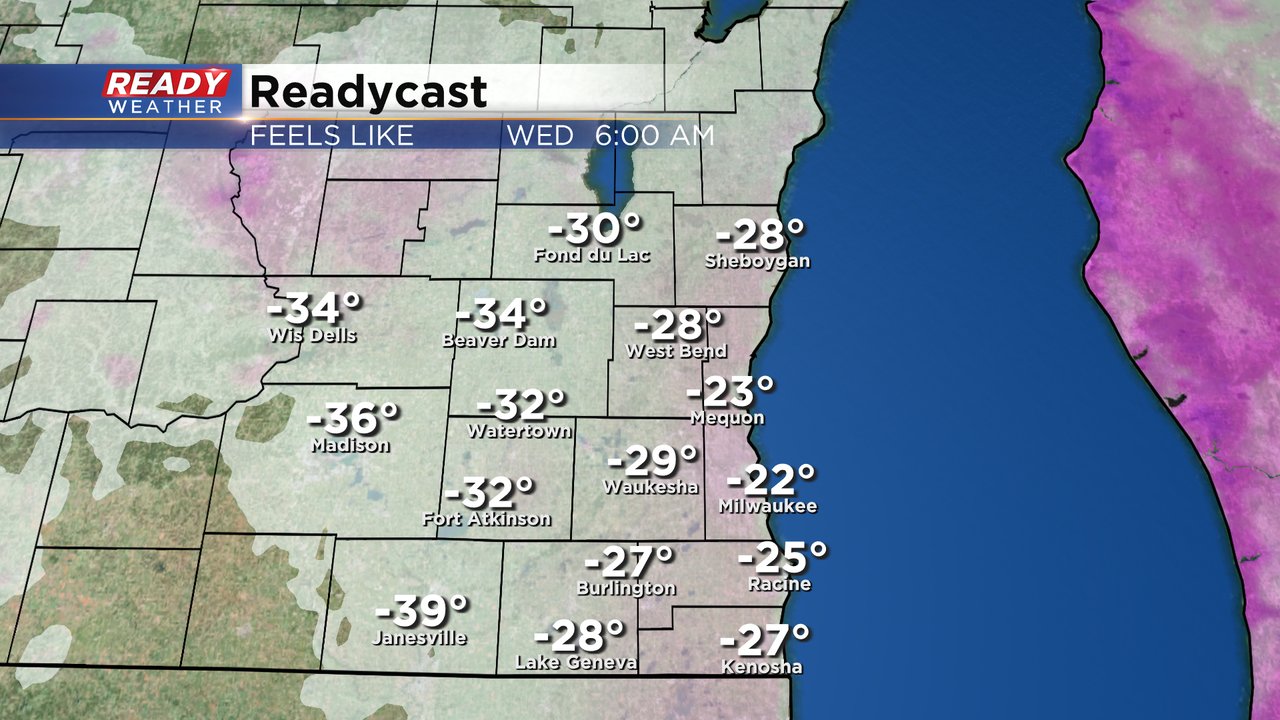
A second wind chill advisory has already been issued for all of southeast Wisconsin for Tuesday evening through all morning of Wednesday. The official start time is 8 PM Tuesday lasting until 12 PM Wednesday. This is the first time this season that all of the counties in our viewing area are under a wind chill advisory and the first time we have one for Milwaukee, Racine and Kenosha Counties.

Download the CBS 58 Ready Weather app to track the temps and bitter wind chills.