8:00 PM Update: Strong to severe storms exiting the area
Updated: 8 pm Sunday, August 9th:
The line of strong to severe storms has moved over Lake Michigan, but not before producing tree and limb damage in Waukesha.
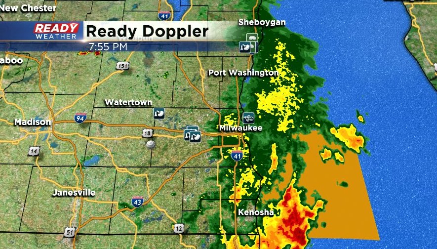
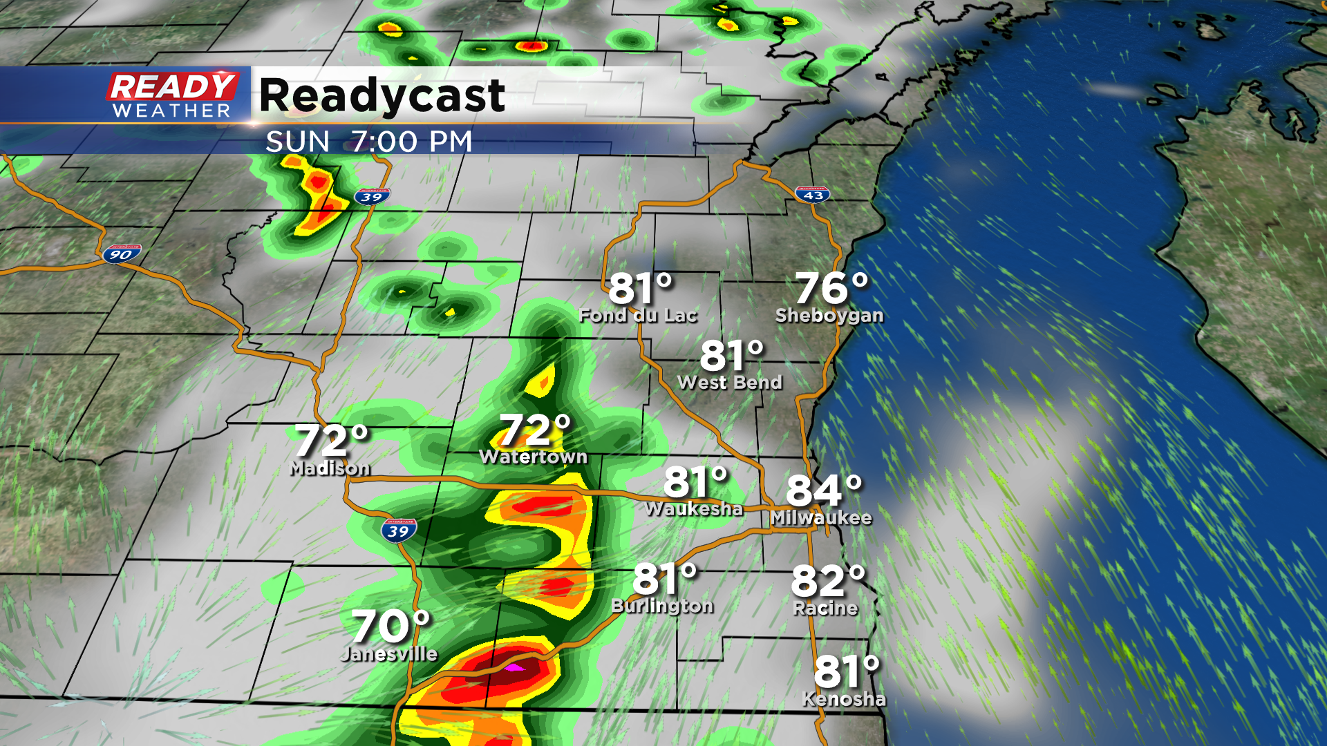
Once the showers on the backside of the storms clear the area, we'll be dry through the rest of the evening. We'll be watching to see if scattered thunderstorms can develop across northern Wisconsin overnight as they may drop into southern Wisconsin, but the best chance for storms will be with the passage of the cold front on Monday.
----------------------------------------------------------------------------------------------
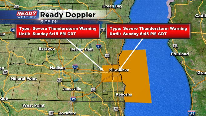
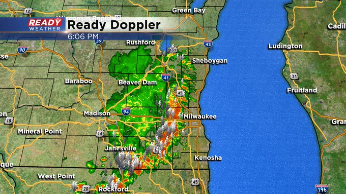
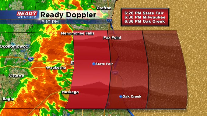
Updated 6:00 pm Sunday, August 9th
A Severe Thunderstorm Warning is in effect until 6:15 pm for Waukesha County and until 6:45 pm for Milwaukee County. Strong to severe storms should be rolling through across the downtown Milwaukee area around 6:30 pm.
_____________________________________________________________________________________________________________
Updated 5:55 pm Sunday, August 9th
All warnings have been allowed to expire except for Waukesha County. This Severe Thunderstorm Warning goes until 6:15 pm. Storms are bearing down on the metro area in the next half hour. Gusty winds, large hail, dangerous lighnting, and heavy rain are all possible.
______________________________________________________________________________________________________________
Updated 5:40 pm Sunday, August 9th
There is now a Severe Thunderstorm Warning until 6:00 pm for Walworth County. This is in addition to the other Severe Thunderstorm Warnings for both Waukesha and Jefferson Counties. 60 mph wind gusts, frequent lightning, large hail, and heavy rain are all possible. Stay tuned to CBS 58 on air and online for all the details.
_____________________________________________________________________________________________________________
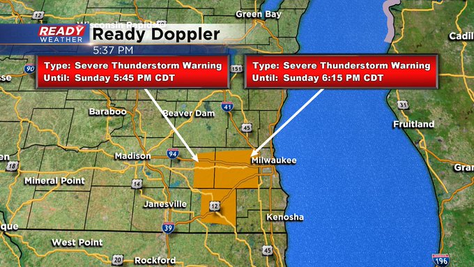
Updated 5:30 pm Sunday, August 9th
Strong to severe storms are bearing down on the metro Milwaukee area from the west. A Severe Thunderstorm Warning is in place until 5:45 pm for Jefferson County and 6:15 pm for Milwaukee County. 60 mph wind gusts, frequent lightning, and heavy rain are all possible. Head indoors if outside and keep it tuned to CBS 58 for all the latest weather details.
______________________________________________________________________________________________________________
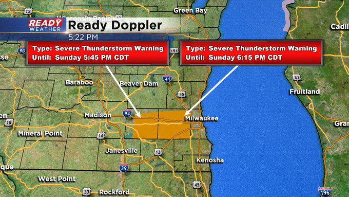
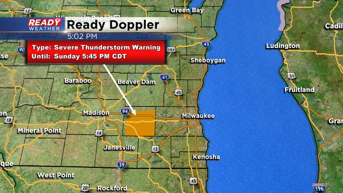
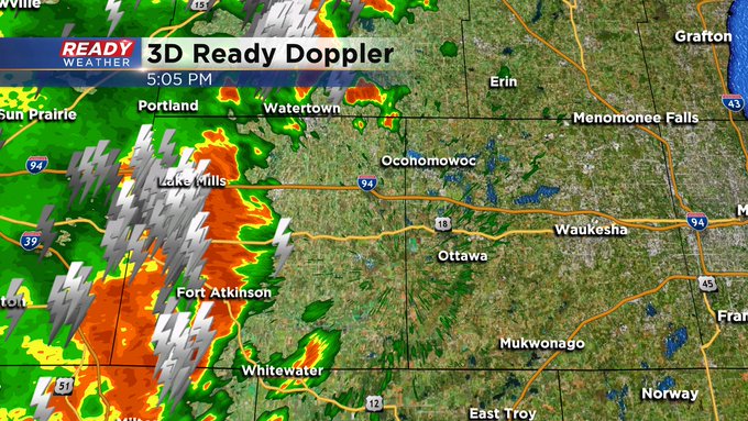
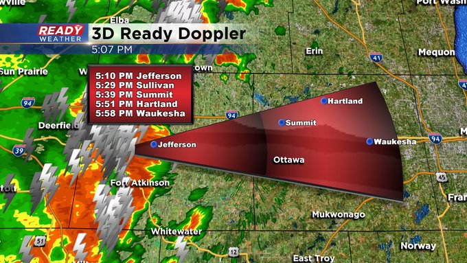
Updated 5:05 pm Sunday, August 9th
Strong to severe storms are beginning to develop just west of the metro. There's a Severe Thunderstorm Warning in place until 5:45 pm for Jefferson County. 60 mph wind gusts and large hail are all possible. If you're in the path of these storms, please head indoors and seek shelter now. The entire CBS 58 Ready Weather team is tracking these storms and will keep you updated into the evening.
_____________________________________________________________________________________________________________
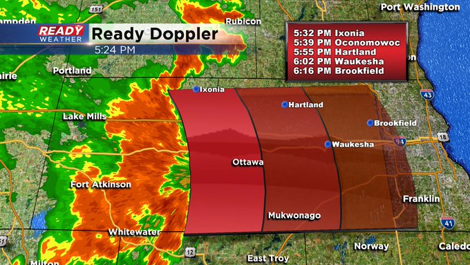
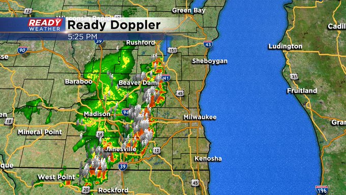
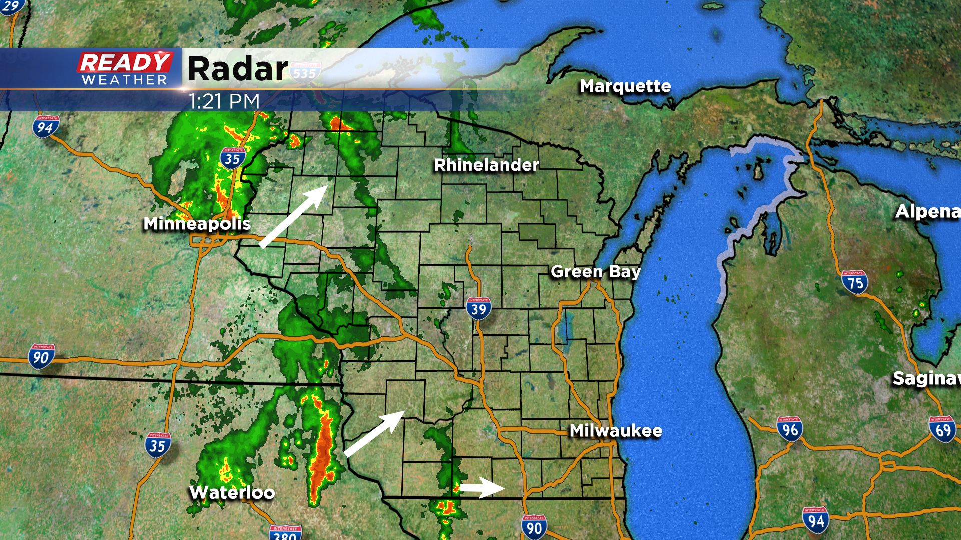
Updated: 3:55 pm Sunday August 9th:
The aforementioned cluster of storms has started to take more of an easterly track and will continue to push across southern Wisconsin through this evening. This line of storms could pack wind gusts of 40-50 mph, with locally stronger gusts of 55 mph possible.
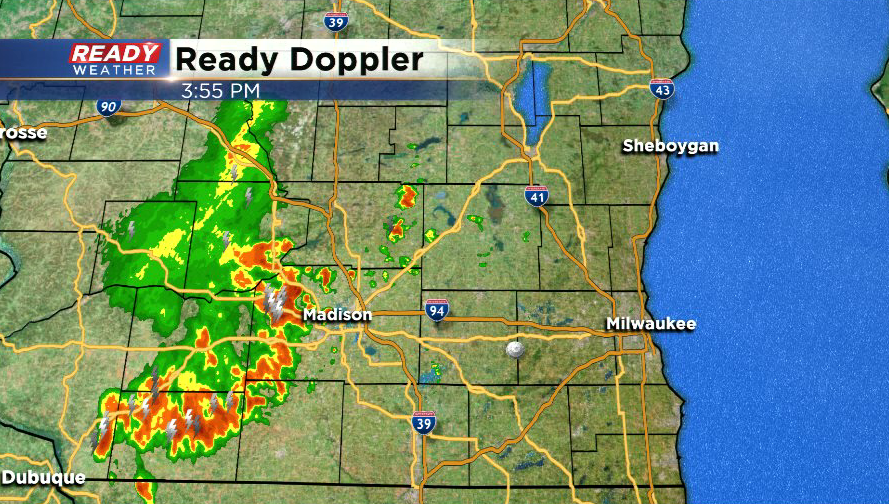
Currently this line of storms is moving east at 30 mph, which would put the leading edge into Jefferson county by 5 pm and Milwaukee between 6-6:30 pm. Another uncertainty with these storms is how they will interact with a lake breeze that has developed this afternoon.
Currently the lake breeze is parked near West Bend, Waukesha, and Burlington. While strong winds, hail, and heavy downpours are the main threats in this line of storms, this lake breeze could add some extra spin, so we'll be watching for an isolated spin up as well.
--------------------------------------------------------------------------------
A complex weather scenario is setting up this afternoon and will be in place until a cold front swings through southeast Wisconsin Monday afternoon. As of early this afternoon, we're watching a few isolated storms in southwest Wisconsin that have been slowly pushing east for the last few hours. To the west, storms are becoming stronger in northeast Iowa, but are currently tracking northeast. More storms are getting going near the Twin Cities into NW Wisconsin, which is where the best chance for severe weather will be this afternoon.
Unfortunately most models didn't, and still haven't, picked up on the ongoing storms in NE Iowa/SW WI. So we still have a lot of uncertainty as to when we'll have the best chance for storms and where they'll be. There is also a lot of uncertainty as to what the storms in Minnesota, and even back into the Dakotas, will do, and that will have an impact on our storm chances. With the sunshine we've had so far today, we could see a few isolated storms late this afternoon or early evening.
Chances for isolated to scattered storms will be possible overnight into Monday morning, and will continue to be possible until the cold front works through sometime Monday afternoon.
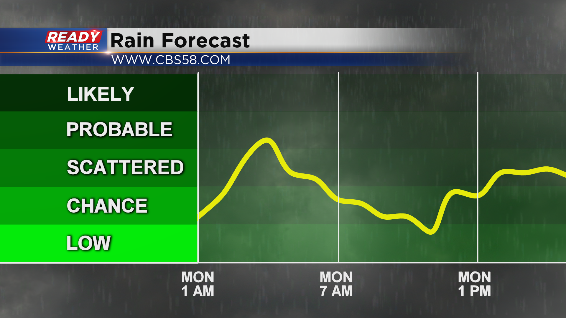
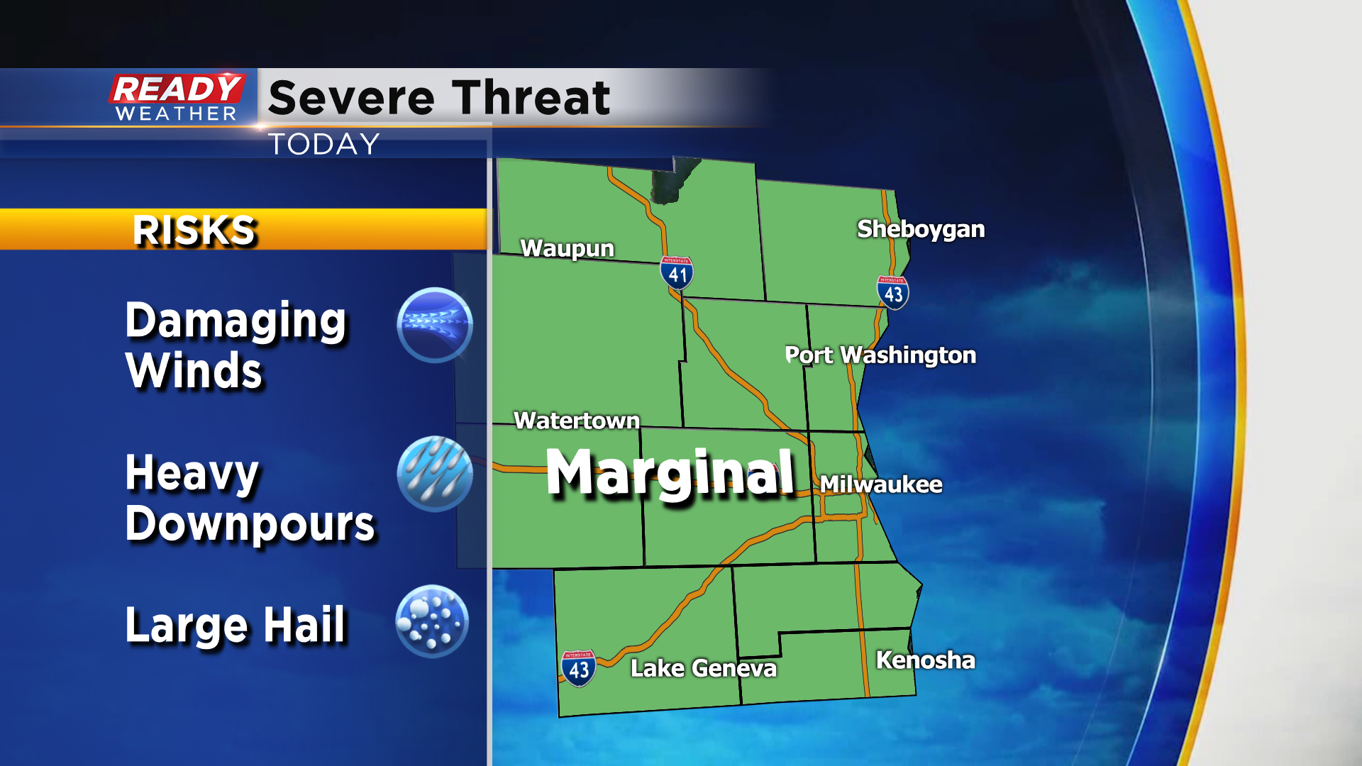
Again, nailing down the exact timing of storms over the next 24 hours is a challenge due, but the best chance for any stronger storms today will be this afternoon and evening. The entire area is under a level 1, Marginal Risk, for severe storms with isolated damaging winds, large hail, and heavy downpours the primary threats.
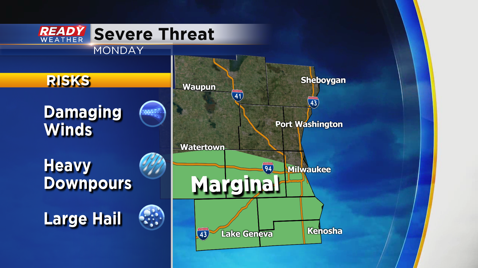
A few storms could be on the strong side ahead of the cold front on Monday as well, with the best chance along and south of I-94.
Best way to prepare for the next 24 hours is to download the CBS 58 Ready Weather App so you can be alerted when storms are approaching. We'll also be updating this article periodically through the remainder of the day when there's (hopefully) more model consensus on what will actually transpire.
