Bitter and dangerous cold for the weekend with some light snow


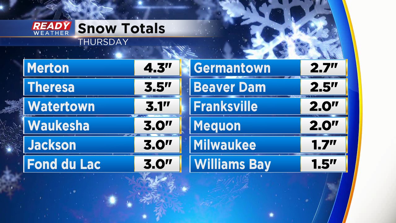
Our latest round of snow has wrapped up and the cold air is rushing in. Snow totals for Thursday's event were mostly in the 2-4" range with a few isolated spots just above or just below those numbers. The snow was very wet and slushy and as temperatures dropped fast Thursday night most of it froze pretty quickly. Roads are still reported as slippery or icy Friday morning.
Wind gusts Thursday night were as high as 45 mph and remain as high as 35 mph for most of Friday with breezy conditions staying with us through the weekend. The strong wind combined with temperature staying chilly means that wind chills will be an issue. The wind chills went below-zero around 5 AM Friday morning and will stay there throughout the rest of the day.

Low temperature Saturday morning will drop into the single digits just above-zero lakeside and below-zero for western areas. Combined with a gusty wind, wind chills will reach into the teens below-zero when we wake up to start the weekend.

Sunday morning is when the cold air will be the worst. Temperatures Saturday night will drop below-zero everywhere with some inland locations getting as cold as the teens below-zero for the actual air temperature. When you factor in the strong wind we could see wind chills in the range of -30 to -20. A wind chill advisory will likely be needed for the cold air Sunday morning. Wind chills Monday and most of next week are also expected to stay below-zero.

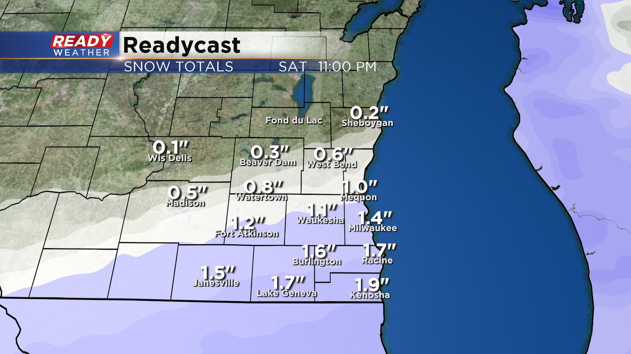
In addition to the cold temperatures and dangerous wind chills for the weekend we also have the chance to see a little bit more snow. As cold air settles over Wisconsin the jet stream will bring waves of storms just south of our area over the next week. A few of those storms could move into southeast Wisconsin. The track for a round of snow on Saturday is very uncertain with some models showing nothing and others with more plowable snow. Right now a forecast of a dusting to the north and up to 2" near the IL border looks best.
Download the CBS 58 Ready Weather app to track the bitter cold and Saturday snow.