Big Warm Up on the Way
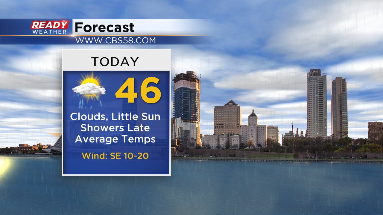
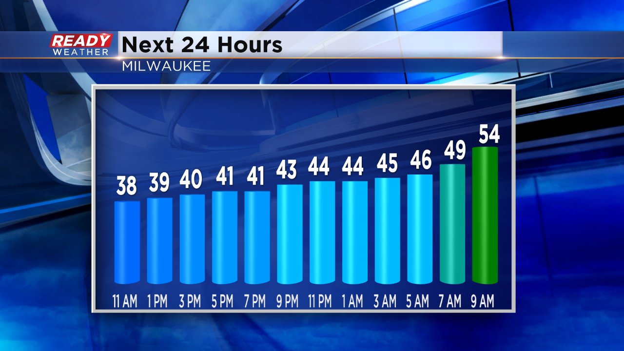
After a chilly Wednesday temperatures will get back to average on Thursday. Despite clouds and a lake breeze highs will reach the middle 40s on Thursday but it may take all day with high temperatures not getting reached until after sunset.
Thursday night temperatures are only expected to drop a degree or two and will begin to warm by sunrise Friday so most of southeast Wisconsin wakes up to temperatures in the upper 40s to around 50° and then continues to warm from there.
Friday's temperatures will all depend on the location of a warm front. That front is expected to sweep through southeast Wisconsin during the morning with temperatures reaching the middle 60s by noon.
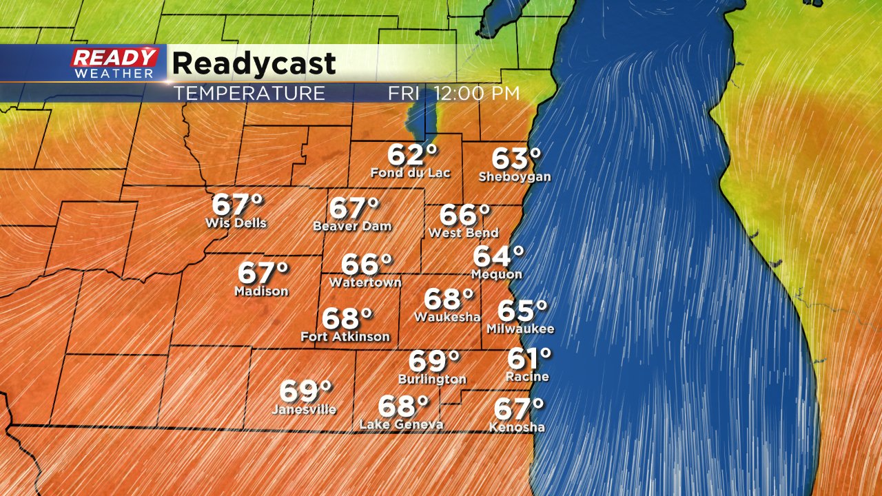
A few isolated 70s aren't out of the question either, but then as the warm front drifts back to the south it's going to take the warm air with it so temperatures could drop from the 60s to the 40s in an hour or two.
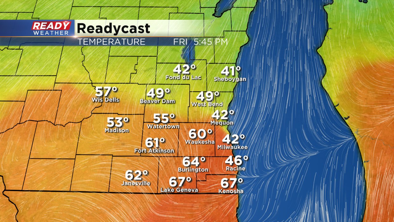
All of this depends on the location of the warm front and it is still possible that the warm front doesn't reach southeast Wisconsin keeping temperatures in the 50s on Friday, but most weather models do have the warmth hitting the area. In case you're wondering, the record for Milwaukee on Friday is 76°. Rain is also on the way but will stay mostly along and north of the warm front so the best chance for rain across all of southeast Wisconsin will be Friday evening and lasting most of Saturday.
