Another round of sub-zero wind chills on the way Thursday morning


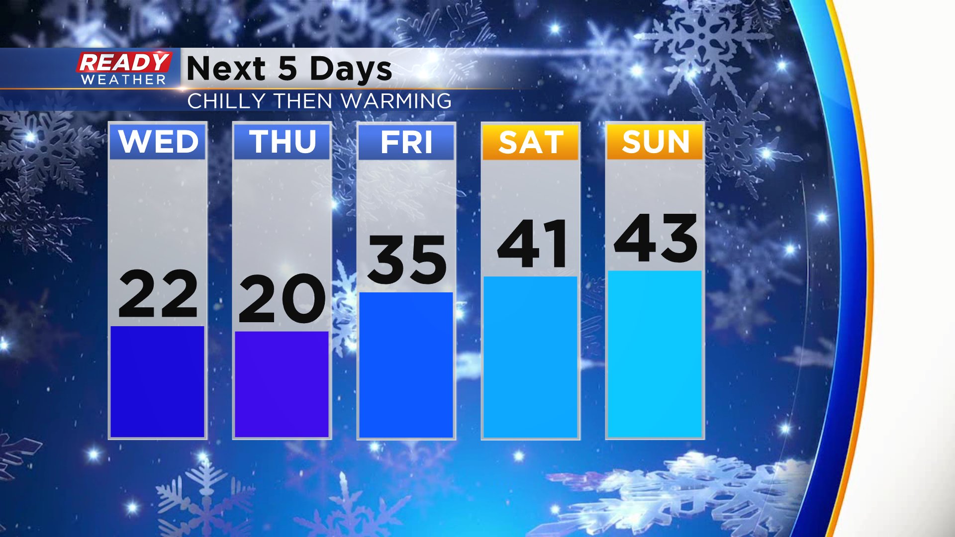
For the second time in a week we are seeing some chillier temps. Highs are expected to rose to around 20° both Wednesday and Thursday with wind chills in the single digits. The cold wouldn't be so bad during a normal winter but it's some of the coldest air we've felt this year thanks to how mild it's been. Wind chills will get to their worst levels Thursday morning as cold as -15°.

A wind chill advisory is usually issued when wind chills get to -20° so it looks like we will be just a little bit too warm for that. After some chillier days a nice southwest breeze gets us back to average on Friday with mid 30s for highs. 40s arrive for the weekend which is shaping up to be very nice.
Enjoy the 40s over the weekend though because they don't last. Another blast of cold air arrives towards the end of next week. The Climate Prediction Center gives Wisconsin a 40% to 50% chance for below-average temps.

There are 20s at the end of the 10-day which you can see by downloading the CBS 58 Ready Weather App.