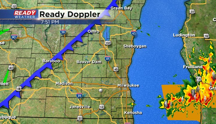
7:45 PM Update: Severe threat is over for southeast Wisconsin, but a few more stray storms possible


Updated: 8:00 pm August 11, 2021
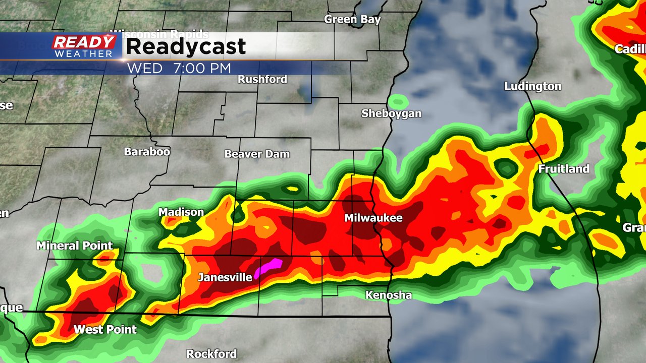
All is quiet at the moment across southeast Wisconsin as the strong to severe storms have moved over Lake Michigan. We'll be watching for a few additional storms to pop up over the next few hours as a front is to our west and the southerly wind ramps up, however most of the severe threat should be concentrated in Illinois into tonight.
--------------------------------------------------------------------------------------------------------------------------
Updated: 6:30 pm August 11, 2021:
New Severe Thunderstorm Warning has been issued for Walworth, Racine, and Kenosha counties until 7:30 pm. Damaging winds up to 60 mph are possible with this quickly developing storm as it moves east at 40 mph.
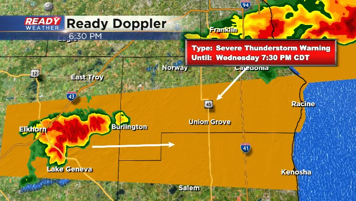
The severe thunderstorm warning that was in place for Waukesha and Milwaukee counties has been allowed to expire.
-----------------------------------------------------------------------
Updated: 6 pm August 11, 2021:
A Severe Thunderstorm Warning has been issued for southern Milwaukee and Waukesha counties until 6:30 mph. Damaging winds are the primary threat with the line as it moves east at 55 mph.
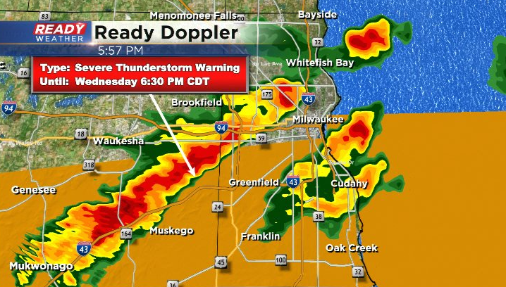
Additional storms possible through the evening.
------------------------------------------------------------
Updated: 4 pm: August 11, 2021:
The storms we've been keeping an eye on have been weakening as they push towards SE WI.
There's still a little bit of a "cap" on the instability in our area due to the cloud cover from earlier this morning, but we expect this "cap" to erode with all of the sunshine in place in the next couple of hours, allowing storms to use that instability. Don't let your guard down yet!
------------------------------------------------------------------------
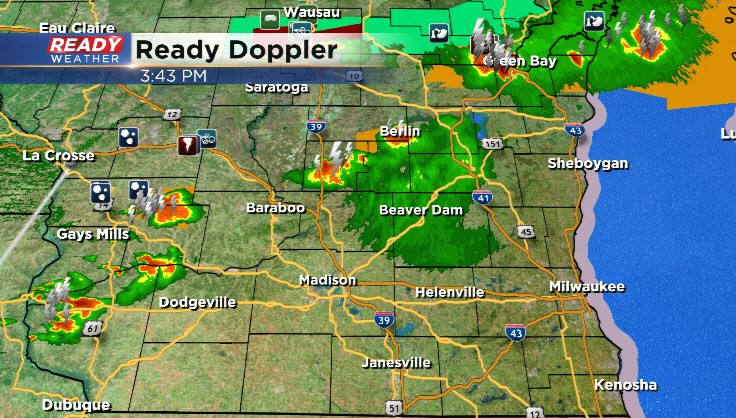
Updated: 2 pm: August 11, 2021:
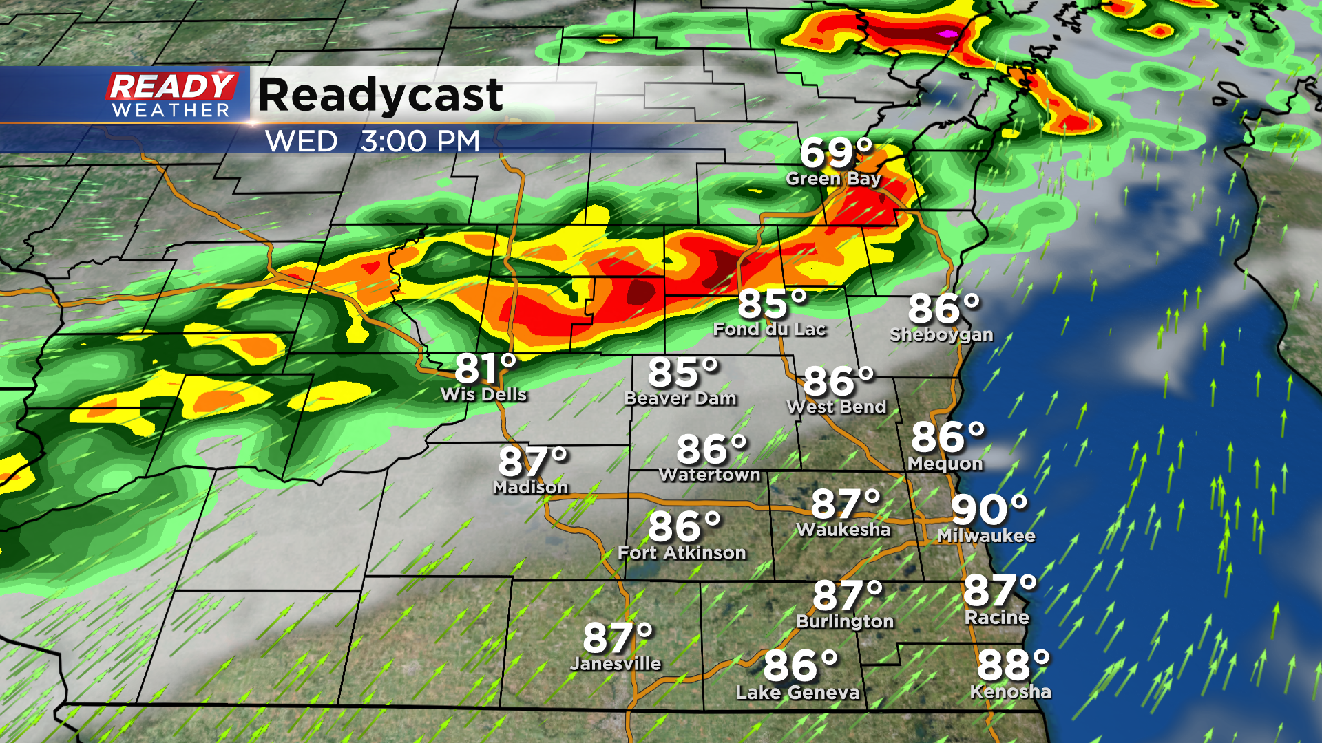
Severe storms are ongoing across portions of central and western Wisconsin. Both severe thunderstorm and tornado warnings are currently out for most of these storms.
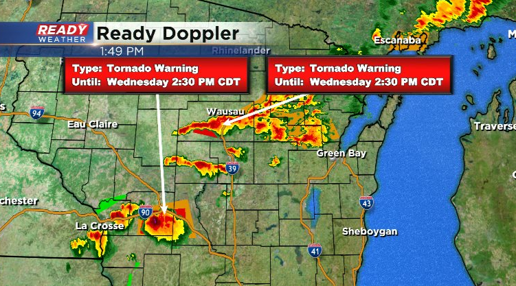
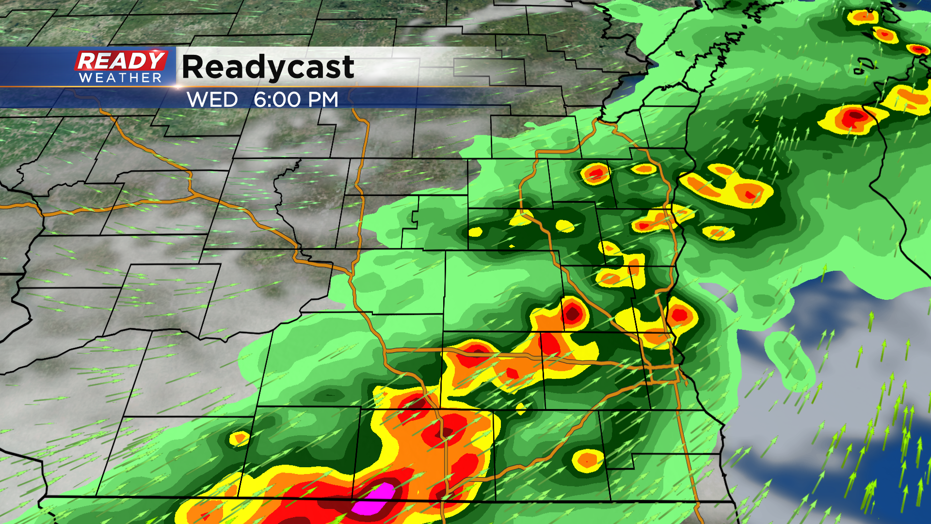
Storms start closing in on Fond du Lac and Dodge counties closer to 4 pm, moving through the metro around 5-7 pm.
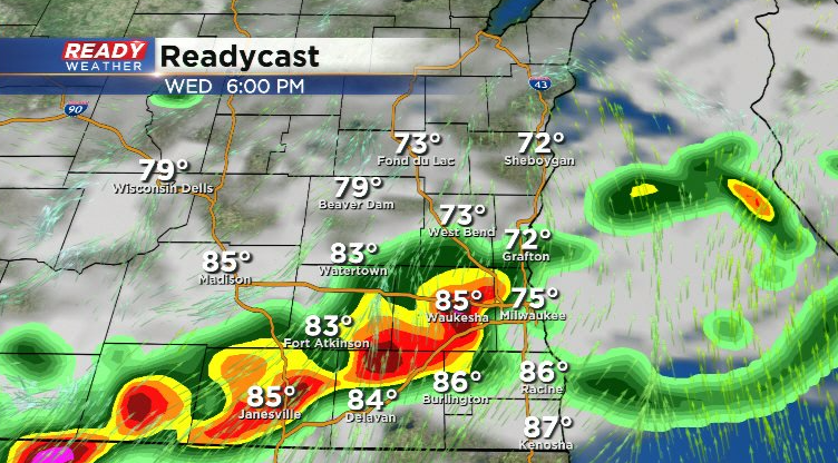
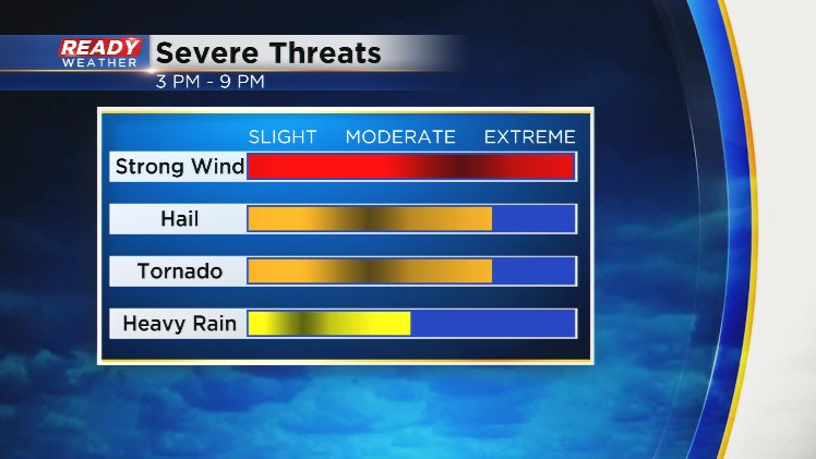
Storms should exit far SE WI by 9 pm. Tornadoes and large hail are the threats with individual storms, but as storms congeal into a line or line segments as they move into SE WI they'll start to pose more of a damaging wind threat (similar to Tuesday evening).
----------------------------------------------------------------------------------------------------------
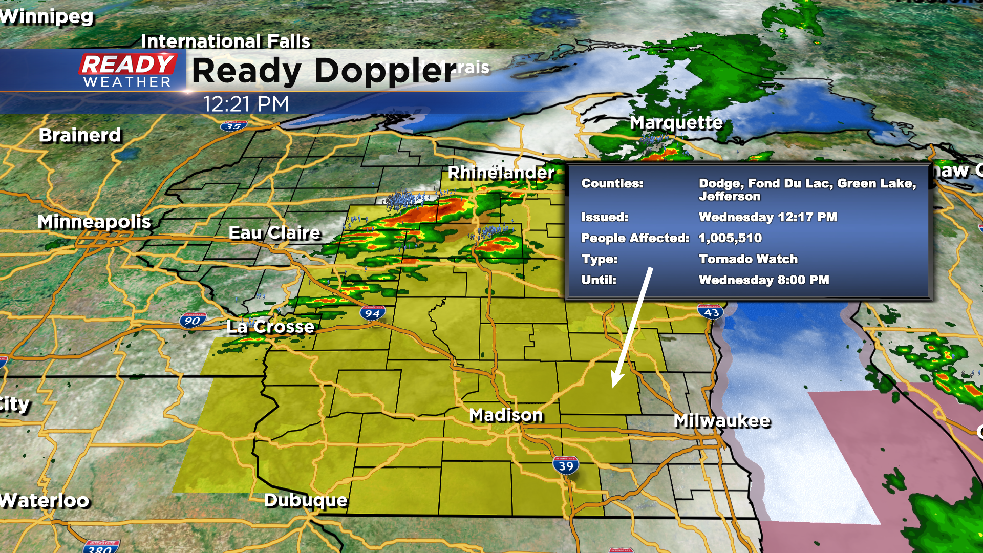
Updated: Noon August 11, 2021
A Tornado Watch has been issued for northwestern spots until 8pm this evening.
Updated: 9:46 a.m. August 11, 2021
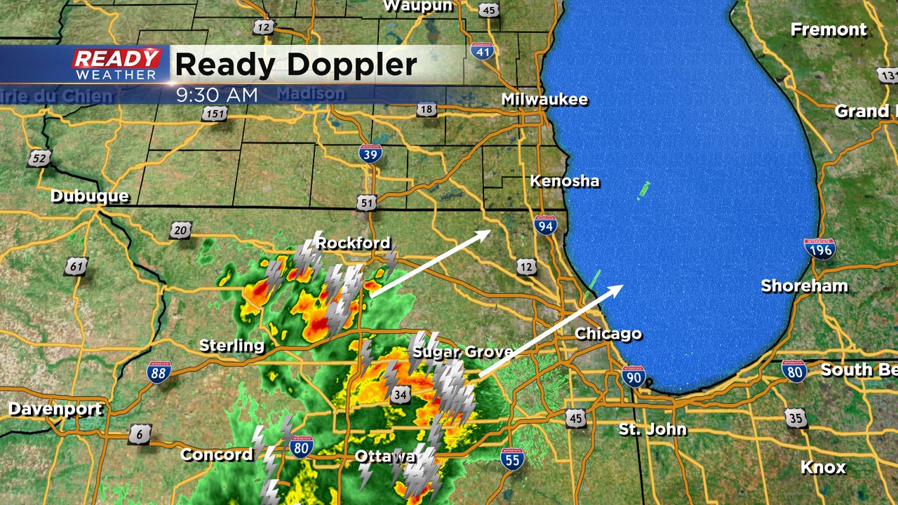
We are watching some severe thunderstorms just south of the border in northern Illinois. These storms have a history of strong wind gusts above 60 mph at times and are moving northeast. Some of those storms could clip our southern counties of Walworth and Kenosha as they get closer to our local area.
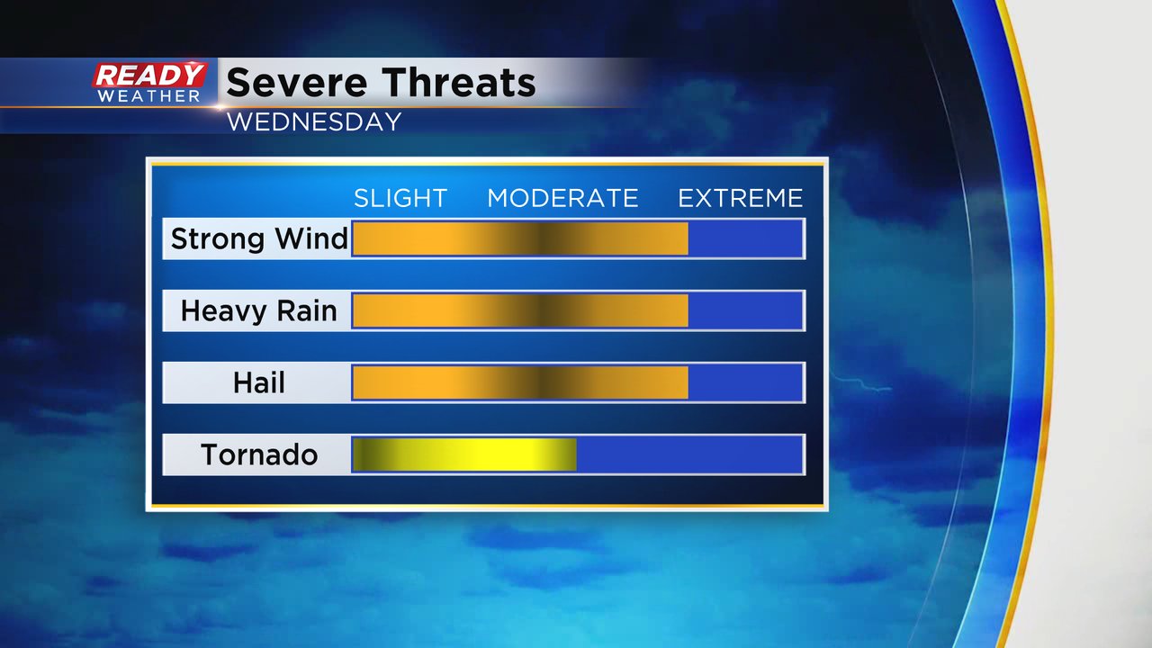
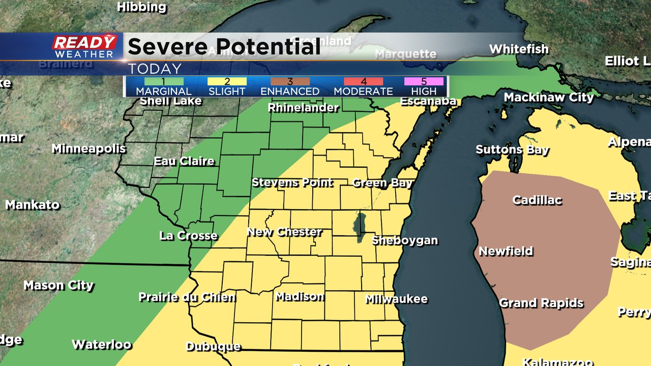
The risk for severe weather has increased for today. All of southeast Wisconsin has been upgraded to the enhanced risk for severe weather (level 3 of 5) which is the same level we were at on Tuesday. Severe storms are looking fairly likely but the timing hasn't changed with most of the storms arriving between 4 PM to 10 PM.

Storms will likely start as individual cells and then combine into a line or cluster and move through our area. The severe threats have increased as well with hail and tornadoes possible when storms first fire. As storms combine the bigger threats will be damaging wind and heavy rain along with a few brief spin up tornadoes.
Make sure you are prepared for a tornado warning and know where in your house to go. Also make sure you have a way to get severe weather warnings even if the power goes out.
------
Posted: 6:09 a.m. August 11, 2021
Widespread severe storms rolled through southeast Wisconsin Tuesday afternoon and evening. Most of our viewing area was under a severe thunderstorm warning at some point. Storm damage reports were widespread from Fond du Lac to Lake Geneva and Kenosha to Port Washington. Dozens, possibly hundreds, of trees came down across our area thanks to a soggy ground and consistent wind gusts.

The Eagle area likely saw a microburst which is a small area of very fast winds that sweeps down from a thunderstorm. Wind gusts there came close to 80 mph. The rest of southeast Wisconsin didn't see nearly as much strong wind but it was enough that when combined with the soggy ground that damage was widespread.

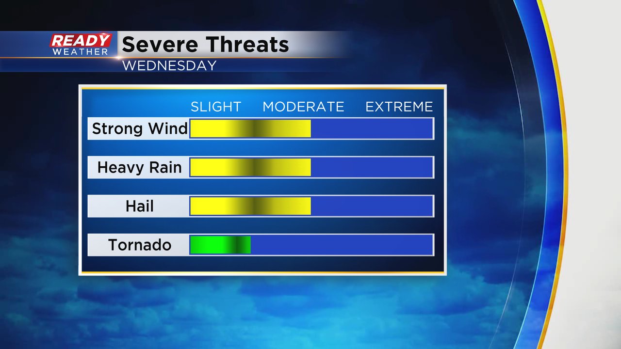
Another round of strong thunderstorms look likely for Wednesday afternoon. The timing for the storms looks similar to Tuesday between 4 PM and 10 PM. Widespread severe thunderstorm warnings might not happen like they did on Tuesday but a few severe warnings are definitely possible.
All of southeast Wisconsin is in the slight risk for severe weather which is level 2 of 5. Tuesday we were under the Enhanced risk so the threat right now is a little lower than Tuesday. Western Michigan has a bit of a better chance to see some of that severe weather.
If severe storms do form widespread threats of damaging wind, hail and heavy rain will all be possible. The tornado threat looks a little bit better than it did on Tuesday but still relatively low.
In addition to the storms it was extremely hot on Tuesday with peak heat index values surpassing 100* for most of our local area and even getting close to 110* in Kenosha and Burlington where the dew point hovered close to 80*. Just nasty!

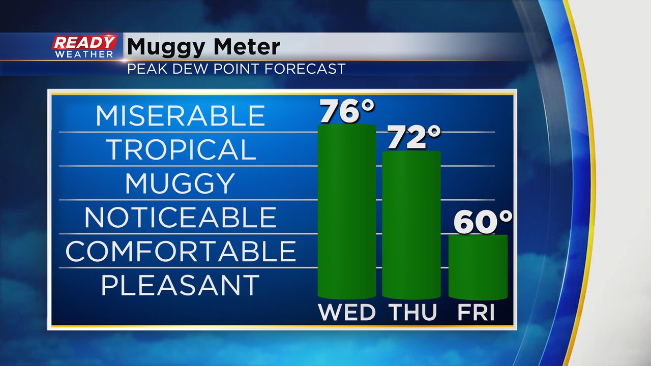
Wednesday will be another day of significant heat and humidity. High temps will hover around 90* Wednesday afternoon and dew points will be close to the mid 70s. Miserable humidity Wednesday will stay fairly tropical on Thursday. If you're looking for relief, Friday is the day to get outside with dew points dropping to around 60.
Heat index values Wednesday afternoon will be similar to where they ended up on Tuesday between 95-105*.

Another heat advisory has been issued for most of southeast Wisconsin except Fond du Lac and Sheboygan Counties. The heat advisory runs from noon to 7 PM. With many people still without power make sure to take plenty of breaks from the heat and drink plenty of water. Head to a mall or library to beat the heat for a bit.

Download the CBS 58 Ready Weather app to track the storms and see how hot it will get where you live.