7:00 PM Update: New flash flood watch issued for parts of the area


7:00 PM Update:
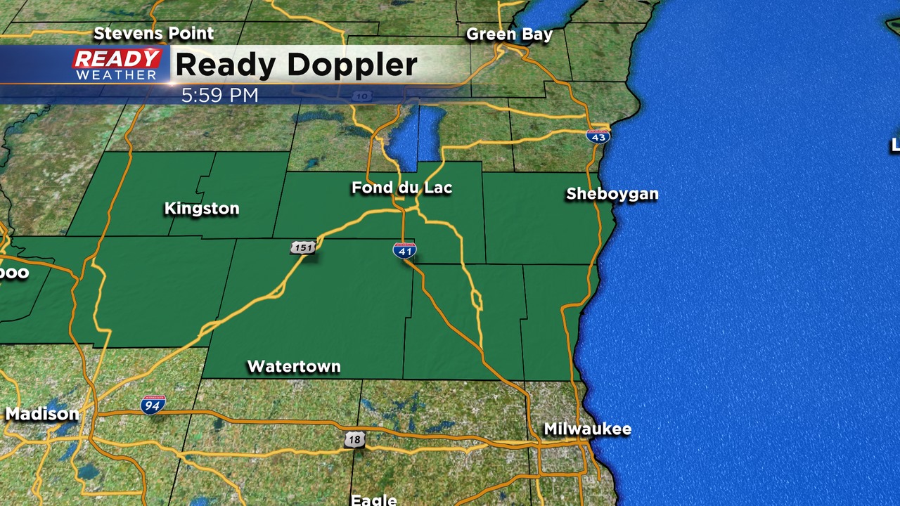
A flash flood watch has been issued for Dodge, Washington, Ozaukee, Sheboygan, and Fond du Lac counties until 7 pm Friday.
These areas have already picked up some heavy rainfall this afternoon, and more is expected overnight into Friday morning. Please use caution around flooded areas.
Scattered showers and storms will likely redevelop late this evening into the overnight. Locally heavy rainfall is possible.
______________________________________________________________________________________________________________
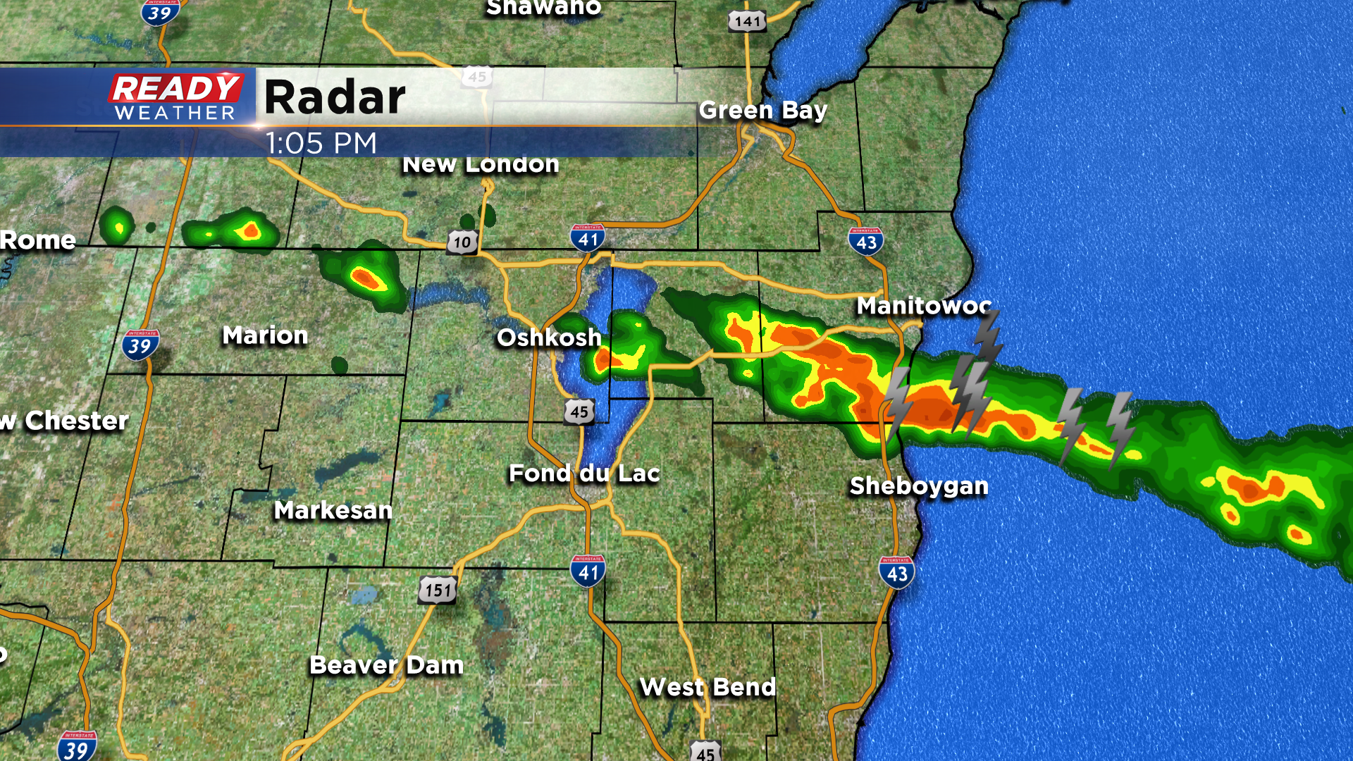
Updated: 6:30 pm
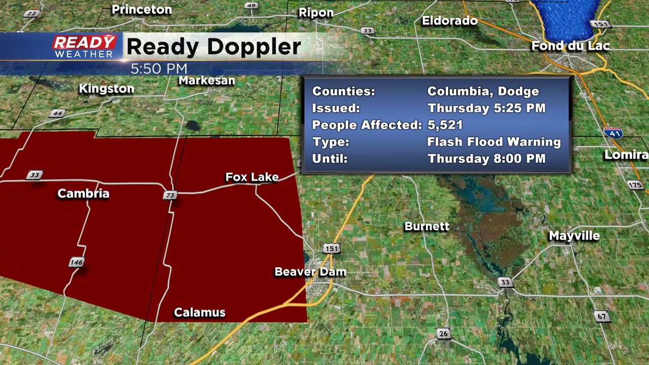
A new flash flood warning has been issued for Dodge county. It has been extended further south and goes until 9:30 pm. Heavy rain in that area over the last several hours has prompted the warning. That area had heavy rain the other day so the water table is already high.
Scattered showers and storms remain in the forecast this evening as an outflow boundary triggers more storms. Storms that pulse up before sundown could produce small hail and gusty winds.
More storms are expected to fire overnight into tomorrow morning.
Updated: 5:10 pm August 27, 2020:
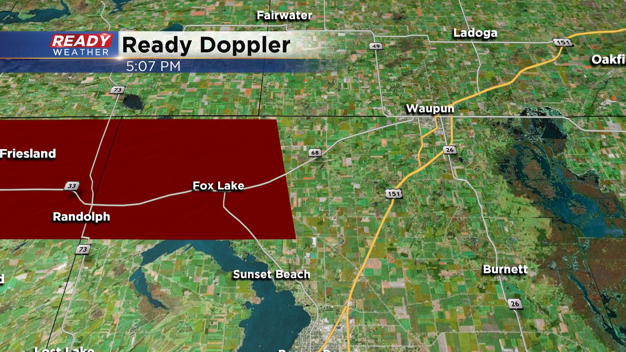
A Flash Flood Warning has been issued for far NW Dodge county through 8pm. 1-2" of rain has already fallen in this area with another 1-2" possible with the severe storm. This could lead to flooding, especially in low lying areas.
--------------------------------------------------------------------------------------
Updated: 4:50 pm August 27, 2020:
A Severe Thunderstorm Warning has been issued for western Dodge county through 5:15 pm. The main threat with this storm is large hail, with the hail core closing in on Randolph as of 4:49 pm.
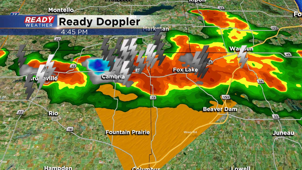
This storm is moving southeast at 30 mph and could also produce gusty winds along with torrential rainfall.
-------------------------------------------------------------------------------------------------------
Updated: 3:10 pm August 27, 2020:
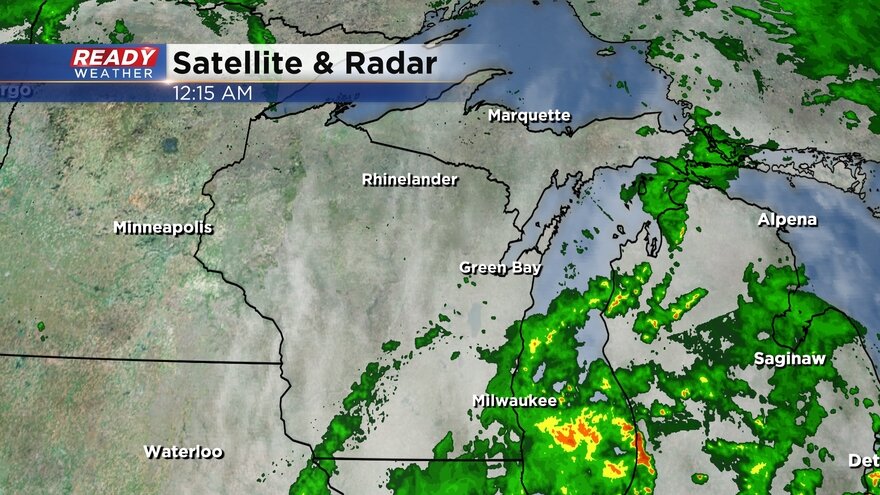
A few showers and storms continue to graze northern Sheboygan county along the stalled frontal boundary. Additional storms have popped up along the inland moving lake breeze in Ozaukee and far NE Milwaukee county.
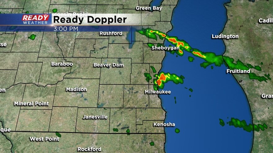
More storms may pop up along these two boundaries this afternoon, and we can't rule out an isolated storm becoming strong to severe with hail and highs winds. Storms still look like they'll become more numerous across the stalled front tonight across northern parts of our area with the severe threat increasing into Friday. See previous update for more details.
-----------------------------------------------------------------
Updated: 1:10 pm August 27, 2020:
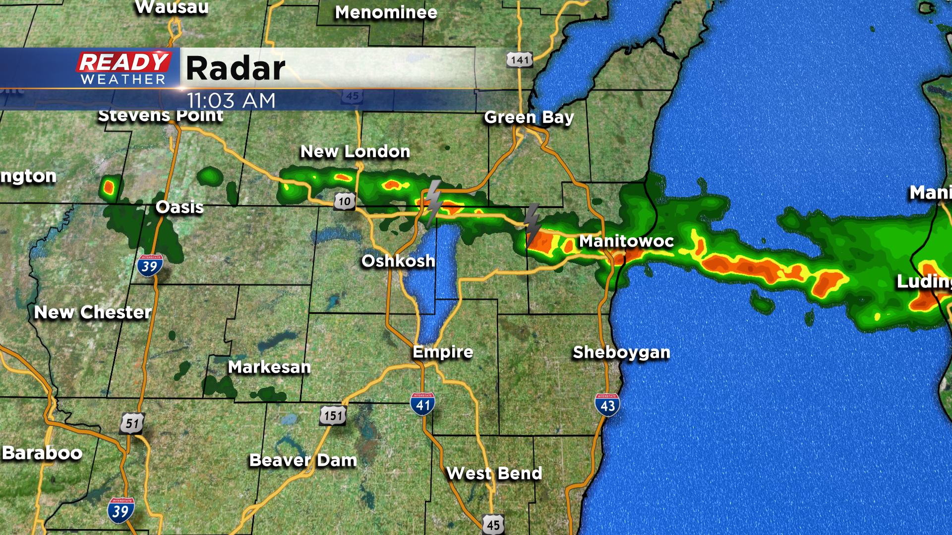
The line of storms with the front is just now starting to sag into northern portions of Sheboygan county.
Recent model trends keep this front pretty much where it is through this afternoon, with only an isolated chance a few storms pop.
Storms look to increase in coverage after 10 pm across central Wisconsin in the vicinity of that front and could train across northern parts of the area into early Friday morning.
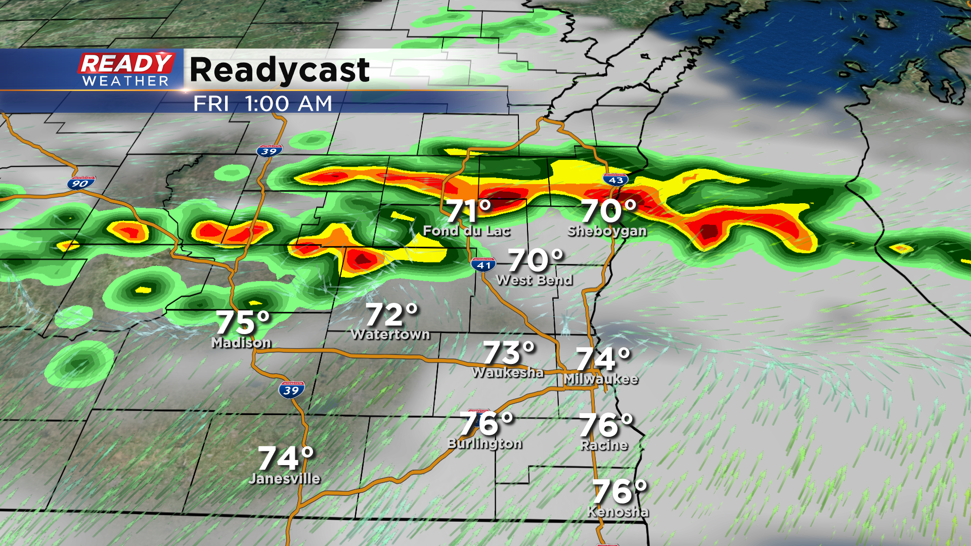
A complex of storms may also approach southern Wisconsin from the west during the morning, but those are expected to weaken before reaching our area. Depending on when/where that line of storms dissipates, and if we get some sunshine in the afternoon, we could have more severe storms pop along the cold front Friday afternoon into the evening.
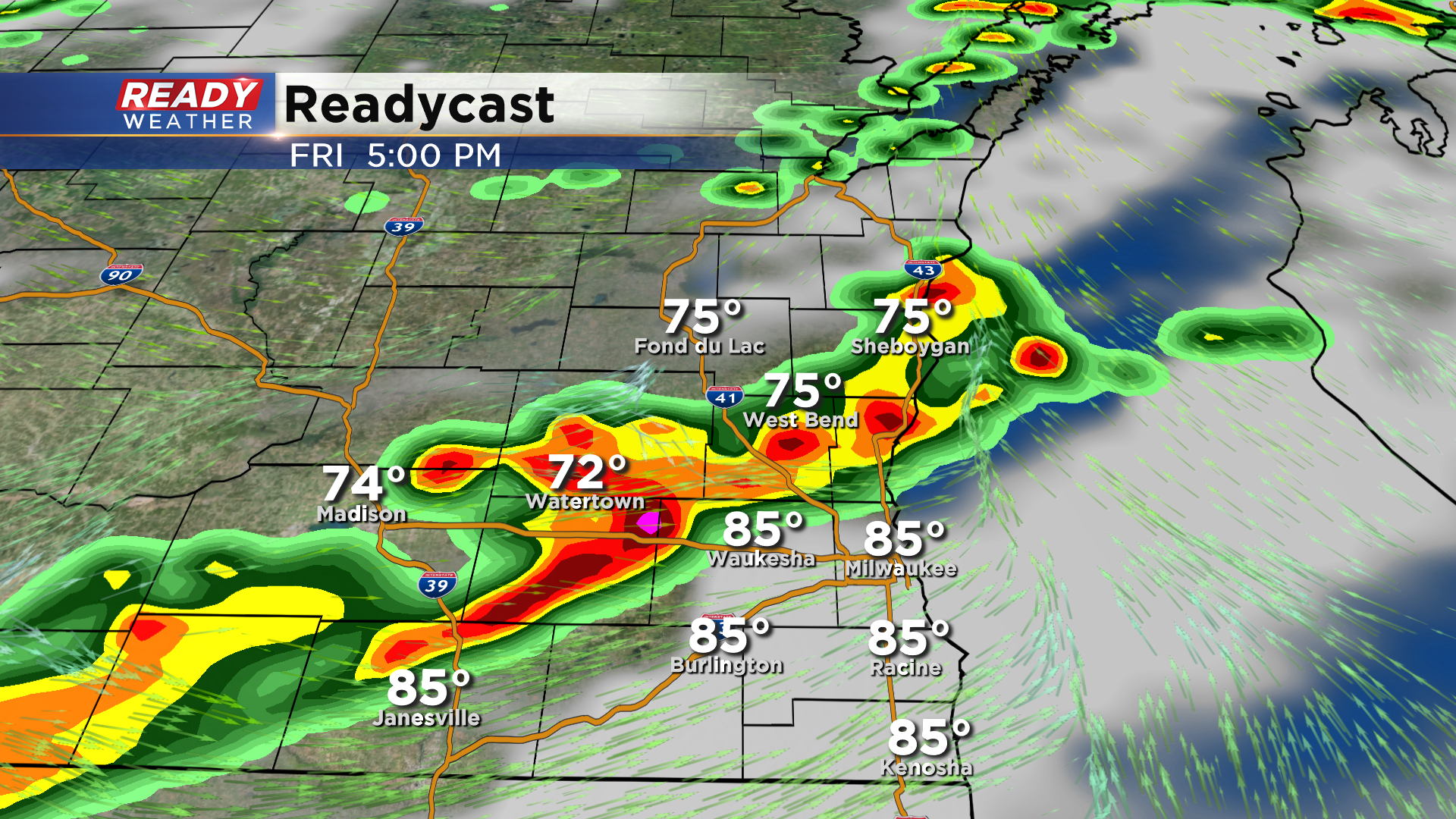
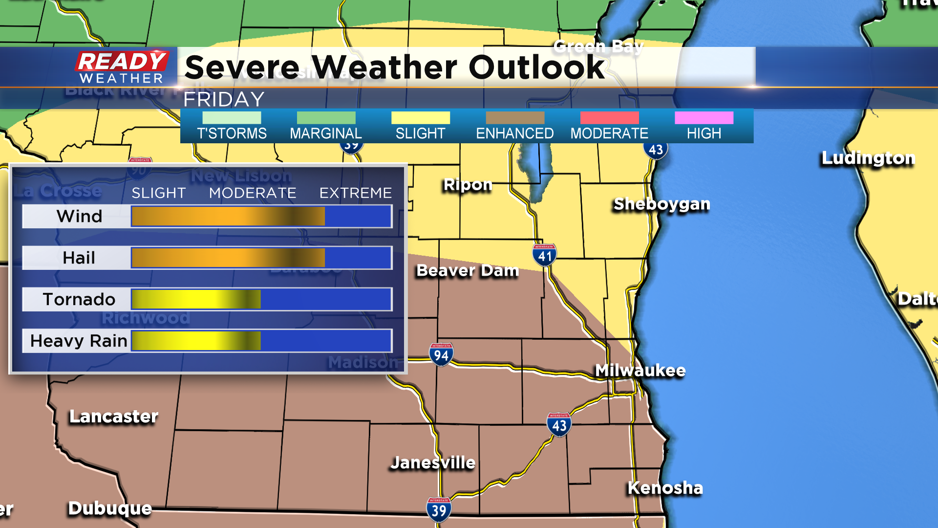
If we see a good amount of sunshine Friday afternoon, severe weather is likely with damaging winds, large hail, and isolated tornadoes all possible. The latest severe weather outlook for Friday has most of SE Wisconsin under the level 3 of 5, Enhanced Risk, for severe storms.
-----------------------------------------------------------------------------------------
Updated: 11:05 am August 27, 2020:
The forecast remains on track this morning with the heat and humidity building into the area. Temps across southeast Wisconsin as of 11 am generally range between 84-87 degrees, but it already feels like the 90s in spots once you factor in the humidity.

The aforementioned front is still generating a few thunderstorms across the Fox Valley. It's sagging south so a few downpours or storms could impact Fond du Lac and Sheboygan counties as early as midday.
As that front hangs around the area, more isolated storms may develop through the afternoon and evening. Storms that pop could be strong with damaging winds and large hail being the main threats. A better chance for scattered storms moves in tonight through Friday. Download the CBS 58 Ready Weather App to get any warnings sent to your phone.
------------------------------------------------------------------------------------------
Updated: 9:36 a.m. August 27, 2020
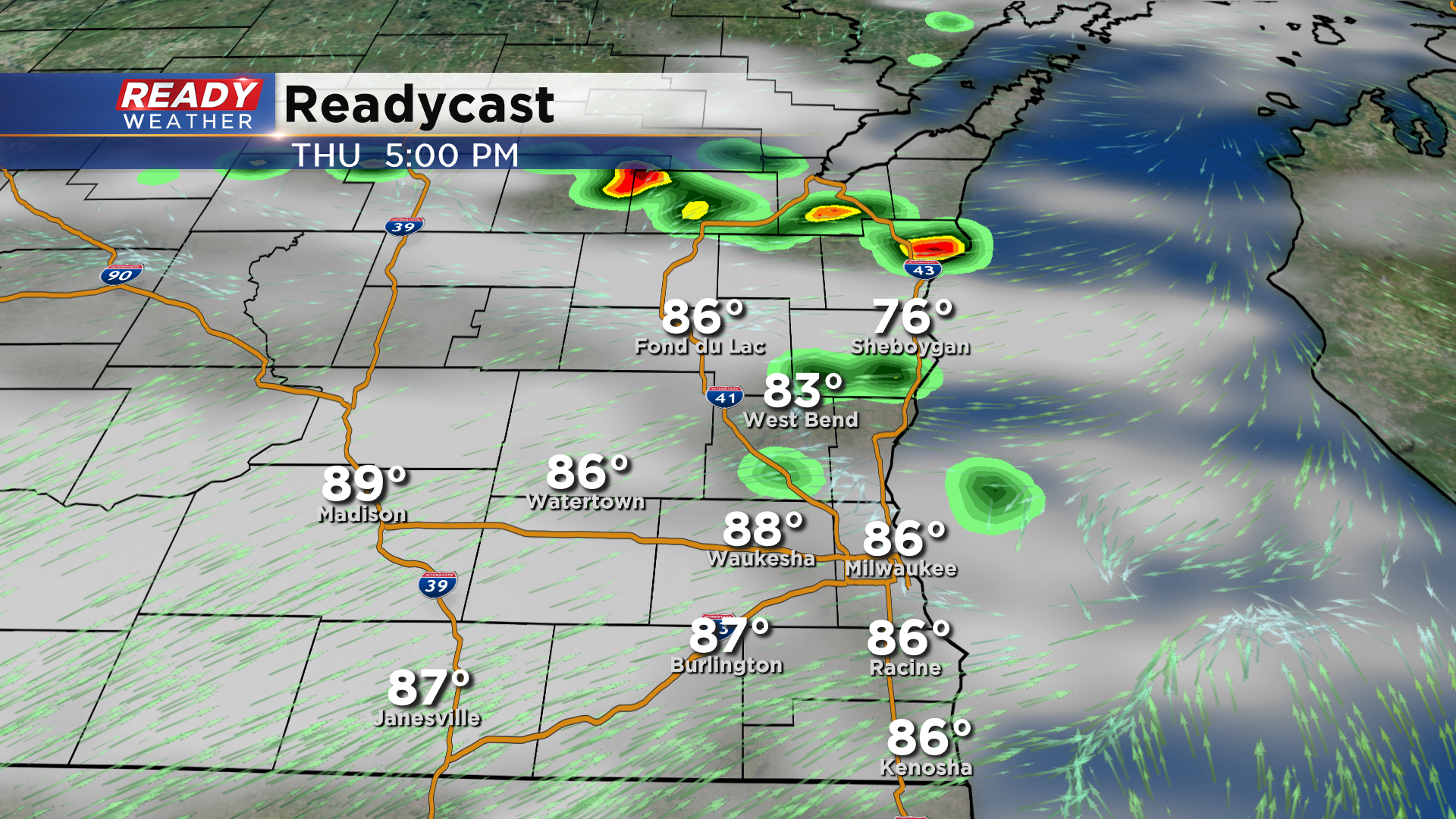
No big changes with the forecast for today with severe storms still possible Thursday afternoon and evening. Rain and storms have formed along the stalled front just south of Green Bay. That front will likely sag south during the day which will increase our storm chance as the day goes on. Best chance for storms Thursday is between 3 p.m. to 10 p.m. with some strong storms lingering overnight into Friday morning.
------
Posted: 6:38 a.m. August 27, 2020
Wednesday was our seventh day in the 90s this year and peak heat indices reached the triple digits in many communities. Thursday will also be hot with highs around 90 and dew points in the low 70s which puts them in the tropical category. The combination of the heat and humidity means it will feel more like the mid 90s during the afternoon of Thursday.

All of that heat and humidity is going to provide fuel for thunderstorms. Those storms will likely form along a front that is expected to stall out somewhere in southeast Wisconsin. A few showers may be possible in northern counties like Fond du Lac and Sheboygan as early as late morning but after 3 p.m looks like the best time to see strong to severe storms develop. The storms on Thursday will be fairly scattered and will last through the evening and overnight into Friday.

Any storms that form Thursday afternoon/evening could be strong to severe. Damaging wind and large hail will be the main severe threats but heavy rain is likely with any storms that develop and an isolated tornado can't be ruled out. A slight risk for severe weather, which is the second of five severe categories, is in place for all of southeast Wisconsin.

Storms will continue Friday morning and through most of Friday afternoon and evening. There could be some dry times during the day on Friday and if we clear out during the late morning our chance for severe weather Friday afternoon and evening would go up.

The severe weather ingredients for Friday look a little better especially south of I-94. An enhanced risk, the third of the five severe levels, is in place for these southern counties with the majority rest of southeast Wisconsin in a slight risk.

Heavy rain will be a big story with any storms that develop. It's possible the storms train over the same area as the front stays stalled which could lead to even more rain. Take the location of the heaviest rain in this map with some uncertainty but a soaking 0.50-1.50" is expected for all with some spots getting 2" to 3" of rain likely.

Download the CBS 58 Ready Weather app to track any storms that develop Thursday and Friday.