


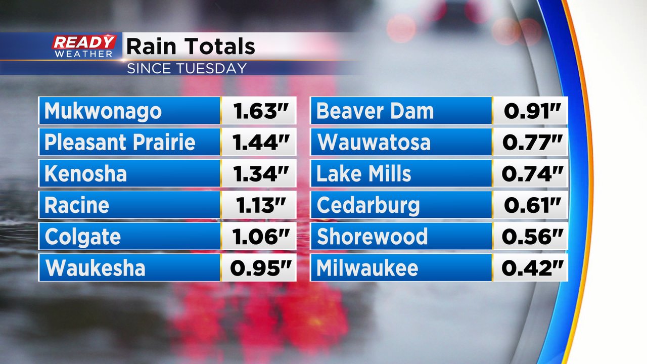
The shower and storm chances from the last few days will continue on Thursday. So far we've seen a good soaking rain since Tuesday but light enough to stay away from flooding concerns. A few hometowns picked up over 1" of rainfall, most of them south of I-94, with the rest of southeast Wisconsin seeing a half to full inch of rain.
The rain this week is just a continuation of what has been a very wet start to the year. Since January 1st Milwaukee has picked up 12.74" of precipitation which is the fifth wettest start to the year on record.

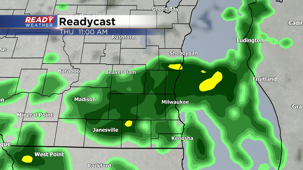
After a nice sunrise Thursday morning more showers are on the way. A few hours of steady rain will be possible with scattered light to moderate rain showers likely most of the day. The rain should wrap up in the evening with decreasing clouds Thursday night.
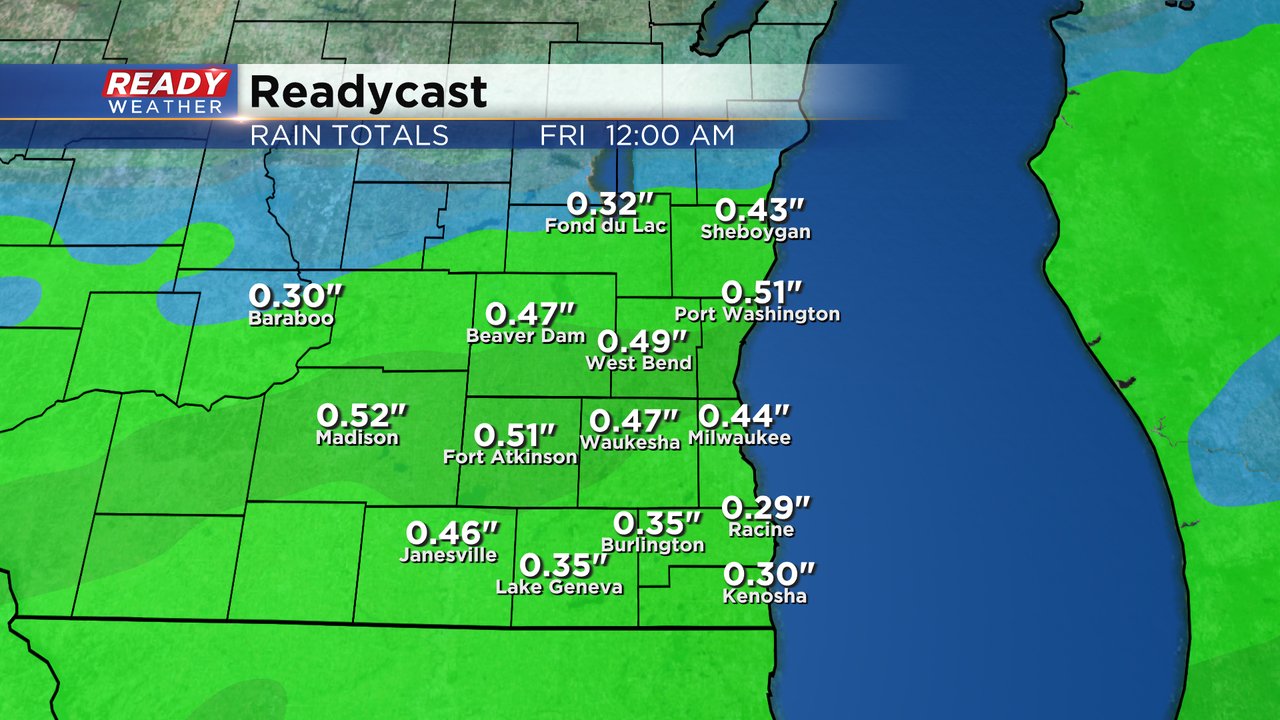
Rain totals throughout the day Thursday end up in the range of 0.25-0.50" for most of southeast Wisconsin.
Download the CBS 58 Ready Weather app to track another day of rain with the interactive radar.