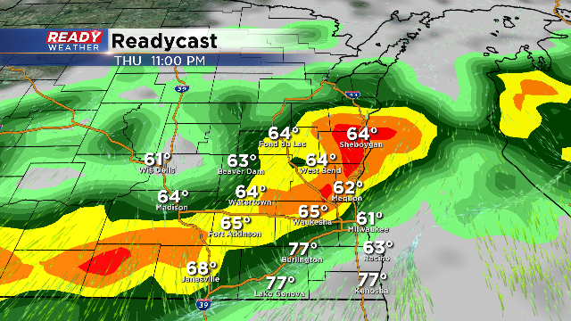
Afternoon Severe Weather Update
Morning convection has put a lid on the atmosphere this afternoon. Clouds are limiting some of the instability potential; however, we do expect along and south of 94 that we should get a mix of clouds and sun with temperatures warming into the 80s.
The main line of showers and storms is expected to develop across the northern part of the viewing area between 6 pm and 8 pm. As they move south, storms will encounter a favorable environment for strong to severe storms to develop and maintain strength.
Heat and humidity should promote strong to severe storms late this evening into the overnight. Storms that do become severe could produce hail and damaging winds. While an isolated tornado is possible, the setup for today isn't very conducive for rotating storms.
Quarter size hail and damaging winds to 70 mph are possible. The overall timing for storms is between 7 pm and 2 am.


